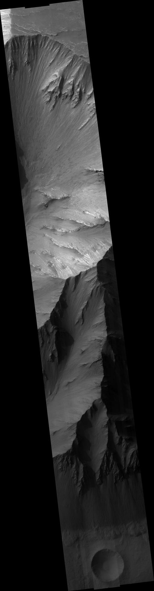
This HiRISE image captures a small part of the northern wall of Valles Marineris, the largest canyon in the solar system. The reason this part of Mars' crust was pulled apart is not known with certainty, so observations like this are part of a campaign to understand the tectonics of Mars. In addition, the canyon provides a view deep into the crust of Mars. This HiRISE image captures 9500 meter (31,000 feet) of vertical relief. A sequence of thin layers can be seen in the upper roughly 1000 m (3000 feet) of the valley wall. Since Valles Marineris cuts into the side of the Tharsis Volcanic Rise, it is likely that these layers are lava flows. Below this, layers are not so regular. This lower section probably exposes rocks that have been intensely disrupted by ancient impact craters, but could also include solidified bodies of magma.
Image PSP_001337_1675 was taken by the High Resolution Imaging Science Experiment (HiRISE) camera onboard the Mars Reconnaissance Orbiter spacecraft on November 8, 2006. The complete image is centered at -12.2 degrees latitude, 297.6 degrees East longitude. The range to the target site was 257.0 km (160.6 miles). At this distance the image scale ranges from 51.4 cm/pixel (with 2 x 2 binning) to 102.8 cm/pixel (with 4 x 4 binning). The image shown here has been map-projected to 50 cm/pixel and north is up. The image was taken at a local Mars time of 3:32 PM and the scene is illuminated from the west with a solar incidence angle of 61 degrees, thus the sun was about 29 degrees above the horizon. At a solar longitude of 132.4 degrees, the season on Mars is Northern Summer.
NASA's Jet Propulsion Laboratory, a division of the California Institute of Technology in Pasadena, manages the Mars Reconnaissance Orbiter for NASA's Science Mission Directorate, Washington. Lockheed Martin Space Systems, Denver, is the prime contractor for the project and built the spacecraft. The High Resolution Imaging Science Experiment is operated by the University of Arizona, Tucson, and the instrument was built by Ball Aerospace and Technology Corp., Boulder, Colo.
 Planetary Data System


