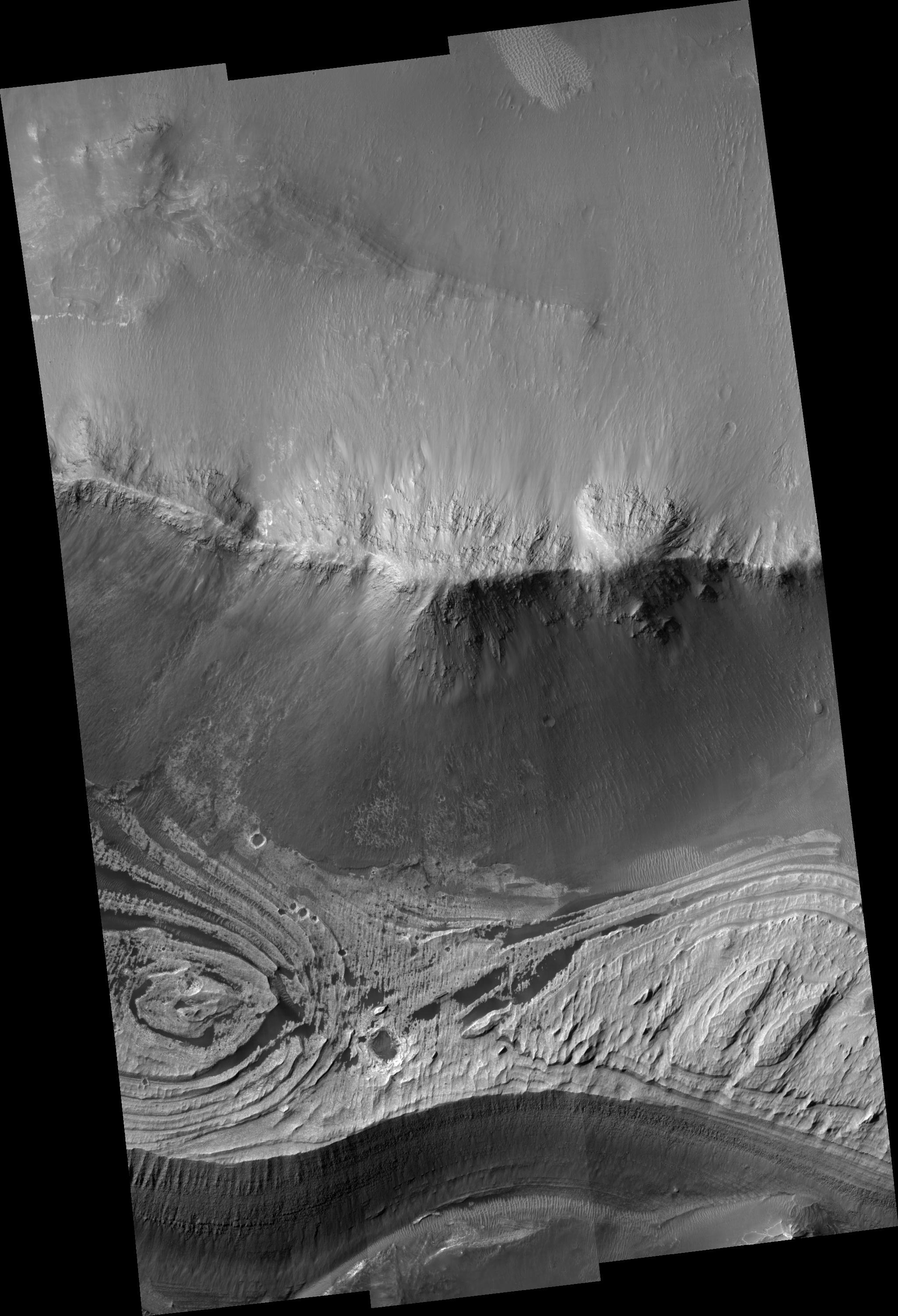
While the canyon walls that define Valles Marineris appear dark and blocky, the interior of the canyons can sometimes be filled with light-toned rocks that appear layered. This HiRISE image shows the two geologic units in Candor Chasma, one of several canyons that make up Valles Marineris. At the center of the image is the wall rock that appears as a linear hill running east-west and composed of spurs and gullies. Larger meter-size boulders can be resolved by HiRISE and indicate lithified rock units that break down to produce these boulders which then roll downhill. The light-toned layered deposits are visible in the lower portion of the image. They appear brighter than the wallrock and also have prominent layering, which is best seen near the bottom of the image where there is a steep exposure and dozens of layers are revealed. Dark debris covers the layered deposits along this cliff face and forms debris aprons as material is shed downhill. The processes that emplaced the light-toned layered deposits are still being debated and include volcanism, eolian, and lacustrine origins. HiRISE images combined with multispectral data from CRISM (also on MRO) should help narrow down the possible origins.
Image PSP_001390_1735 was taken by the High Resolution Imaging Science Experiment (HiRISE) camera onboard the Mars Reconnaissance Orbiter spacecraft on November 12, 2006. The complete image is centered at -6.2 degrees latitude, 290.8 degrees East longitude. The range to the target site was 264.4 km (165.3 miles). At this distance the image scale ranges from 26.5 cm/pixel (with 1 x 1 binning) to 105.8 cm/pixel (with 4 x 4 binning). The image shown here has been map-projected to 25 cm/pixel and north is up. The image was taken at a local Mars time of 3:30 PM and the scene is illuminated from the west with a solar incidence angle of 57 degrees, thus the sun was about 33 degrees above the horizon. At a solar longitude of 134.4 degrees, the season on Mars is Northern Summer.
NASA's Jet Propulsion Laboratory, a division of the California Institute of Technology in Pasadena, manages the Mars Reconnaissance Orbiter for NASA's Science Mission Directorate, Washington. Lockheed Martin Space Systems, Denver, is the prime contractor for the project and built the spacecraft. The High Resolution Imaging Science Experiment is operated by the University of Arizona, Tucson, and the instrument was built by Ball Aerospace and Technology Corp., Boulder, Colo.
