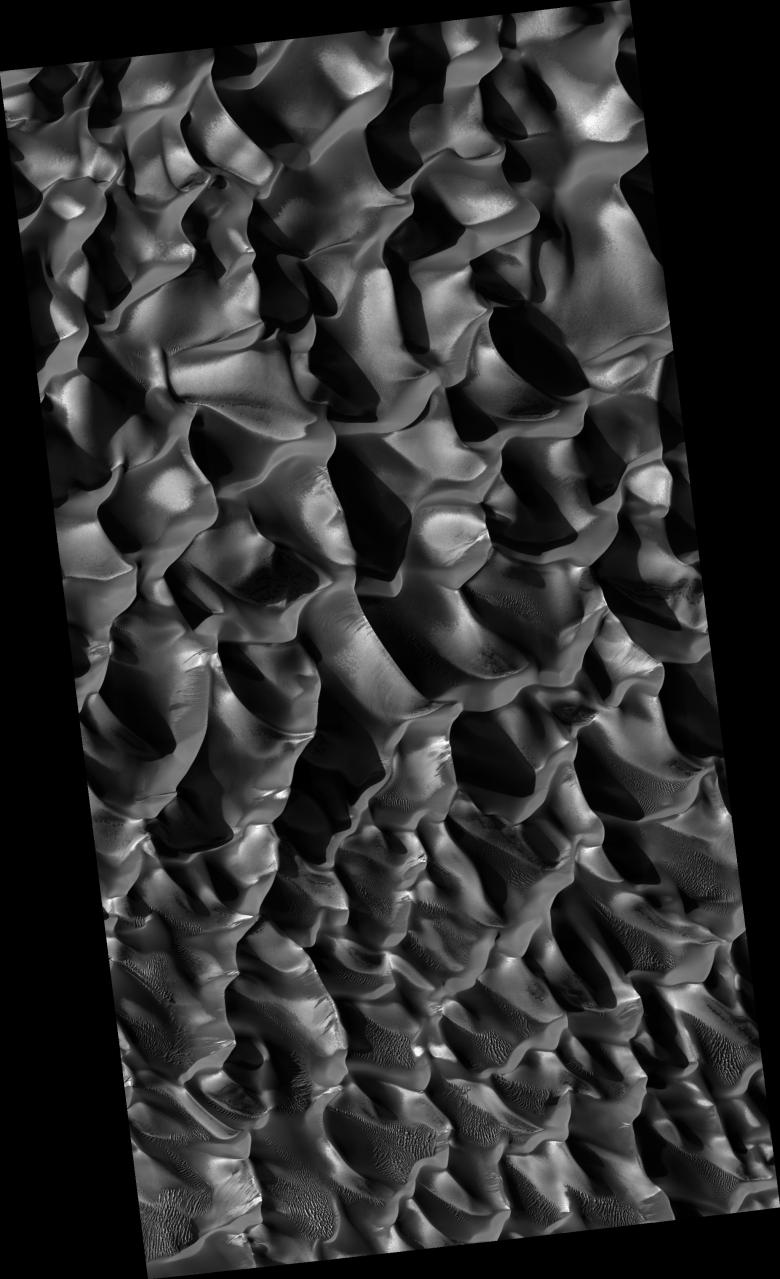
Dunes with Proctor Crater on Mars are seen in this newly released HiRISE image. Proctor is located in the southern hemisphere where it is winter at the time this image was taken. The HiRISE image documents new seasonal processes occurring on dunes at this latitude, as well as other interesting phenomena. The bright tones are interpreted as CO2 or H2O frost. This is generally concentrated on the east-facing slopes of the dunes, which are in shadow and therefore cooler. Some dark spots on the dunes may be areas that have defrosted more than surrounding terrain. Landslides and dark-toned streaks are seen on many of the west-facing dune slopes. The general dune morphology indicates formation by westerly winds. However, zooming in on the image shows smaller scale ripples that appear to have been formed by winds blowing from the south and north.
Image PSP_001558_1325 was taken by the High Resolution Imaging Science Experiment (HiRISE) camera onboard the Mars Reconnaissance Orbiter spacecraft on November 25, 2006. The complete image is centered at -47.2 degrees latitude, 33.9 degrees East longitude. The range to the target site was 249.2 km (155.7 miles). At this distance the image scale is 49.9 cm/pixel (with 2 x 2 binning) so objects ~150 cm across are resolved. The image shown here has been map-projected to 50 cm/pixel and north is up. The image was taken at a local Mars time of 3:44 PM and the scene is illuminated from the west with a solar incidence angle of 80 degrees, thus the sun was about 10 degrees above the horizon. At a solar longitude of 140.9 degrees, the season on Mars is Northern Summer.
NASA's Jet Propulsion Laboratory, a division of the California Institute of Technology in Pasadena, manages the Mars Reconnaissance Orbiter for NASA's Science Mission Directorate, Washington. Lockheed Martin Space Systems, Denver, is the prime contractor for the project and built the spacecraft. The High Resolution Imaging Science Experiment is operated by the University of Arizona, Tucson, and the instrument was built by Ball Aerospace and Technology Corp., Boulder, Colo.
 Planetary Data System


