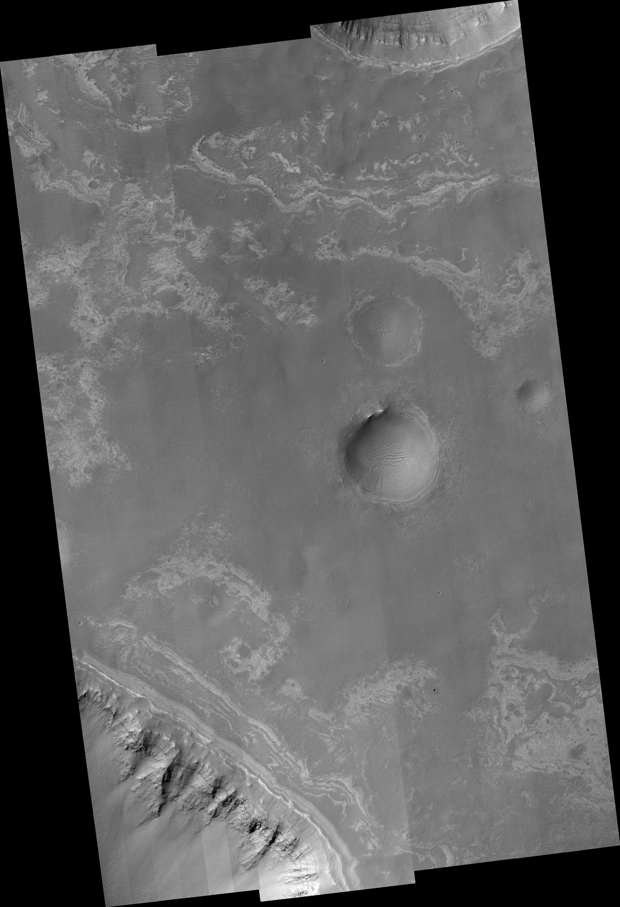
This image covers valley tributaries of Ius Chasma, as well as the plains adjacent to the valleys. Ius Chasma is one of several canyons that make up the Valles Marineris canyon system. Valles Marineris likely formed by extension associated with the growth of the large volcanoes and topographic high of Tharsis to the northwest. As the ground was pulled apart, large and deep gaps resulted in the valleys seen in the top and bottom of this HiRISE image. Ice that was once in the ground could have also melted to create additional removal of material in the formation of the valleys. HiRISE is able to see the rocks along the walls of both these valleys and also impact craters in the image. Rock layers that appear lower down in elevation appear rougher and are shedding boulders. Near the top of the walls and also seen in patches along the smooth plains are brighter layers. These brighter layers are not shedding boulders so they must represent a different kind of rock formed in a different kind of environment than those further down the walls. Because they are highest in elevation, the bright layers are youngest in age. HiRISE is able to see dozens of the bright layers, which are perhaps only a meter in thickness. Darker sand dunes and ripples cover most of the plains and fill the floors of impact craters.
Image PSP_001351_1715 was taken by the High Resolution Imaging Science Experiment (HiRISE) camera onboard the Mars Reconnaissance Orbiter spacecraft on November 9, 2006. The complete image is centered at -8.3 degrees latitude, 275.4 degrees East longitude. The range to the target site was 254.3 km (158.9 miles). At this distance the image scale ranges from 25.4 cm/pixel (with 1 x 1 binning) to 101.8 cm/pixel (with 4 x 4 binning). The image shown here has been map-projected to 25 cm/pixel and north is up. The image was taken at a local Mars time of 3:32 PM and the scene is illuminated from the west with a solar incidence angle of 59 degrees, thus the sun was about 31 degrees above the horizon. At a solar longitude of 133.0 degrees, the season on Mars is Northern Summer.
NASA's Jet Propulsion Laboratory, a division of the California Institute of Technology in Pasadena, manages the Mars Reconnaissance Orbiter for NASA's Science Mission Directorate, Washington. Lockheed Martin Space Systems, Denver, is the prime contractor for the project and built the spacecraft. The High Resolution Imaging Science Experiment is operated by the University of Arizona, Tucson, and the instrument was built by Ball Aerospace and Technology Corp., Boulder, Colo.
 Planetary Data System


