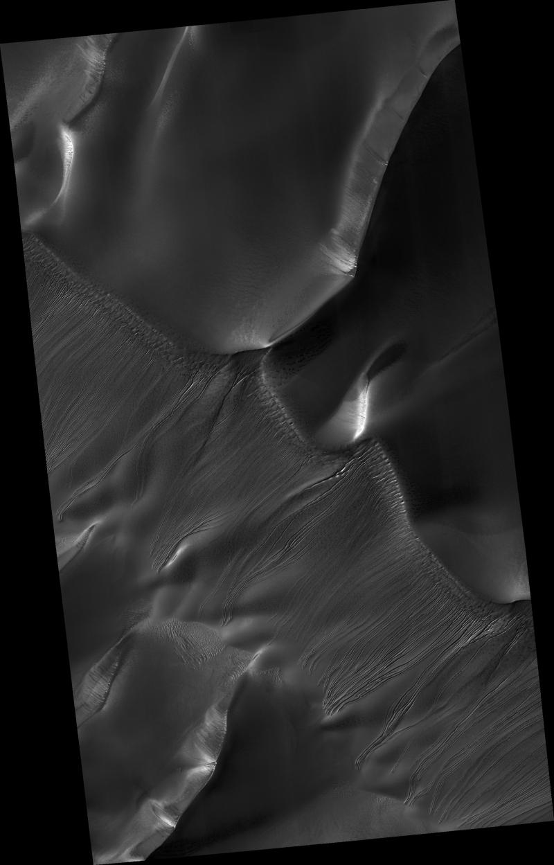
Hundreds of enigmatic small channels are seen to carve into the slopes of these dark sand dunes lying within Russell Crater on Mars. These features were previously identified as gullies in images from the Mars Orbiter Camera (MOC) on Mars Global Surveyor, but the higher resolution HiRISE image brings out many new details and mysteries. The channels extend from near the top of the dunes to their bases, indicating that some fluid material carved into the sand. The channels commonly begin as smaller tributaries joined together, suggesting several sources of fluid. Distinct dark spots are located near where the channels seem to originate. Several channels appear to originate at alcoves. Several of these channels have sinuous middle reaches while others are straighter. Further down slope, some channel edges appear elevated above the surrounding terrain, particularly in the lower reaches. The channels seem to terminate abruptly, with no deposition of material, unlike at the bases of some other gullies on Mars that are not on dunes.
One hypothesis for the origin of the channels, which has previously been proposed by the MOC team, is that CO2 (or maybe H2O) frost is deposited on the dunes in shadows or at night. Some frost may also be incorporated into the internal parts of the dunes due to natural avalanching. When the frost is eventually heated by sunlight, rapid sublimation triggers an avalanche of fluidized sand, forming a gully. HiRISE will continue to target small channel features such as these and may return to search for any changes over time.
Image PSP_001440_1255 was taken by the High Resolution Imaging Science Experiment (HiRISE) camera onboard the Mars Reconnaissance Orbiter spacecraft on November 16, 2006. The complete image is centered at -54.2 degrees latitude, 12.9 degrees East longitude. The range to the target site was 251.4 km (157.1 miles). At this distance the image scale is 50.3 cm/pixel (with 2 x 2 binning) so objects ~151 cm across are resolved. The image shown here has been map-projected to 50 cm/pixel and north is up. The image was taken at a local Mars time of 3:41 PM and the scene is illuminated from the west with a solar incidence angle of 85 degrees, thus the sun was about 5 degrees above the horizon. At a solar longitude of 136.3 degrees, the season on Mars is Northern Summer.
NASA's Jet Propulsion Laboratory, a division of the California Institute of Technology in Pasadena, manages the Mars Reconnaissance Orbiter for NASA's Science Mission Directorate, Washington. Lockheed Martin Space Systems, Denver, is the prime contractor for the project and built the spacecraft. The High Resolution Imaging Science Experiment is operated by the University of Arizona, Tucson, and the instrument was built by Ball Aerospace and Technology Corp., Boulder, Colo.
 Planetary Data System


