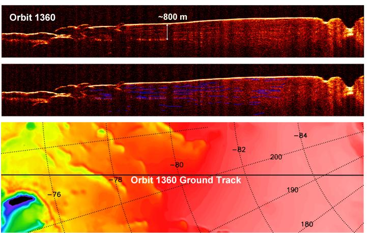
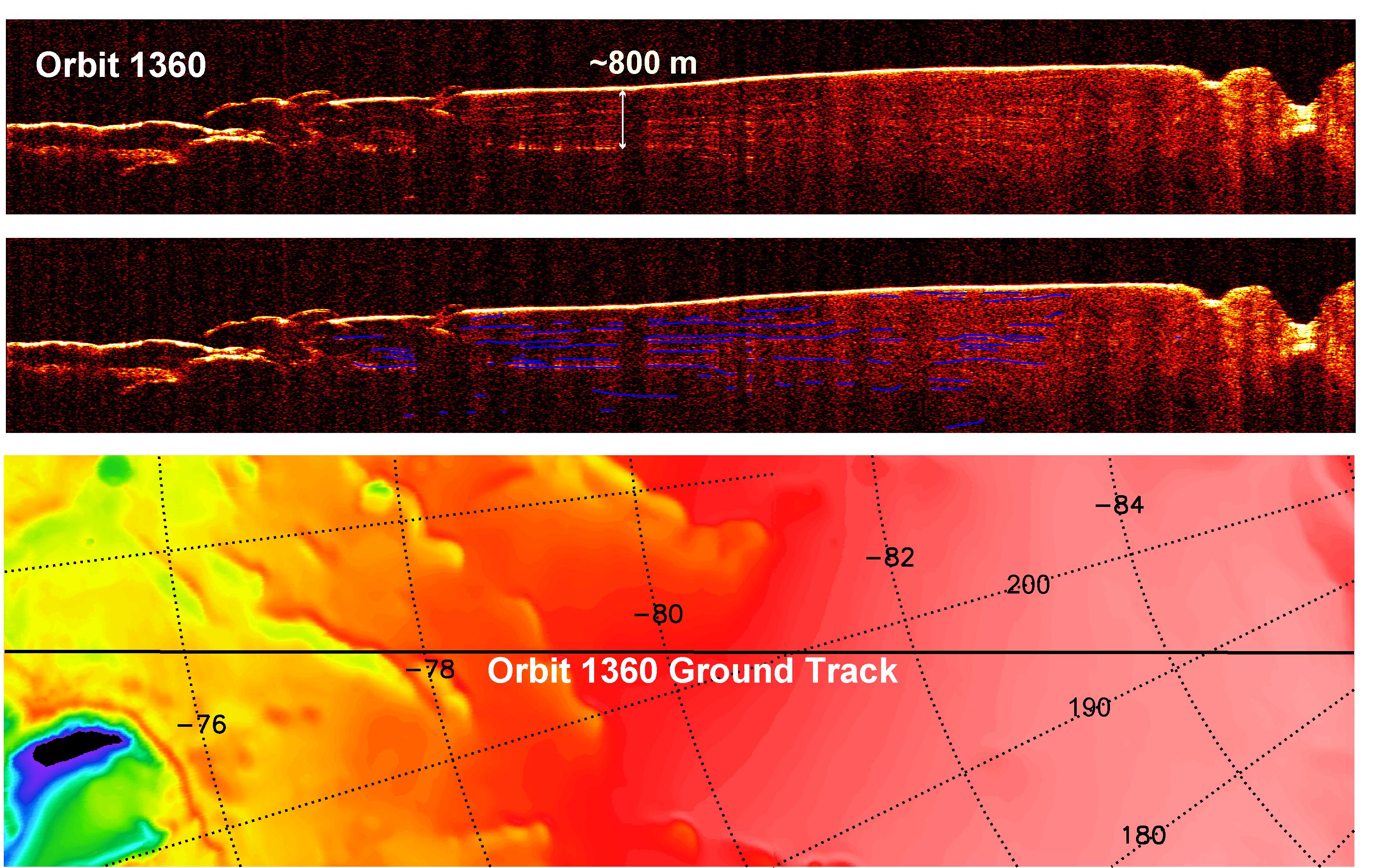
A radargram from the Shallow Subsurface Radar instrument (SHARAD) on NASA's Mars Reconnaissance Orbiter is shown in the upper-right panel and reveals detailed structure in the polar layered deposits of the south pole of Mars.
The sounding radar collected the data presented here during orbit 1360 of the mission, on Nov. 10, 2006.
The horizontal scale in the radargram is distance along the ground track. It can be referenced to the ground track map shown in the lower right. The radar traversed from about 74 degrees to 85 degrees south latitude, or about 650 kilometers (400 miles). The ground track map shows elevation measured by the Mars Orbiter Laser Altimeter on NASA's Mars Global Surveyor orbiter. Green indicates low elevation; reddish-white indicates higher elevation. The traverse proceeds up onto a plateau formed by the layers.
The vertical scale on the radargram is time delay of the radar signals reflected back to Mars Reconnaissance Orbiter from the surface and subsurface. For reference, using an assumed velocity of the radar waves in the subsurface, time is converted to depth below the surface at one place: about 800 meters (2,600 feet) to one of the strongest subsurface reflectors. This reflector marks the base of the polar layered deposits. The color scale varies from black for weak reflections to white for strong reflections.
The middle panel shows mapping of the major subsurface reflectors, some of which can be traced for a distance of 100 kilometers (60 miles) or more. The layering manifests the recent climate history of Mars, recorded by the deposition and removal of ice and dust.
The Shallow Subsurface Radar was provided by the Italian Space Agency (ASI). Its operations are led by the University of Rome and its data are analyzed by a joint U.S.-Italian science team. NASA's Jet Propulsion Laboratory, a division of the California Institute of Technology, Pasadena, manages the Mars Reconnaissance Orbiter for the NASA Science Mission Directorate, Washington.
 Planetary Data System


