The high resolution camera on NASA's Mars Reconnaissance Orbiter captured its first image of Mars in the mapping orbit, demonstrating the full resolution capability, on Sept. 29, 2006. The High Resolution Imaging Science Experiment (HiRISE) acquired this first image at 8:16 AM (Pacific Time). With the spacecraft at an altitude of 280 kilometers (174 miles), the image scale is 25 centimeters per pixel (10 inches per pixel). If a person were located on this part of Mars, he or she would just barely be visible in this image.
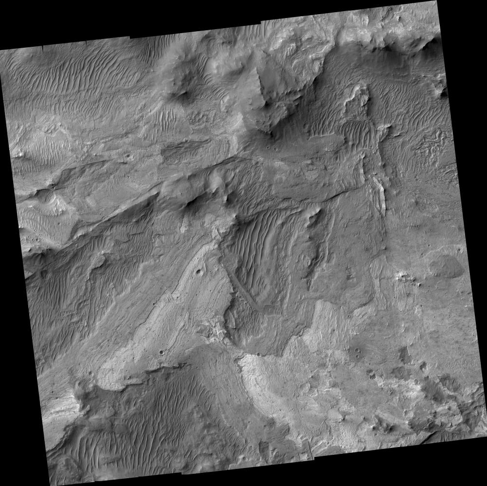
The image covers a small portion of the floor of Ius Chasma, one branch of the giant Valles Marineris system of canyons. The image illustrates a variety of processes that have shaped the Martian surface. There are bedrock exposures of layered materials, which could be sedimentary rocks deposited in water or from the air. Some of the bedrock has been faulted and folded, perhaps the result of large-scale forces in the crust or from a giant landslide. The image resolves rocks as small as small as 90 centimeters (3 feet) in diameter. It includes many dunes or ridges of windblown sand.
This image (TRA_000823_1720) was taken by the High Resolution Imaging Science Experiment camera onboard the Mars Reconnaissance Orbiter spacecraft on Sept. 29, 2006. Shown here is the full image, centered at minus 7.8 degrees latitude, 279.5 degrees east longitude. The image is oriented such that north is to the top. The range to the target site was 297 kilometers (185.6 miles). At this distance the image scale is 25 centimeters (10 inches) per pixel (with one-by-one binning) so objects about 75 centimeters (30 inches) across are resolved. The image was taken at a local Mars time of 3:30 PM and the scene is illuminated from the west with a solar incidence angle of 59.7 degrees, thus the sun was about 30.3 degrees above the horizon. The season on Mars is northern winter, southern summer.
[Photojournal note: Due to the large sizes of the high-resolution TIFF and JPEG files, some systems may experience extremely slow downlink time while viewing or downloading these images; some systems may be incapable of handling the download entirely.]
NASA's Jet Propulsion Laboratory, a division of the California Institute of Technology in Pasadena, manages the Mars Reconnaissance Orbiter for NASA's Science Mission Directorate, Washington. Lockheed Martin Space Systems, Denver, is the prime contractor for the project and built the spacecraft. The HiRISE camera was built by Ball Aerospace & Technologies Corporation, Boulder, Colo., and is operated by the University of Arizona, Tucson.
 Planetary Data System


