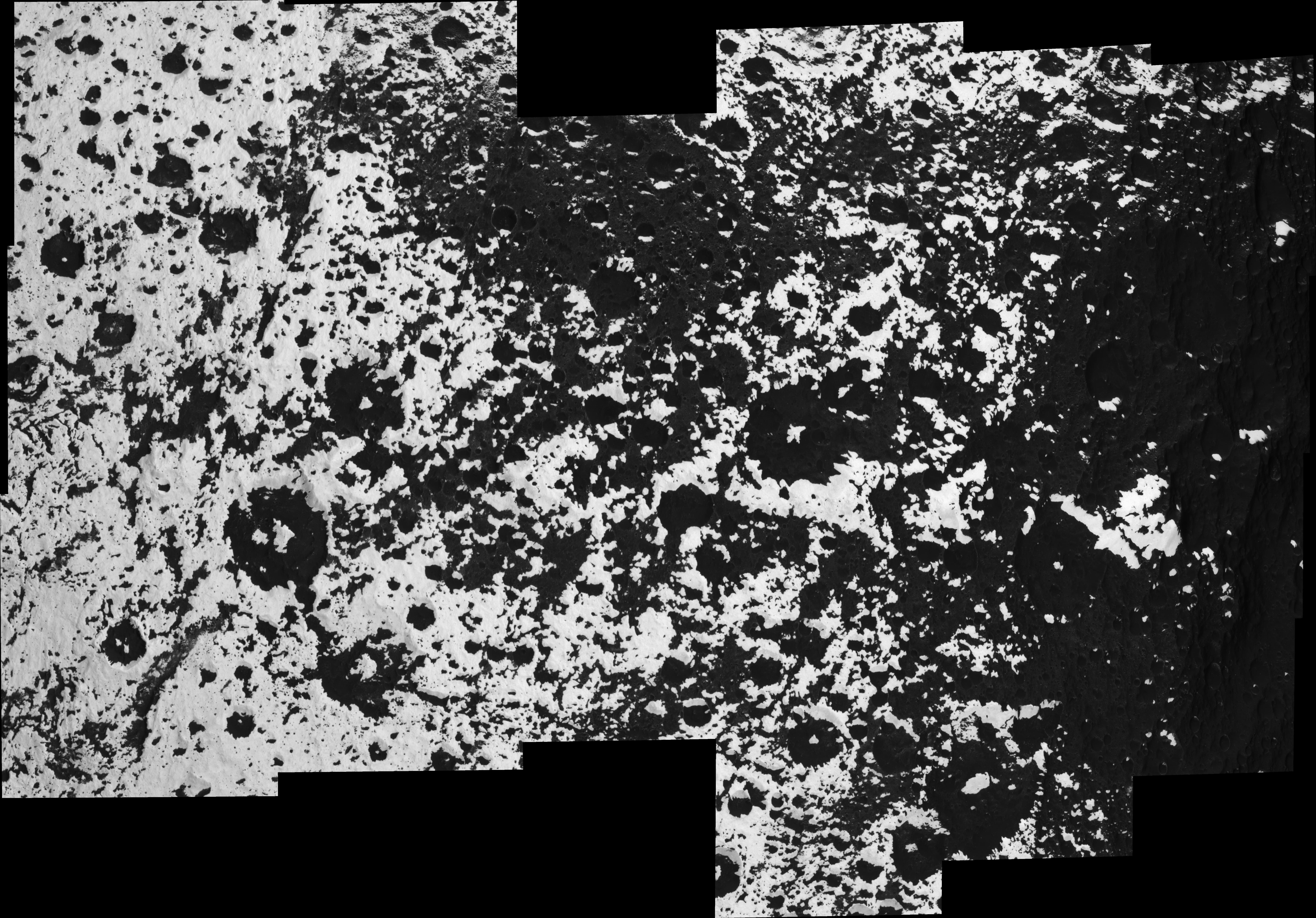
The transition region from Saturn's moon Iapetus' dark leading hemisphere to its bright trailing hemisphere is a complicated patchwork of craters and highlands, with low elevations filled in by dark material.
An explanation of the pattern visible here might be key to a full understanding of the bright/dark dichotomy on Iapetus, 1,468 kilometers (912 miles) across.
The view is centered on the equator and covers an area 711 kilometers wide by 417 kilometers tall (442 by 259 miles).
The giant equatorial ridge visible on the dark leading hemisphere is not present anymore in this region. Instead, large, isolated mountains more than 10 kilometers (6 miles) tall are spread along the equator. These mountains show bright western flanks, while the surrounding lowlands are generally dark.
The bright mountains at center right, surrounded by dark terrain, are also visible in the stereo view PIA08379. The region of Iapetus seen in this mosaic is also visible in the color full-disk mosaic PIA08384.
The mosaic is an orthographic projection consisting of 21 image footprints across the surface of Iapetus. The view is centered on terrain near 0.1 degree north latitude, 199 degrees west longitude, in the quadrant of Iapetus that faces away from Saturn. Image scale is approximately 83 meters (272 feet) per pixel. An orthographic view is most like the view seen by a distant observer looking through a telescope.
The clear spectral filter images in this mosaic were obtained with the Cassini spacecraft narrow- angle camera on Sept. 10, 2007, at distances ranging from 13,857 to 21,846 kilometers (8,610 to 13,574 miles) from Iapetus.
The Cassini-Huygens mission is a cooperative project of NASA, the European Space Agency and the Italian Space Agency. The Jet Propulsion Laboratory, a division of the California Institute of Technology in Pasadena, manages the mission for NASA's Science Mission Directorate, Washington, D.C. The Cassini orbiter and its two onboard cameras were designed, developed and assembled at JPL. The imaging operations center is based at the Space Science Institute in Boulder, Colo.
For more information about the Cassini-Huygens mission visit http://saturn.jpl.nasa.gov/home/index.cfm. The Cassini imaging team homepage is at http://ciclops.org.
 Planetary Data System


