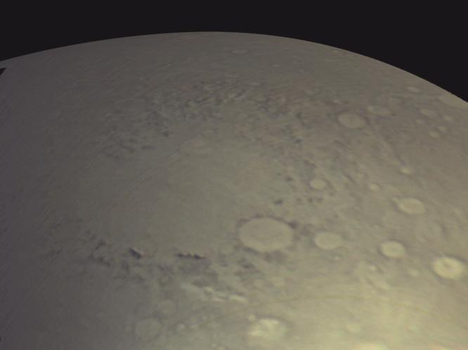
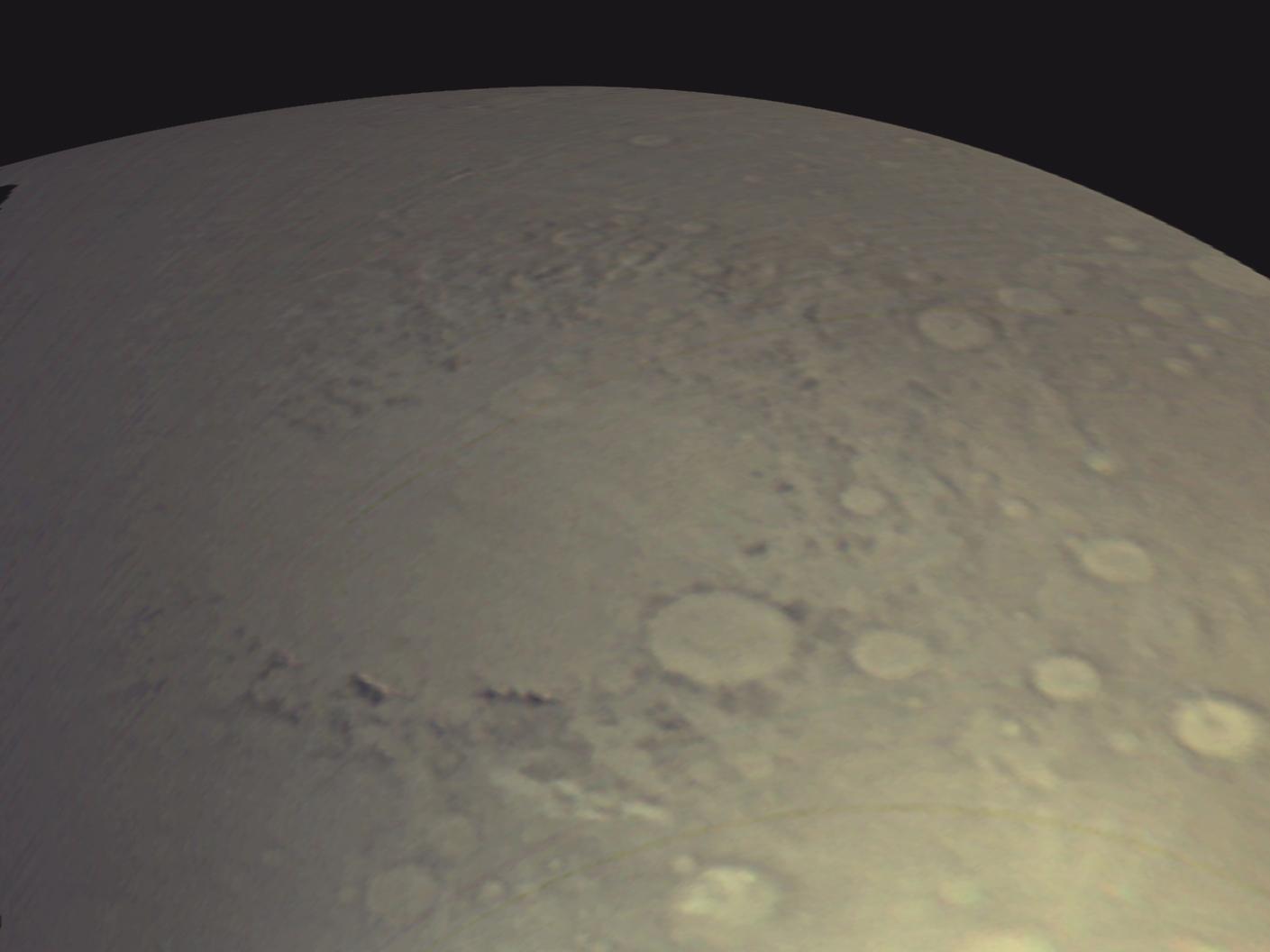
MARCI Bands CompositeThe Mars Color Imager (MARCI) camera on NASA's Mars Reconnaissance Orbiter acquired a seven-band color, wide-angle view of Mars on March 24, 2006, as part of a checkout of the orbiter's payload. This image shows a color composite made from the MARCI red, green, and blue bands. The view looks northward and includes the large Argyre Basin in Mars' southern hemisphere.
One use of the test imaging is an opportunity to fine-tune calibrations used for processing the separate bands into "true" color -- as it would appear to a human eye looking down from orbit. Further calibration will be needed. Regular use of MARCI and the other science instruments on Mars Reconnaissance Orbiter will begin in autumn 2006, after the spacecraft's orbit has been reshaped to a nearly circular, low-altitude path.
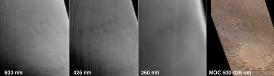
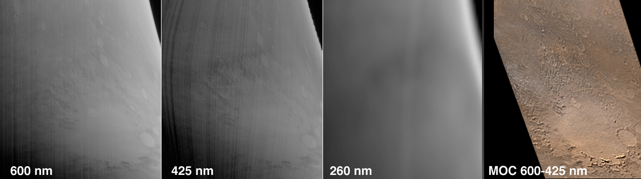
The March 24 test produced images from each color band. Illustrated here are some of these test images. In figure 1, three views acquired by MARCI are compared to a color composite of two views acquired about four hours later by the wide-angle imager of Mars Orbiter Camera (MOC) on NASA's Mars Global Surveyor spacecraft. The MARCI imaging occurred during the morning on Mars, while the MOC observations were made at about 2 p.m. local solar time. The region of Mars imaged by MARCI was south of the Valles Marineris. It includes the Argyre Basin's interior plains, Argyre Planitia, and mountains forming the basin rim, Nereidum Montes to the northwest (middle of images) and Charitum Montes to the southeast (bottom of images).
The color composite from MARCI differs from the MOC wide-angle color composite because, to create a color image with MOC data, camera-team members synthesize (fake) a green channel by adding the red and blue channels together and dividing by two. The slightly greenish tint of the MARCI image shows that the approximation used for MOC images underestimates the amount of green.
The test image labeled 260 nm shows how the planet appears at an ultraviolet (UV) waveband of 260 nanometers, where ozone absorbs the UV light. Relatively darker areas in this band normally will indicate the presence of ozone, and relatively lighter areas will indicate the absence of ozone. Water vapor in Mars' atmosphere is in an inverse relationship with ozone; where there is more of one, there is less of the other. So, lighter areas in images can be used to track water vapor. The term "relatively" is used here because Mars itself is very dark in the UV owing to absorption of UV light by iron-bearing minerals, and sunlight is deficient in UV relative to visible light, so in general Mars will always look dark in the UV. A second UV band on MARCI (not shown in the figure above) at a longer wavelength allows these differences to be quantified. The MOC wide-angle image shows wispy, light water-ice clouds to the northwest of Argyre in the afternoon, but researchers cannot yet correlate these clouds with the UV information from MARCI, especially because the times of day are different. When in its final mapping orbit, Mars Reconnaissance Orbiter will view the same area as Mars Global Surveyor separated by only one hour, and such correlations will be much more direct.
For more details of how MARCI images are acquired and processed, see the companion release, MARCI2-3, and be certain to examine the 15.6 Mbyte animated Gif movie.
The pictures shown here are the first views of Mars acquired by the Mars Color Imager on Mars Reconnaissance Orbiter. This is a re-flight of a similar instrument that was aboard the Mars Climate Orbiter, which was lost in September 1999 during its orbit insertion activity. In the primary science phase of the Mars Reconnaissance Orbiter, MARCI will routinely acquire daily global maps of the planet. These data will be used to help track storms, monitor clouds and water vapor, and track seasonal changes in surface albedo (bright and dark) patterns and the polar caps.
 Planetary Data System


