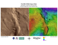
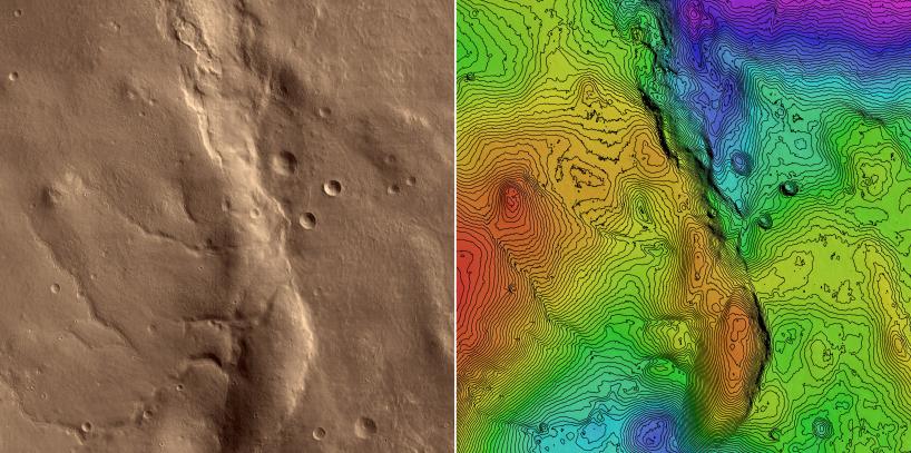
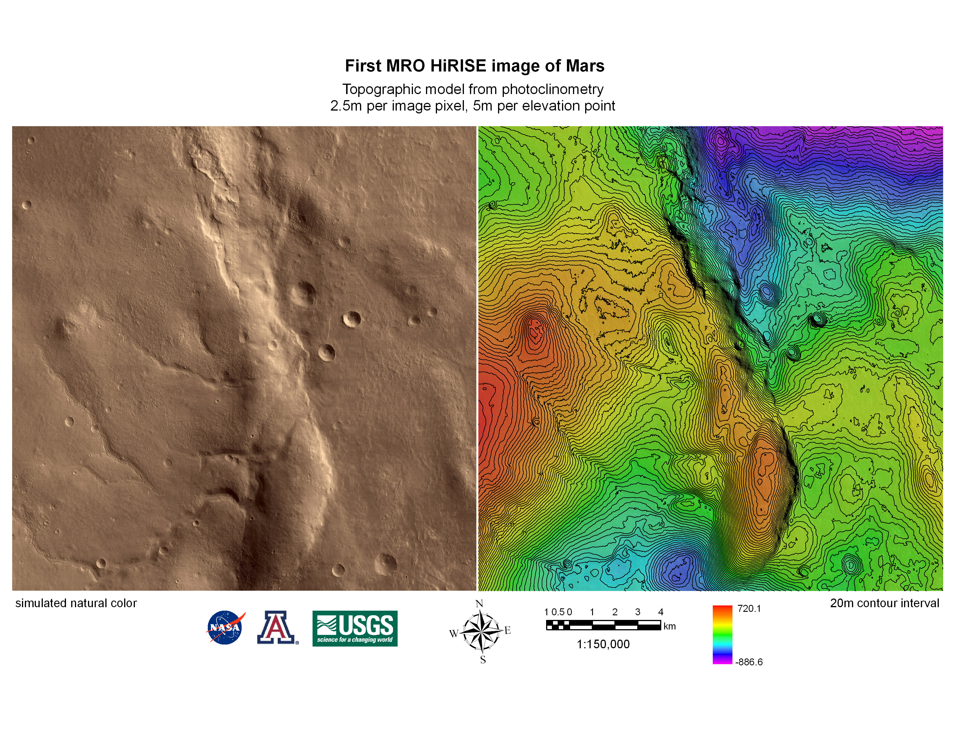
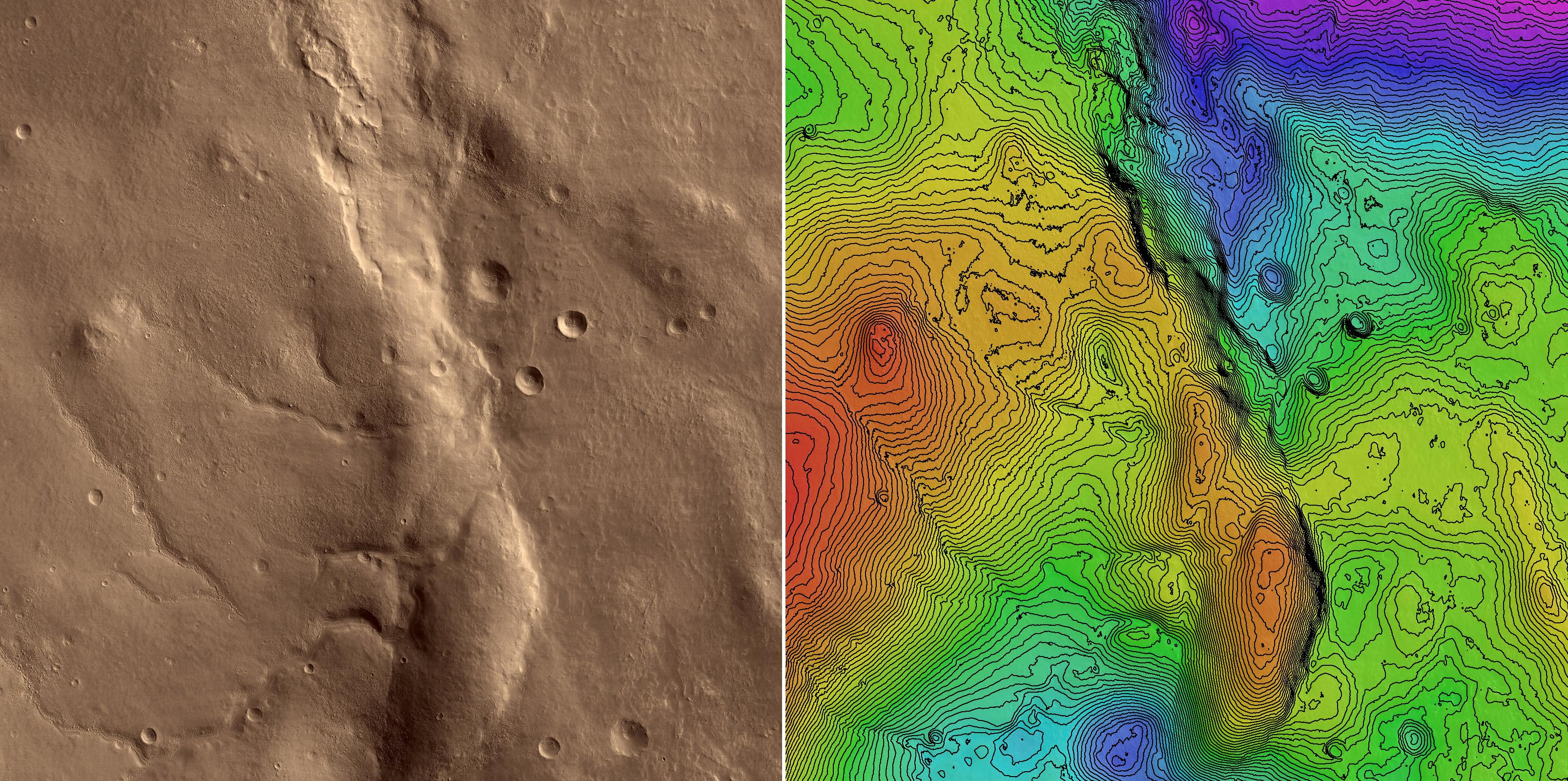
Annotated Topographic MapThis is a topographic map of part of the area covered by the first image of Mars obtained by the High Resolution Imaging Science Experiment (HiRISE) camera on NASA's Mars Reconnaissance Orbiter spacecraft. The image was processed at the U.S. Geological Survey, Flagstaff, by a technique called photoclinometry (or, more descriptively, "shape-from-shading"). This method allows elevations to be reconstructed from a single image by noting how surfaces sloping toward the sun appear brighter than areas that slope away from it. This image is almost ideal for such interpretation because the low sun angle reveals even subtle slopes with dramatic contrast, and variations in the brightness of surface materials (which could be confused with slopes) are minimal. At left is the region of the image that was analyzed, tinted to approximate the visual appearance of the Martian surface. This region is a square 20.4 kilometers (12.7 miles) wide (8,192 pixels by 8,192 pixels at a scale of 2.49 meters or 8.17 feet per pixel). At right is a color-coded topographic contour map of the same area. The total range of elevations is 1.6 kilometers (1 mile), with low areas shown in purple and high areas in red. Contours mark each 20-meter (66-foot) change in elevation. Photoclinometry gives relative rather than absolute heights, but the overall height and shape of features in this map, such as the ridge Ogygis Rupes in the center, agree reasonably well with results from the Mars Orbiter Laser Altimeter on NASA's Mars Odyssey spacecraft, an instrument with high absolute accuracy but relatively low spatial resolution. The real value of mapping by photoclinometry, however, is that it reveals the details of the smallest topographic features resolved by the image. In this example, the image was resampled by a factor of 2 before processing, so the topographic map has a scale of 5 meters (16 feet) per pixel and resolves features as small as 15 meters (49 feet). Computer-generated three-dimensional close-ups of the surface provide one way to visualize these small but important clues to Martian geologic history.
This illustration shows a subset of PIA08014, which was taken by the HiRISE camera on March 24, 2006. The image is oriented such that north is 7 degrees to the left of up. The range to the target was 2,493 kilometers (1,549 miles). At this distance the image scale is 2.49 meters (8.17 feet) per pixel, so objects as small as 7.5 meters (24.6 feet) are resolved. The image was taken at a local Mars time of 07:33 and the scene is illuminated from the upper right with a solar incidence angle of 78.1 degrees, thus the sun was about 11.9 degrees above the horizon. At an Ls of 29 degrees (with Ls an indicator of Mars' position in its orbit around the sun), the season on Mars is southern autumn.
Images from the High Resolution Imaging Science Experiment and additional information about the Mars Reconnaissance Orbiter are available online at: http://www.nasa.gov/mro or http://HiRISE.lpl.arizona.edu. For information about NASA and agency programs on the Web, visit: http://www.nasa.gov.
JPL, a division of the California Institute of Technology in Pasadena, manages the Mars Reconnaissance Orbiter for NASA's Science Mission Directorate, Washington. Lockheed Martin Space Systems is the prime contractor for the project and built the spacecraft. The HiRISE camera was built by Ball Aerospace and Technology Corporation and is operated by the University of Arizona.