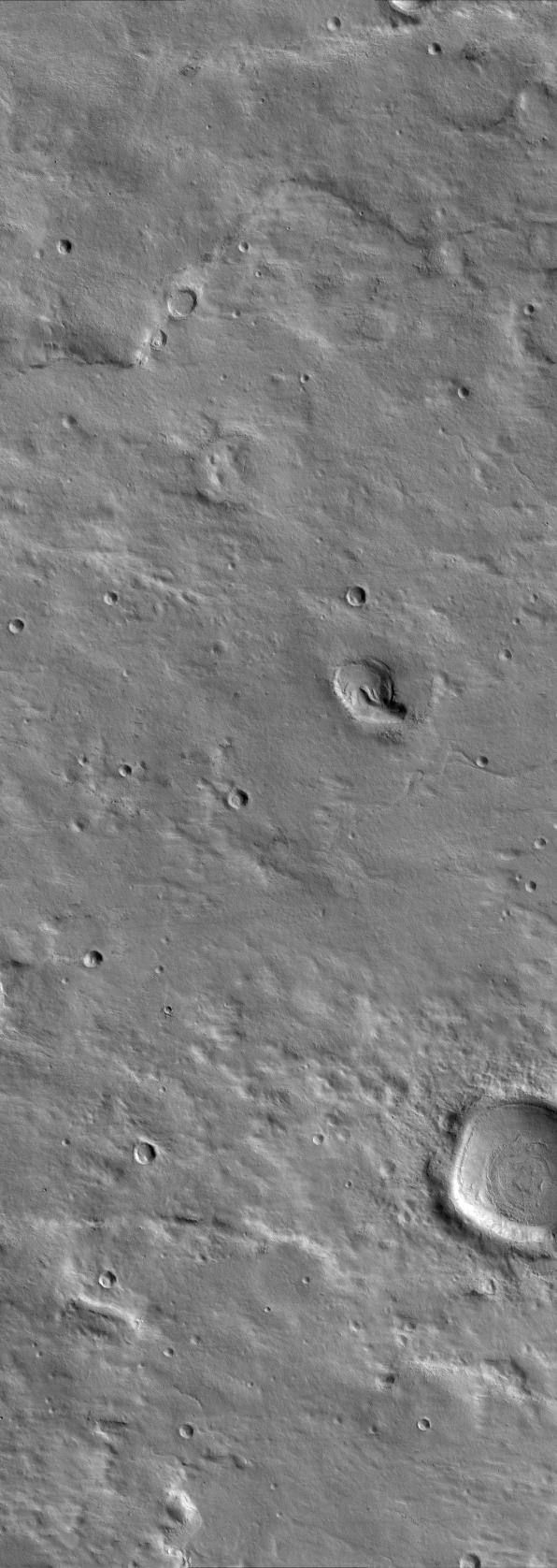
This scene in a region of Mars named Terra Cimmeria shows a variety of ancient and recent geologic processes. In the upper portion of the image, a twisting ridge of raised ground may outline the location of a subsurface thrust fault. This type of fault results in the compression and crumpling of a planet's surface. This crumpling of the planet's surface has squeezed two originally circular craters on the ridge into oval-shaped craters. Valleys are also present throughout the image, suggesting that water flowed across this area a long time ago. Many valleys and craters in the image are now filled by deposits of dust or debris. This debris mantle is common over the middle latitudes of Mars and is a geologically recent deposit.
This image was taken by the High Resolution Imaging Science Experiment (HiRISE) camera onboard NASA's Mars Reconnaissance Orbiter spacecraft on March 25, 2006. The image is centered at 40.64 degrees south latitude, 144.39 degrees east longitude. It is oriented such that north is 7 degrees to the left of up. The range to the target was 2,038 kilometers (1,266 miles). At this distance the image scale is 2.04 meters (6.69 feet) per pixel, so objects as small as 6.1 meters (20 feet) are resolved. In total this image is 12.34 kilometers (7.67 miles) or 6,045 pixels wide and 34.68 kilometers (21.55 miles) or 17,003 pixels long. The image was taken at a local Mars time of 07:28 and the scene is illuminated from the upper right with a solar incidence angle of 82.0 degrees, thus the sun was about 8.0 degrees above the horizon. At an Ls of 30 degrees (with Ls an indicator of Mars' position in its orbit around the sun), the season on Mars is southern autumn.
Images from the High Resolution Imaging Science Experiment and additional information about the Mars Reconnaissance Orbiter are available online at: http://www.nasa.gov/mro or http://HiRISE.lpl.arizona.edu. For information about NASA and agency programs on the Web, visit: http://www.nasa.gov.
JPL, a division of the California Institute of Technology in Pasadena, manages the Mars Reconnaissance Orbiter for NASA's Science Mission Directorate, Washington. Lockheed Martin Space Systems is the prime contractor for the project and built the spacecraft. The HiRISE camera was built by Ball Aerospace and Technology Corporation and is operated by the University of Arizona.
 Planetary Data System


