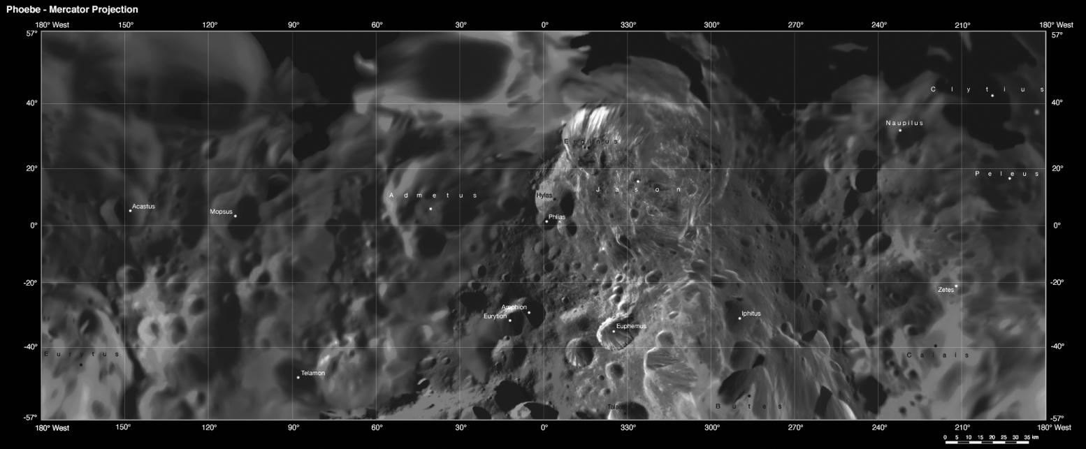
This map is part of a group release of Mercator and polar stereographic projections of Saturn's moon Phoebe. A Mercator projection is a map that preserves directions on a body, but distorts sizes, especially near the poles. For the other maps, see PIA07796 and PIA07797.
This global digital map of Phoebe was created using data taken during the Cassini spacecraft's close flyby of the small moon in June 2004.
The mosaic is projected into the Mercator projection within the latitude range of 57 degrees south to 57 degrees north latitude; the stereographic projections represent latitudes greater and lower than plus or minus 55 degrees. Thus, this map meets the standard scale of 1:1,000,000 recommended by the U.S. Geological Survey.
The projections are conformal, the quadrangles overlap and the scale of the poles was chosen such that the circumference of the stereographic projection is identical to the width of the Mercator projection.
The nomenclature (naming scheme) was proposed by the Cassini imaging team and has yet to be validated by the International Astronomical Union. Resolution of the digital mosaic is 233 meters (764 feet) per pixel, although the highest resolution images have resolutions of 70 meters (230 feet) per pixel.
The mean radius of Phoebe is 106.8 kilometers (66 miles).
See PIA07775 for a global mosaic of Phoebe in Equidistant projection. Equidistant projections preserve distances on a body, with some distortion of area and direction.
The Cassini-Huygens mission is a cooperative project of NASA, the European Space Agency and the Italian Space Agency. The Jet Propulsion Laboratory, a division of the California Institute of Technology in Pasadena, manages the mission for NASA's Science Mission Directorate, Washington, D.C. The Cassini orbiter and its two onboard cameras were designed, developed and assembled at JPL. The imaging operations center is based at the Space Science Institute in Boulder, Colo.
For more information about the Cassini-Huygens mission visit http://saturn.jpl.nasa.gov/home/index.cfm. The Cassini imaging team homepage is at http://ciclops.org.
 Planetary Data System


