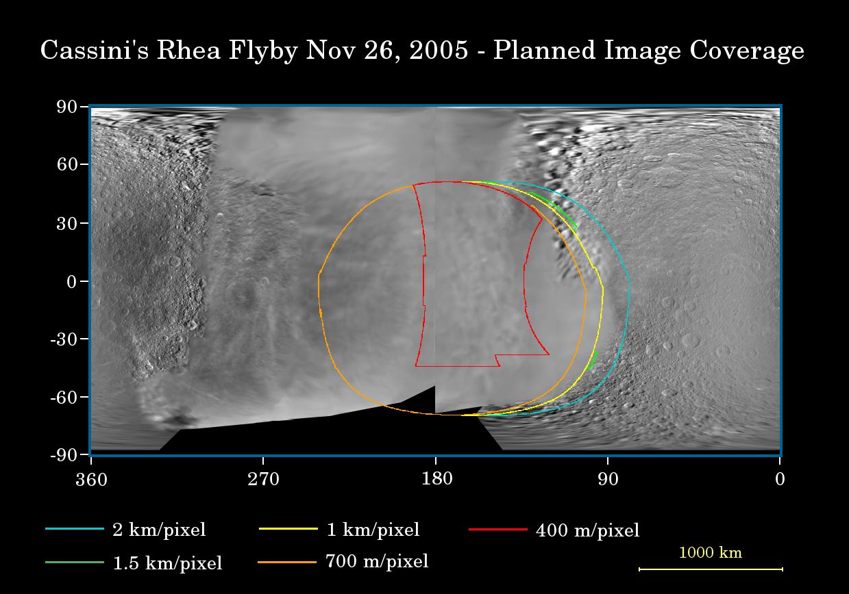
This map of the surface of Saturn's moon, Rhea, illustrates the regions that will be imaged by Cassini during the spacecraft's close flyby of the moon on Nov. 26, 2005. At closest approach, the spacecraft is expected to pass approximately 500 kilometers (310 miles) above the moon's surface.
The colored lines delineate the regions that will be imaged at differing resolutions, listed in the legend at bottom. Rhea is 1,528 kilometers (949 miles) across.
The new high-resolution coverage will examine details on the anti-Saturn hemisphere of Rhea, including two large impact basins there. Cassini previously imaged terrain farther to the south of this at approximately 1 kilometer (0.6 mile) per pixel in August 2005 (see PIA07566). Imaging scientists also hope to get a high-resolution view of a relatively young 50-kilometer-wide (30-mile) crater on the moon's leading hemisphere (see PIA06648). Planetary scientists are interested in learning about the compositional makeup of Rhea, other than water ice, as well as the nature of the wispy streaks on the moon's trailing hemisphere. In December, 2004, Cassini revealed that similar bright, wispy markings on Dione are actually a system of braided tectonic fractures (see PIA06162).
The map was made from images obtained by both the Cassini and NASA Voyager spacecraft.
The Cassini-Huygens mission is a cooperative project of NASA, the European Space Agency and the Italian Space Agency. The Jet Propulsion Laboratory, a division of the California Institute of Technology in Pasadena, manages the mission for NASA's Science Mission Directorate, Washington, D.C. The Cassini orbiter and its two onboard cameras were designed, developed and assembled at JPL. The imaging operations center is based at the Space Science Institute in Boulder, Colo.
For more information about the Cassini-Huygens mission visit http://saturn.jpl.nasa.gov. The Cassini imaging team homepage is at http://ciclops.org.
