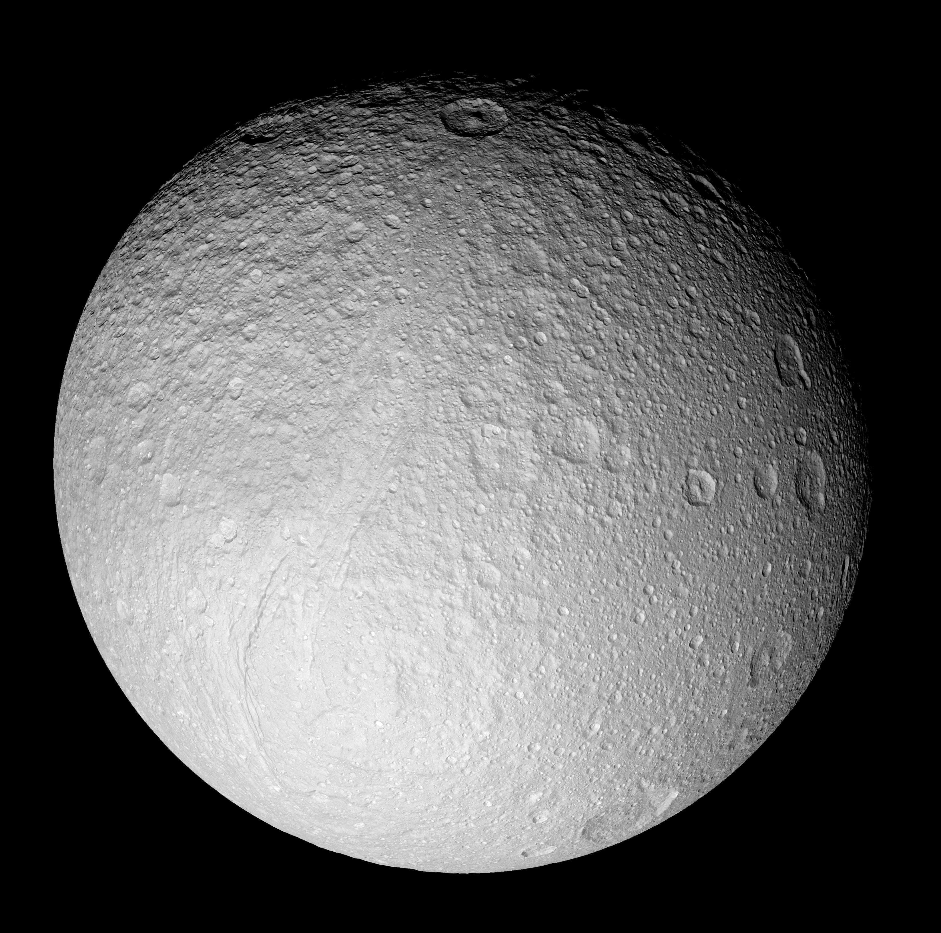
With this full-disk mosaic, Cassini presents the best view yet of the south pole of Saturn's moon Tethys.
The giant rift Ithaca Chasma cuts across the disk. Much of the topography seen here, including that of Ithaca Chasma, has a soft, muted appearance. It is clearly very old and has been heavily bombarded by impacts over time.
Many of the fresh-appearing craters (ones with crisp relief) exhibit unusually bright crater floors. The origin of the apparent brightness (or "albedo") contrast is not known. It is possible that impacts punched through to a brighter layer underneath, or perhaps it is brighter because of different grain sizes or textures of the crater floor material in comparison to material along the crater walls and surrounding surface.
The moon's high southern latitudes, seen here at the bottom, were not imaged by NASA's Voyager spacecraft during their flybys of Tethys 25 years ago.
The mosaic is composed of nine images taken during Cassini's close flyby of Tethys (1,071 kilometers, or 665 miles across) on Sept. 24, 2005, during which the spacecraft passed approximately 1,500 kilometers (930 miles) above the moon's surface.
This view is centered on terrain at approximately 1.2 degrees south latitude and 342 degrees west longitude on Tethys. It has been rotated so that north is up.
The clear filter images in this mosaic were taken with the Cassini spacecraft narrow-angle camera at distances ranging from 71,600 kilometers (44,500 miles) to 62,400 kilometers (38,800 miles) from Tethys and at a Sun-Tethys-spacecraft, or phase, angle of 21 degrees. The image scale is 370 meters (1,200 feet) per pixel.
The Cassini-Huygens mission is a cooperative project of NASA, the European Space Agency and the Italian Space Agency. The Jet Propulsion Laboratory, a division of the California Institute of Technology in Pasadena, manages the mission for NASA's Science Mission Directorate, Washington, D.C. The Cassini orbiter and its two onboard cameras were designed, developed and assembled at JPL. The imaging operations center is based at the Space Science Institute in Boulder, Colo.
For more information about the Cassini-Huygens mission visit http://saturn.jpl.nasa.gov. For additional images visit the Cassini imaging team homepage http://ciclops.org.
 Planetary Data System


