- Original Caption Released with Image:
-
9 July 2004
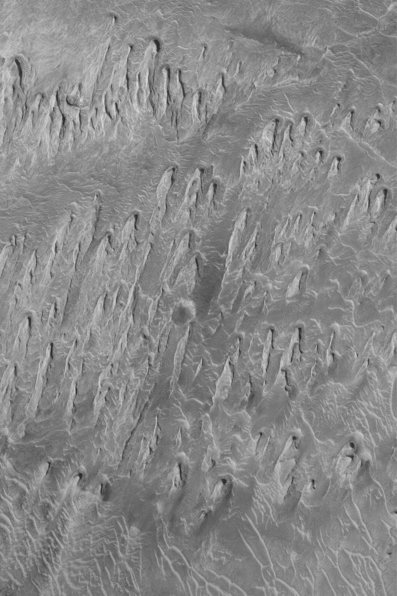
The processes that have eroded and exposed sedimentary rock outcrops in many of the Valles Marineris troughs are unclear. However, this Mars Global Surveyor (MGS) Mars Orbiter Camera (MOC) image shows an example from western Tithonium Chasma that is unambiguous. The ridges are yardangs, an erosional form created by wind. To acquire the characteristic shape of a yardang, the material being eroded must contain some amount of sand. As weathering processes loosen sand grains from the outcrop, they become available to be picked up and transported away by wind. In the case shown here, the dominant, rock-eroding winds came from the top/upper right (north). This view of eroded sedimentary rock in western Valles Marineris is located near 4.6°S, 89.1°W. At 1.5 meters (5 feet) per pixel, this image covers an area about 3 km (1.9 mi) wide, and is illuminated by sunlight from the left.
- Image Credit:
-
NASA/JPL/Malin Space Science Systems
Image Addition Date: -
2004-07-09
|