- Original Caption Released with Image:
-
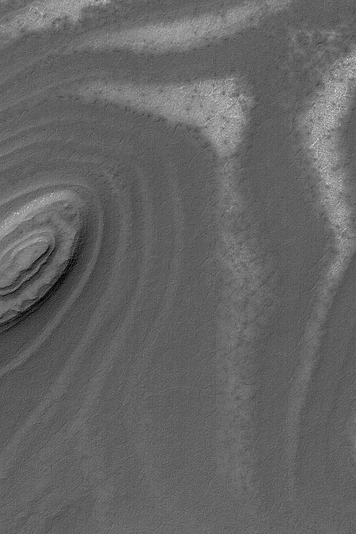
4 June 2004
This Mars Global Surveyor (MGS) Mars Orbiter Camera (MOC) image shows exposures of layered material on slopes in the south polar region near 81.9°S, 72.2°W. Layers record the history of a place, but accessing the information contained in these layers may one day require a visit by a human or robotic explorer. The south polar layers, in general, are believed to be accumulations of dust and ice that were built up in the most recent billion years or so. However, they could just as easily be sedimentary rocks from much earlier in martian history. The picture covers an area about 3 km (1.9 mi) across. The scene is illuminated by sunlight from the upper left.
- Image Credit:
-
NASA/JPL/Malin Space Science Systems
Image Addition Date: -
2004-06-04
|
