1 June 2004
The Mars Orbiter Camera (MOC) team celebrated a milestone late last week as Mars Global Surveyor (MGS) completed its 25,000th orbit since it reached the red planet on 12 September 1997. Also last week, on 27 May 2004, MGS's thrusters were fired briefly to adjust the spacecraft's orbit. This Orbit Synchronization Maneuver-7 (OSM-7) was designed to stop the orbital drift in Mars local mean solar time that MGS had been experiencing as a result of the OSMs that were done in late 2003 and early 2004 to move the spacecraft into position to relay data during the January landings of the Mars Exploration Rovers.
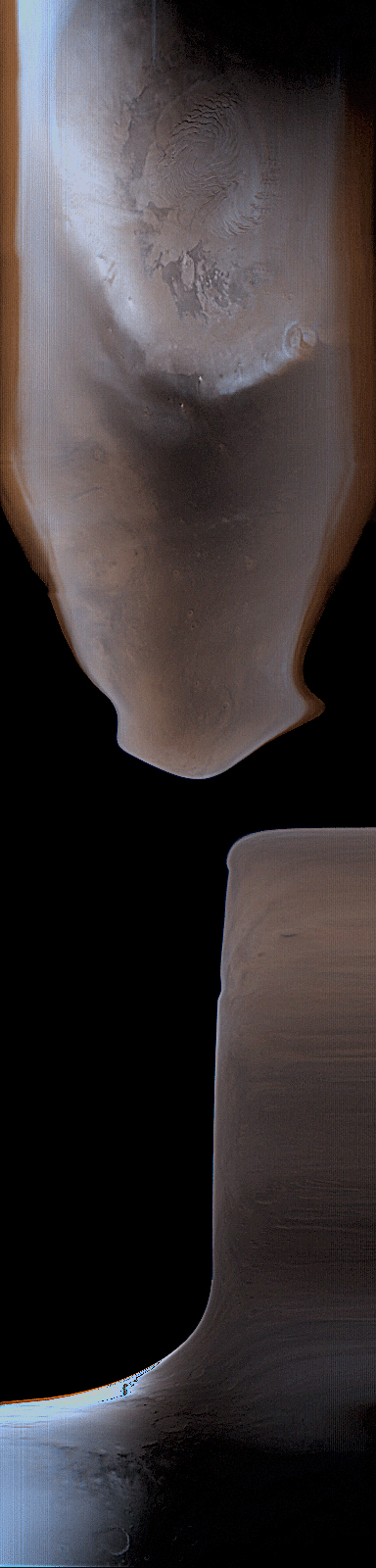
OSM-7 occurred on the day side of Mars, and thus the effects of the maneuver are visible in the MOC wide angle daily global map image acquired on that orbit, as shown here. MOC has two wide angle cameras, one that acquires a red view, the other is blue. Because Mars has very little that is green, the green channel in the color image is synthesized by combining the red and blue channels by a known ratio. The black areas in the image are views of outer space. Black portions of the image were obtained because MGS was rotated into position for the burn, then the engines were fired.
The spacecraft moves from south to north on the day side of the planet. Thus, the bottom of the image is near the south polar region of Mars, and the top shows the north polar cap. Before the black areas appeared near the bottom of the scene, the spacecraft was moving along in its normal orientation. Then, where the black first appears, MGS was being rotated relative to its normal position. Later, toward the middle of the image, the thrusters were fired. The spacecraft returned to its normal operational orientation before it reached the north polar region. The white area toward the lower left of the image is saturated by sunlight glinting off of clouds over the southern high latitudes. Bluish areas are clouds in the atmosphere. Sunlight illuminates the planet from the left. The dark region immediately south (below) the north polar cap is Acidalia Planitia.
The status of MGS is described each week by the MGS Project at the Jet Propulsion Laboratory's web page, http://marsweb.jpl.nasa.gov/mgs/status/reports/msop-mgs.html. These reports include additional information about OSM-7 and the previous OSMs conducted to support the rover mission.
 Planetary Data System


