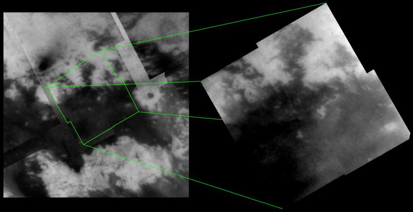
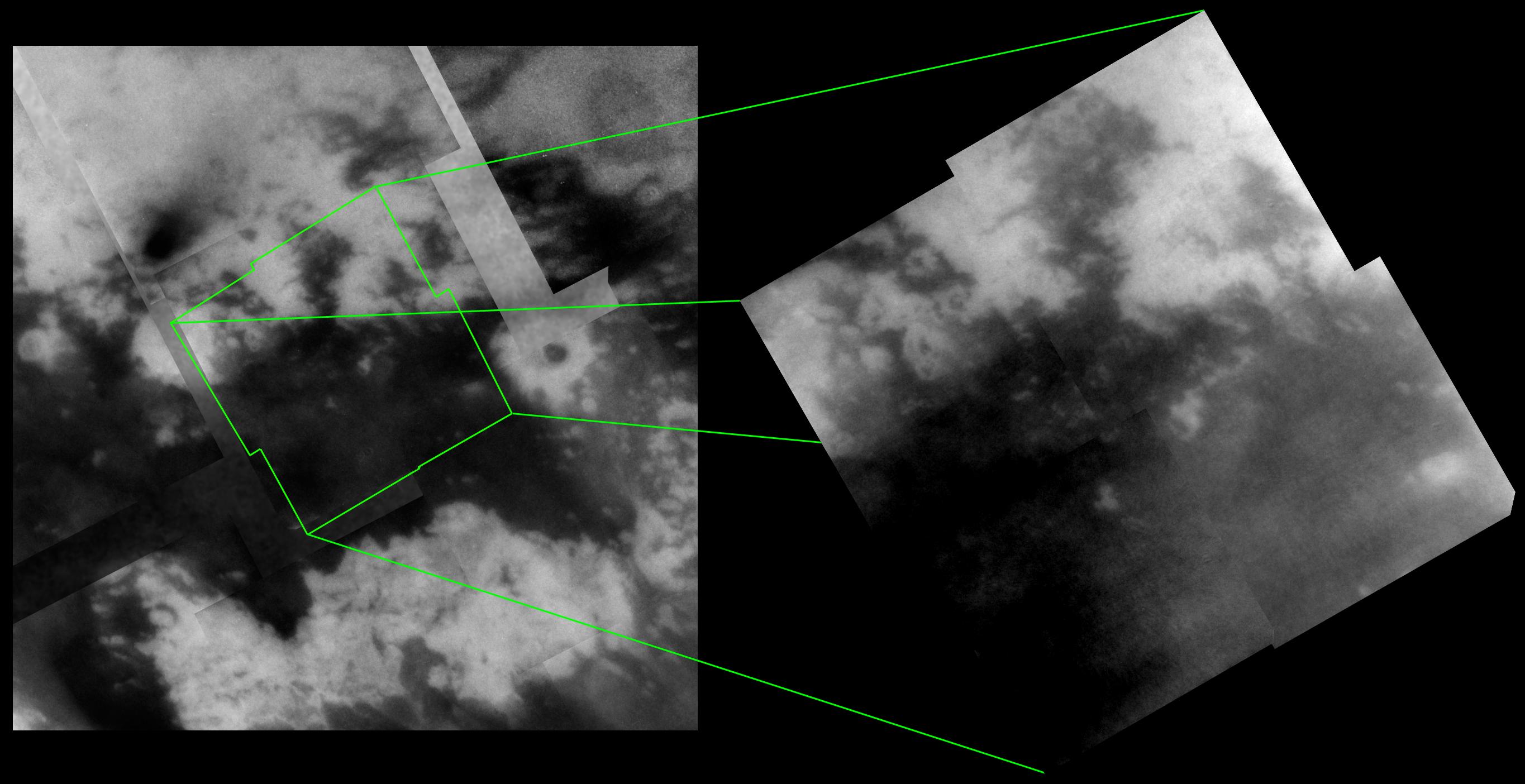
Images of Titan's surface from Cassini's April 16, 2005 flyby continue to reveal the incredibly intricate nature of the boundaries between dark and bright material.
During the two most recent flybys of Titan, on March 31 and April 16, 2005, Cassini captured a number of images of the hemisphere of Titan that faces Saturn. The mosaic at the right consists of four narrow-angle camera frames taken during the April flyby and highlights intriguing features seen along a boundary between bright and dark terrain. The image at the left shows the location of this mosaic within a lower resolution mosaic of images taken during the March 2005 flyby (see PIA06222).
The outline of the bright and dark boundary in some places suggests fluvial (river or stream) activity, particularly along the margin of the dark region that extends north near the top center of the mosaic. Along the mosaic's western edge, dark, curving and linear features can be seen running from the bright area into the dark area, similar to other channel-like features seen in previous flybys (see PIA06202).
Data taken by the synthetic aperture radar experiment during the February 2005 flyby of Titan covers much of the region shown in the mosaic at right, particularly along its northern and western edges. For example, the bright oval-shaped feature (34 kilometers, or 21 miles across) near the lower right corner of the mosaic corresponds to the bright feature seen in the lower left corner of a previously released radar image from February (see PIA07368). Comparing the same features as seen by different instruments will be important in understanding how these features formed. Furthermore, it will help to constrain what exactly each instrument is detecting (i.e., surface roughness vs. brightness, surface vs. subsurface, topographic effects, etc.).
The new mosaic at the right is centered on 11 degrees north latitude, 27 degrees west longitude. The image has been rotated so that north is up. Each of the four frames consists of five individual images that have been added together and enhanced to bring out surface detail and reduce noise, although some camera artifacts remain.
These images were taken using a filter sensitive to wavelengths of infrared light centered at 938 nanometers -- considered to be the imaging science subsystem's best spectral filter for observing the surface of Titan. This view was acquired at distances ranging from approximately 57,000 to 46,000 kilometers (35,400 to 28,600 miles). The pixel scale ranges from 670 to 550 meters (0.4 to 0.3 miles) per pixel, although the actual resolution is likely to be several times larger.
The Cassini-Huygens mission is a cooperative project of NASA, the European Space Agency and the Italian Space Agency. The Jet Propulsion Laboratory, a division of the California Institute of Technology in Pasadena, manages the mission for NASA's Science Mission Directorate, Washington, D.C. The Cassini orbiter and its two onboard cameras were designed, developed and assembled at JPL. The imaging team is based at the Space Science Institute, Boulder, Colo.
For more information about the Cassini-Huygens mission visit http://saturn.jpl.nasa.gov. For additional images visit the Cassini imaging team homepage http://ciclops.org.
 Planetary Data System


