PDS logoPlanetary Data System
PDS Information
Find a Node - Use these links to navigate to any of the 8 publicly accessible PDS Nodes.

This bar indicates that you are within the PDS enterprise which includes 6 science discipline nodes and 2 support nodes which are overseen by the Project Management Office at NASA's Goddard Space Flight Center (GSFC). Each node is led by an expert in the subject discipline, supported by an advisory group of other practitioners of that discipline, and subject to selection and approval under a regular NASA Research Announcement.
Click here to return to the Photojournal Home Page Click here to view a list of Photojournal Image Galleries Photojournal_inner_header
Latest Images  |  Spacecraft & Technology  |  Animations  |  Space Images App  |  Feedback  |  Photojournal Search  

PIA06045: Approaching the Hills
 Target Name:  Mars
 Is a satellite of:  Sol (our sun)
 Mission:  Mars Exploration Rover (MER)
 Spacecraft:  Spirit
 Instrument:  Panoramic Camera
 Product Size:  2667 x 972 pixels (w x h)
 Produced By:  Cornell University 
 Full-Res TIFF:  PIA06045.tif (5.736 MB)
 Full-Res JPEG:  PIA06045.jpg (349.7 kB)
 QuickTime VR:  PIA06045.mov (1.312 MB)

Click on the image above to download a moderately sized image in JPEG format (possibly reduced in size from original)

Original Caption Released with Image:

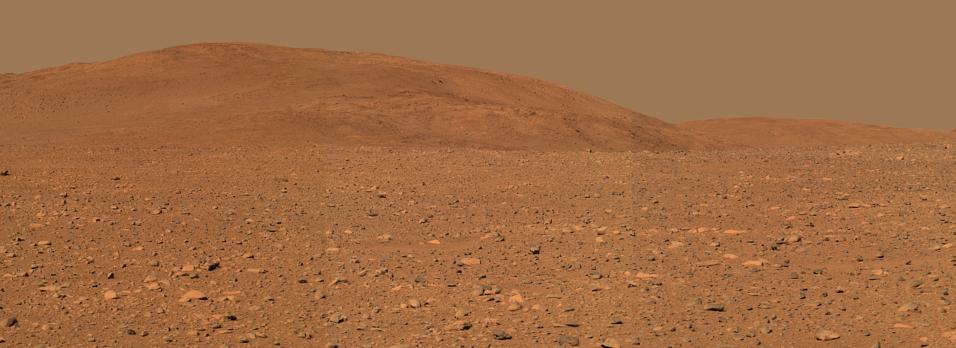
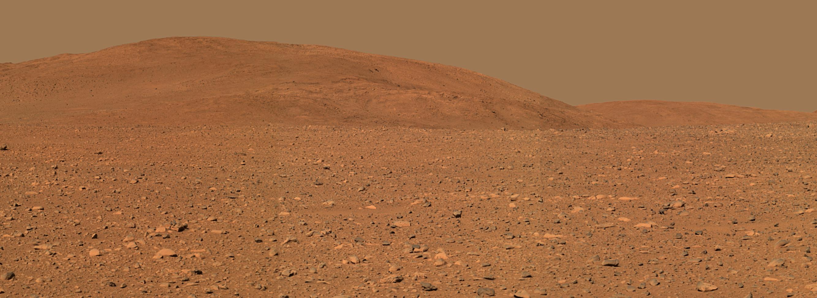
This approximate true-color rendering of the central part of the "Columbia Hills" was made using images taken by NASA's Mars Exploration Rover Spirit panoramic camera. Scientists plan to use the science instruments on the rover to analyze the composition of rock and soil at the hills," Spirit's planned destination. The images in this mosaic, acquired on sol 149 (June 3, 2004), were taken with the camera's 600, 530, and 480 nanometer filters from three rover positions approximately 300 meters (984 feet) away from the base of the hills.

Image Credit:
NASA/JPL/Cornell

Image Addition Date:
2004-06-08