April 14, 2004
Bringing Out the Color in 'Bounce'
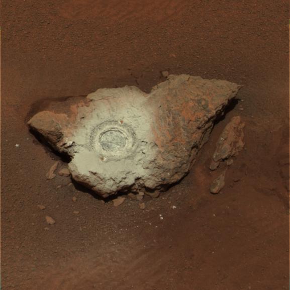
This false-color composite of the rock dubbed "Bounce" shows the rock
after the Mars Exploration Rover Opportunity drilled into it with its rock
abrasion tool.
The drilling of the 7-millimeter-deep (0.3-inch) hole generated a
bright powder. The color in this image has been enhanced to show that
these tailings are relatively blue when compared with the unaltered rock
(to the human eye, the tailings would appear red).
This image was assembled from the infrared (750-nanometer),green
(530-nanometer) and violet (430-nanometer) filters of the rover's
panoramic camera. It was taken on sol 68.

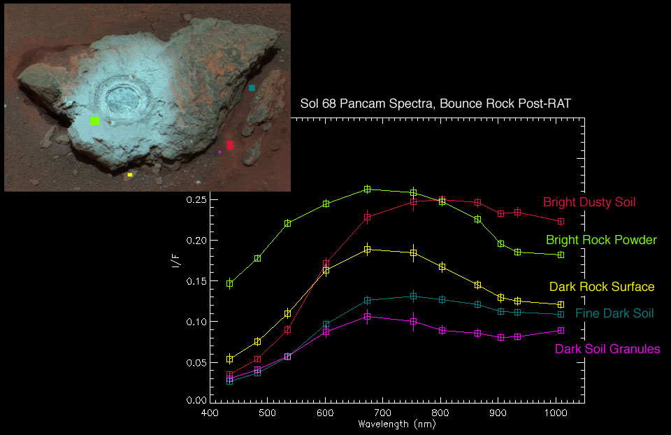
Figure 1: The Many Sides of 'Bounce'
In Figure 1, the graph shows light signatures, or spectra, taken from
five different places on the rock dubbed "Bounce" at Meridiani Planum.
The green and yellow spectra are from the bright rock powder and dark
rock surface respectively. These spectra show a drop in reflectance near
the one-micron wavelength mark, consistent with a less-oxidized,
iron-bearing silicate such as olivine or pyroxene. These findings are
not inconsistent with this rock being a basaltic rock. The relative
brightness of the powder can be explained by particle sizes.
The red spectrum is from the bright dusty soil next to Bounce.
The spectrum is dominated by the signature of oxidized "ferric" iron
(Fe3+) like that seen in the classic martian dust. The teal spectrum
is from the darker Meridiani soils. That spectrum is also dominated by
ferric iron, though the reflectivity is lower probably because the
grains are coarser in these soils compared to the dust.
The purple spectrum from the larger granules in the Meridiani soil
show a fine-grained iron oxide (Fe3+) component. These spectra were
taken by the rover's panoramic camera.

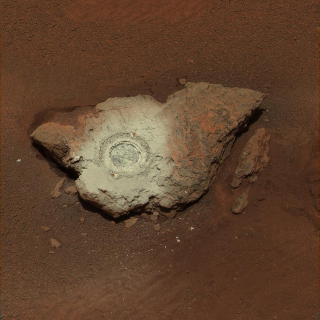
Figure 2: 'Bounce' Gets a Thorough Read
This image shows the rock dubbed "Bounce" near the Mars Exploration
Rover Opportunity's landing site at Meridiani Planum, Mars. The two
colored spots show where scientists took measurements of the rock with
the rover's miniature thermal emission spectrometer. The area on the
right is untouched rock and the area on the left is where the rover
drilled a hole. This image was taken by the rover's panoramic camera.
 Planetary Data System


