PDS logoPlanetary Data System
PDS Information
Find a Node - Use these links to navigate to any of the 8 publicly accessible PDS Nodes.

This bar indicates that you are within the PDS enterprise which includes 6 science discipline nodes and 2 support nodes which are overseen by the Project Management Office at NASA's Goddard Space Flight Center (GSFC). Each node is led by an expert in the subject discipline, supported by an advisory group of other practitioners of that discipline, and subject to selection and approval under a regular NASA Research Announcement.
Click here to return to the Photojournal Home Page Click here to view a list of Photojournal Image Galleries Photojournal_inner_header
Latest Images  |  Spacecraft & Technology  |  Animations  |  Space Images App  |  Feedback  |  Photojournal Search  

PIA05184: Virtual Rover on Its Own
 Target Name:  Mars
 Is a satellite of:  Sol (our sun)
 Mission:  Mars Exploration Rover (MER)
 Spacecraft:  Opportunity
 Instrument:  Navigation Camera
 Product Size:  960 x 780 pixels (w x h)
 Produced By:  JPL
 Full-Res TIFF:  PIA05184.tif (773.8 kB)
 Full-Res JPEG:  PIA05184.jpg (55.49 kB)

Click on the image above to download a moderately sized image in JPEG format (possibly reduced in size from original)

Original Caption Released with Image:
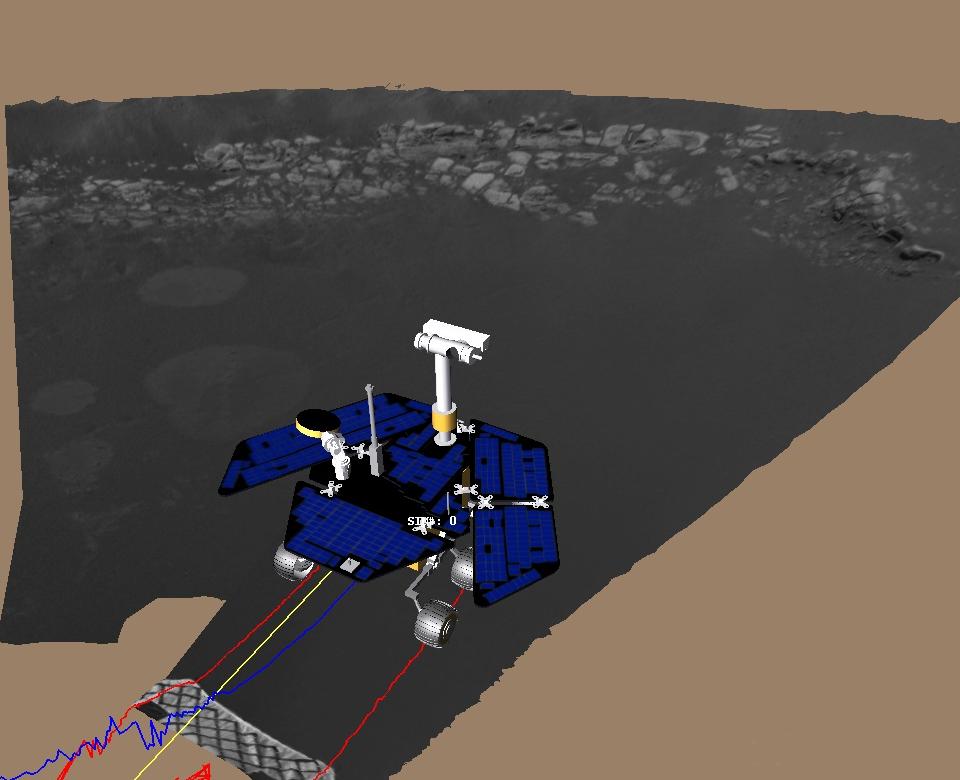
This image shows a screenshot from the software used by engineers to roll the Mars Exploration Rover Opportunity off its lander and onto martian soil. Engineers received confirmation that Opportunity's six wheels had touched ground at 3:01 a.m. PST, January 31, 2004, on the seventh martian day, or sol, of the mission. The software simulates the rover's movements, helping to plot a safe course. The virtual 3-D world around the rover is built from images taken by Opportunity's stereo navigation cameras. Regions for which the rover has not yet acquired 3-D data are represented in beige. The rover is approximately 1 meter (3 feet) in front of the lander, facing north.
Image Credit:
NASA/JPL

Image Addition Date:
2004-01-31