PDS logoPlanetary Data System
PDS Information
Find a Node - Use these links to navigate to any of the 8 publicly accessible PDS Nodes.

This bar indicates that you are within the PDS enterprise which includes 6 science discipline nodes and 2 support nodes which are overseen by the Project Management Office at NASA's Goddard Space Flight Center (GSFC). Each node is led by an expert in the subject discipline, supported by an advisory group of other practitioners of that discipline, and subject to selection and approval under a regular NASA Research Announcement.
Click here to return to the Photojournal Home Page Click here to view a list of Photojournal Image Galleries Photojournal_inner_header
Latest Images  |  Spacecraft & Technology  |  Animations  |  Space Images App  |  Feedback  |  Photojournal Search  

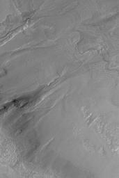
PIA04888: Multiple-Event Gully
 Target Name:  Mars
 Is a satellite of:  Sol (our sun)
 Mission:  Mars Global Surveyor (MGS)
 Spacecraft:  Mars Global Surveyor Orbiter
 Instrument:  Mars Orbiter Camera (MOC)
 Product Size:  2048 x 3072 pixels (w x h)
 Produced By:  Malin Space Science Systems
 Full-Res TIFF:  PIA04888.tif (5.547 MB)
 Full-Res JPEG:  PIA04888.jpg (804.9 kB)

Click on the image above to download a moderately sized image in JPEG format (possibly reduced in size from original)

Original Caption Released with Image:

MGS MOC Release No. MOC2-554, 24 November 2003

Middle- and polar-latitude gullies are common on crater and trough walls in the martian southern hemisphere. Some also occur in the north. One of the controversies surrounding gullies is whether they involved fluid flow (such as liquid water) or were formed by dry landsliding processes. The occurrence of banked and leveed channels in many gullies argues that they formed by fluid flow. Another question centers on whether gullies are "one-shot deals" or involved more than one episode of fluid flow. This Mars Global Surveyor (MGS) Mars Orbiter Camera (MOC) image, acquired in November 2003, shows a gully with an apron, near the center of the frame, that formed by multiple fluid flows. The apron of debris at the base of the gully near the center of the picture is not just one apron, it is three. Three separate aprons formed at three different times. First, the larger, left-most apron formed. Later, another event caused fluid to cut through that apron and create a new one (the middle of the three). Later, a third event cut both aprons and formed a small, third one. This image shows the wall of an impact crater located near 51.3°S, 326.6°W. The image covers an area 3 km (1.9 mi) wide, and is illuminated by sunlight from the upper left.

Image Credit:
NASA/JPL/Malin Space Science Systems

Image Addition Date:
2003-11-24