MGS MOC Release No. MOC2-481, 12 September 2003
This image is in the first pair obtained in the Public Target Request program, which accepts suggestions for sites to photograph with the Mars Orbiter Camera on NASA's Mars Global Surveyor spacecraft.
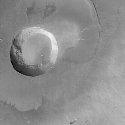
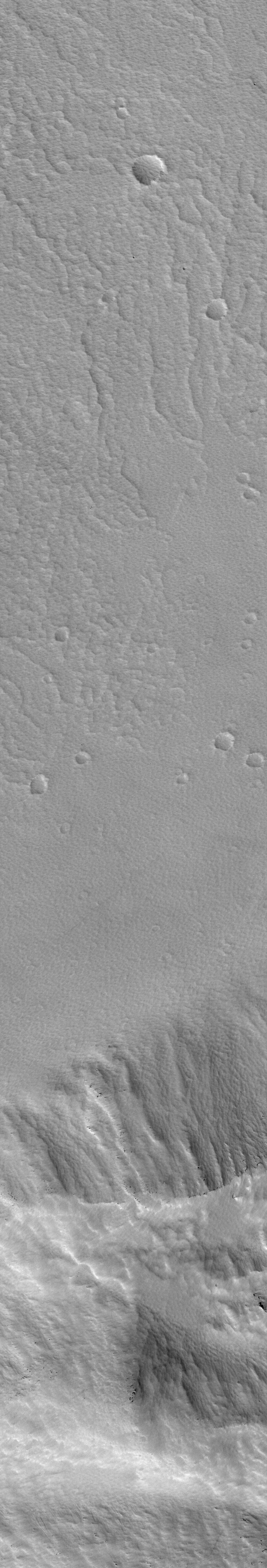
It is a narrow-angle (high-resolution) view of a portion of the lower wall and floor of the caldera at the top of a martian volcano named Pavonis Mons. A companion picture is a wide-angle context image, taken at the same time as the high-resolution view. The white box in the context frame shows the location of the high-resolution picture.

Pavonis Mons is a broad shield volcano. Its summit region is about 14 kilometers (8.7 miles) above the martian datum (zero-elevation reference level). The caldera is about 4.6 kilometers (2.8 miles) deep. The caldera formed by collapse--long ago--as molten rock withdrew to greater depths within the volcano. The high-resolution picture shows that today the floor and walls of this caldera are covered by a thick, textured mantle of dust, perhaps more than 1 meter (1 yard) deep. Larger boulders and rock outcroppings poke out from within this dust mantle. They are seen as small, dark dots and mounds on the lower slopes of the wall in the high-resolution image.
The narrow-angle Mars Orbiter Camera image has a resolution of 1.5 meters (about 5 feet) per pixel and covers an area 1.5 kilometers (0.9 mile) wide by 9 kilometers (5.6 miles) long. The context image, covering much of the summit region of Pavonis Mons, is about 115 kilometers (72 miles) wide. Sunlight illuminates both images from the lower left; north is toward the upper right; east to the right. The high-resolution view is located near 0.4 degrees north latitude, 112.8 degrees west longitude.
