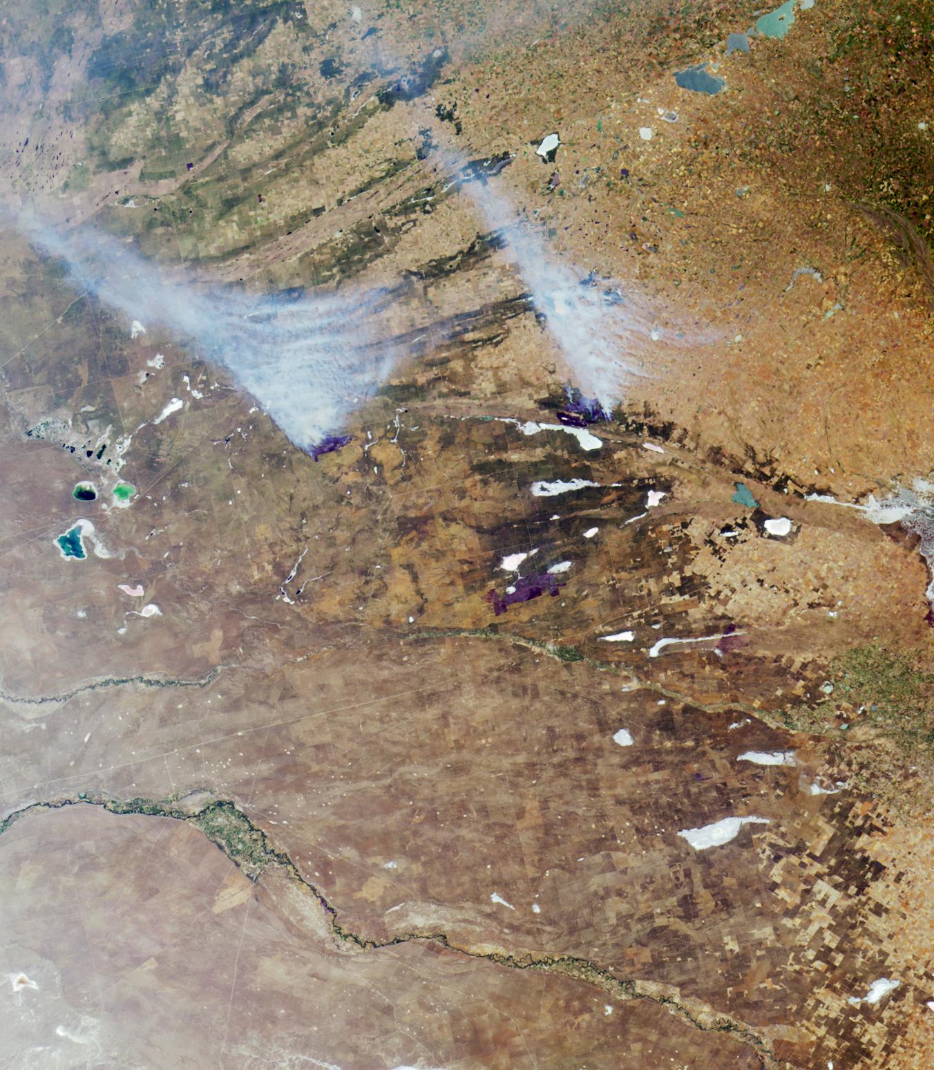
Here's another chance to play geographical detective! This natural-color image from the Multi-angle Imaging SpectroRadiometer (MISR) represents an area of about 372 kilometers x 425 kilometers, and was captured by the instrument's vertical-viewing (nadir) camera in December, 2000. Only some of the following 9 statements about the region shown are true.
Use any reference materials you like to mark each statement true or false:
1. Of the two large smoke plumes rising from fires near image center, one is burning within 10 kilometers of a major gas pipeline.
2. The blue, green, and silver-colored lakes and lagoons, and the white salt-encrusted lakes and marshes that appear throughout the image area, are usually drier during winter and wetter in the summer.
3. Agriculture in this region is devoted primarily to vegetable and fruit production.
4. There are fewer trees and forests in the region today than there were 500 years ago.
5. The fresh waters that feed the silver-colored lakes in the upper-right corner of the image are described as an aid to digestion in a 19th century novel by a French science fiction author.
6. The silver-colored area along the right-hand edge at image center is situated along the boundary of a city that was originally named for its white beaches.
7. In the same year in which this image was acquired, a water contamination event occurred and residents of the aforementioned city were warned not to drink from the municipal water supply.
8. The dark blue lake apparent at left-hand edge of image center is named for its sweet waters and supports year-round commercial and sport fishing.
9. The waters of the river that ends in a large alluvial fan (situated near the right-hand edge below image center), are saltier than the waters of the river below it, which continues to flow beyond the right-hand image edge.
E-mail your answers, name (initials are acceptable if you prefer), and your hometown by the quiz deadline of Tuesday, February 17, 2004, to suggestions@mail-misr.jpl.nasa.gov
Answers will be published on the MISR Quiz page . The names and home towns of respondents who answer all questions correctly by the deadline will also be published in the order responses were received. The first 3 people on this list who are not affiliated with NASA, JPL, or MISR and who have not previously won a prize will be sent a print of the image.
A new "Where on Earth...?" mystery appears as the MISR "latest featured image" approximately once every two months. New featured images are released on Wednesdays at noon Pacific time on the MISR home page, http://www-misr.jpl.nasa.gov . The image also appears on the Earth Observatory, http://earthobservatory.nasa.gov/, and on the Atmospheric Sciences Data Center home page, http://eosweb.larc.nasa.gov/, though usually with a several-hour delay.
MISR was built and is managed by NASA's Jet Propulsion Laboratory, Pasadena, CA, for NASA's Office of Earth Science, Washington, DC. The Terra satellite is managed by NASA's Goddard Space Flight Center, Greenbelt, MD. JPL is a division of the California Institute of Technology.
