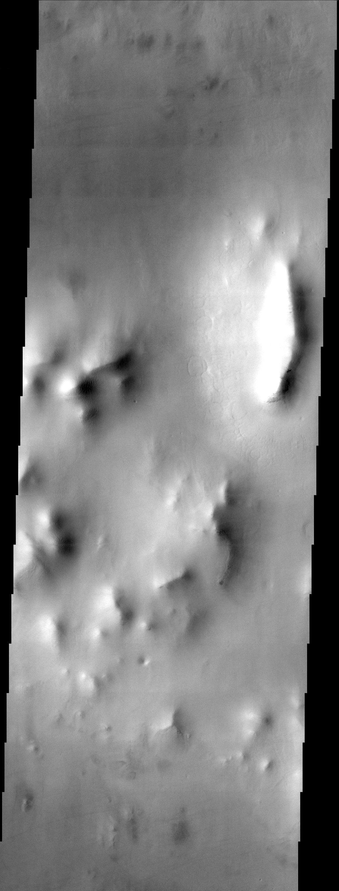
The muted terrain of northern Acidalia Planitia testifies to the fact that the region is heavily mantled with dust. The most interesting features in this image are the small terraces located along the flanks of the ridges and the patterned ground seen at the base of the largest ridge (upper right). These features appear to be classic examples of periglacial landforms and may indicate the presence of shallow subsurface ice.
Note: this THEMIS visual image has not been radiometrically nor geometrically calibrated for this preliminary release. An empirical correction has been performed to remove instrumental effects. A linear shift has been applied in the cross-track and down-track direction to approximate spacecraft and planetary motion. Fully calibrated and geometrically projected images will be released through the Planetary Data System in accordance with Project policies at a later time.
NASA's Jet Propulsion Laboratory manages the 2001 Mars Odyssey mission for NASA's Office of Space Science, Washington, D.C. The Thermal Emission Imaging System (THEMIS) was developed by Arizona State University, Tempe, in collaboration with Raytheon Santa Barbara Remote Sensing. The THEMIS investigation is led by Dr. Philip Christensen at Arizona State University. Lockheed Martin Astronautics, Denver, is the prime contractor for the Odyssey project, and developed and built the orbiter. Mission operations are conducted jointly from Lockheed Martin and from JPL, a division of the California Institute of Technology in Pasadena.
Image information: VIS instrument. Latitude 54.9, Longitude 351 East (9 West). 19 meter/pixel resolution.
