
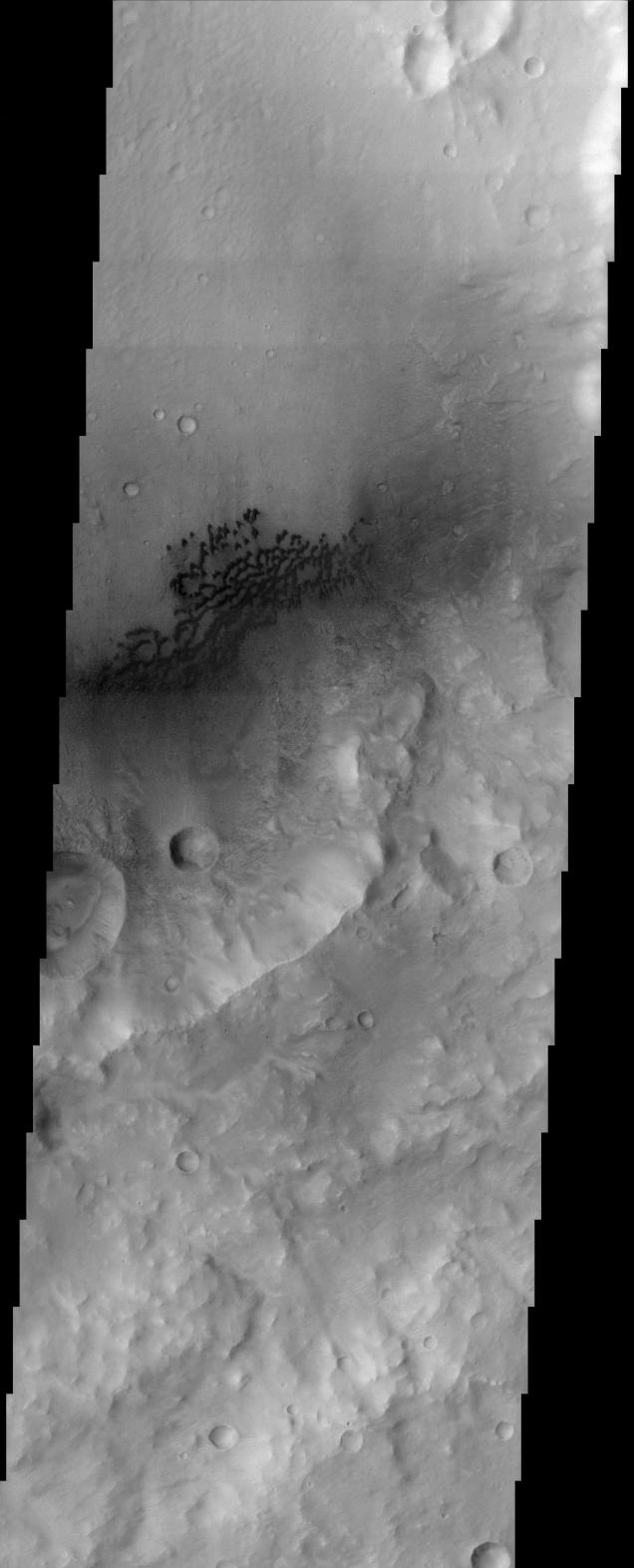
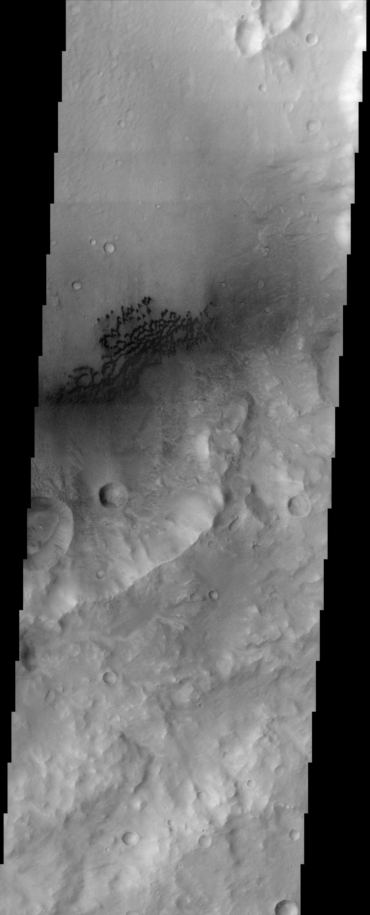
This image is located in the eastern portion of a region on Mars called Hesperia Planum, which is in the cratered southern highlands of Mars. Immediately visible in the image is the dark barchan type dunes that are being blown against the southeast wall of the crater. The position of the dunes in the crater as well as the southeast facing slipfaces on the dunes indicate that the local winds blow primarily towards the southeast. An interesting aspect of this image is the relatively brighter ripple like features that are visible just to the southeast of the dune field. These features are smaller than the dark dunes, but can be clearly seen in the full resolution image. Wind processes also probably formed these features and their orientation also indicates a northwest-southeast wind direction. It is not clear if these features are actively being formed by the wind or if they were only active at some point in the Martian past. Mars is a very dry, desert-like environment and the wind plays a very important role in shaping the present landscape.
Note: this THEMIS visual image has not been radiometrically nor geometrically calibrated for this preliminary release. An empirical correction has been performed to remove instrumental effects. A linear shift has been applied in the cross-track and down-track direction to approximate spacecraft and planetary motion. Fully calibrated and geometrically projected images will be released through the Planetary Data System in accordance with Project policies at a later time.
NASA's Jet Propulsion Laboratory manages the 2001 Mars Odyssey mission for NASA's Office of Space Science, Washington, D.C. The Thermal Emission Imaging System (THEMIS) was developed by Arizona State University, Tempe, in collaboration with Raytheon Santa Barbara Remote Sensing. The THEMIS investigation is led by Dr. Philip Christensen at Arizona State University. Lockheed Martin Astronautics, Denver, is the prime contractor for the Odyssey project, and developed and built the orbiter. Mission operations are conducted jointly from Lockheed Martin and from JPL, a division of the California Institute of Technology in Pasadena.