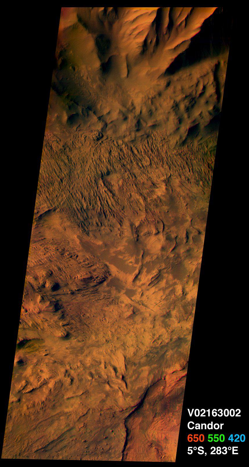
This image from the camera system on NASA. Mars Odyssey was acquired of Candor Chasma within Valles Marineris, centered near 5 degrees south latitude, 283 degrees east longitude. This visible color image shows the effects of erosion on a sequence of dramatically layered rocks. These layers were initially deposited within Candor Chasma and have subsequently been eroded by a variety of processes, including wind and down-slope motion due to gravity. Relatively dark materials appear to mantle some areas of the layered deposits; these dark materials are likely sand. Few impact craters of any size can be seen in this image, indicating that the erosion and transport of material is occurring at a relatively rapid rate, so that any craters that form are rapidly buried or eroded. This image was acquired using the thermal infrared imaging system.s visible bands 1 (centered at 420 nanometers), 2 (centered at 550 nanometers), and 3 (centered at 650 nanometers), and covers an area approximately 19 kilometers (12 miles) in width by 50 kilometers (50 miles) in length.
This and several other new color images can be obtained from the NASA Planetary Photojournal website.
Note: this THEMIS visual image has not been radiometrically nor geometrically calibrated for this preliminary release. An empirical correction has been performed to remove instrumental effects. A linear shift has been applied in the cross-track and down-track direction to approximate spacecraft and planetary motion. Fully calibrated and geometrically projected images will be released through the Planetary Data System in accordance with Project policies at a later time.
NASA's Jet Propulsion Laboratory manages the 2001 Mars Odyssey mission for NASA's Office of Space Science, Washington, D.C. The Thermal Emission Imaging System (THEMIS) was developed by Arizona State University, Tempe, in collaboration with Raytheon Santa Barbara Remote Sensing. The THEMIS investigation is led by Dr. Philip Christensen at Arizona State University. Lockheed Martin Astronautics, Denver, is the prime contractor for the Odyssey project, and developed and built the orbiter. Mission operations are conducted jointly from Lockheed Martin and from JPL, a division of the California Institute of Technology in Pasadena.