- Original Caption Released with Image:
-
MGS MOC Release No. MOC2-317, 8 August 2002
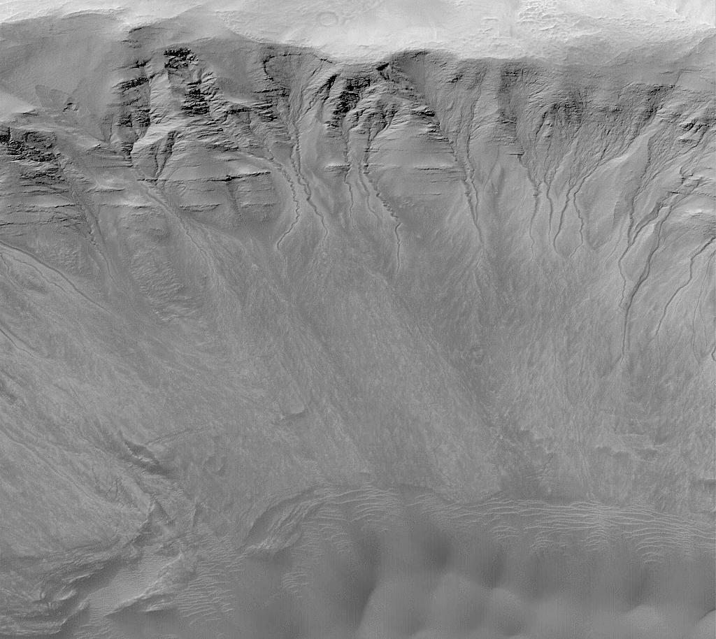
One of the advantages of having a high resolution camera orbiting Mars is that whole new classes of martian landforms can be revealed. As first described by Mars Global Surveyor (MGS) Mars Orbiter Camera (MOC) scientists in June 2000, MOC images of 1.5 to 12 meters per pixel (4.9 to 39 feet per pixel) have done just that--revealed a whole new class of martian landform, the mid-latitude gully. Mid-latitude gullies provide the most compelling evidence--though not conclusively--that Mars may have aquifers of groundwater at shallow depths (less than 500 meters, 1640 ft) below the surface. They are found most commonly on pole-facing slopes in craters and troughs at middle to high latitudes. Where multiple gullies are present, they usually emanate from the same layer in a given crater or trough wall.
The gullies shown here occur on the layered north wall of a crater in Newton Basin near 41.8°S, 158.0°W. The picture was obtained by MOC in May 2002. Dark sand dunes are visible at the bottom of the image, especially at the lower right. This view has an aspect ratio of 1.5 to 1; that is, the image covers an area 4.3 km (2.7 mi) from top to bottom and 2.9 km (1.8 mi) from left to right. Nearly all of the craters in Newton Basin have a plethora of similar gullies, suggesting that Newton is the site of an aquifer. Instead of forming by seepage and runoff of groundwater, other researchers have suggested that martian gullies may form by melting of ground ice, melting of surficial snow (under climate conditions different than today), or discharge of carbon dioxide that somehow became buried under the martian surface. None of these alternatives can explain all of the observed attributes of the gullies, especially their associations with specific layers. Seeping water, potentially as a saline brine, remains the most likely explanation.
- Image Credit:
-
NASA/JPL/MSSS
Image Addition Date: -
2002-08-07
|
 Planetary Data System


