- Original Caption Released with Image:
-

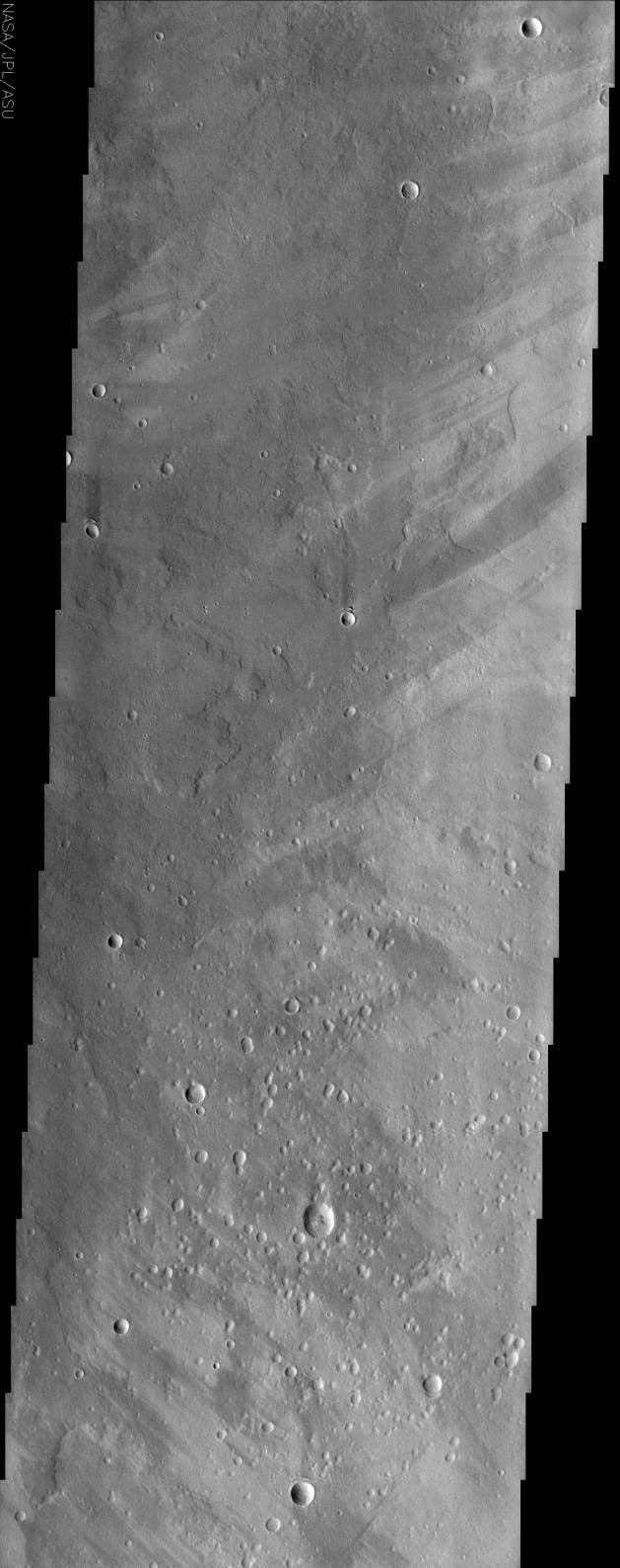
(Released 16 July 2002)
This is an image of a region of Mars called Ophir Planum, located at 8.4 S, 306.8 E. The Valles Marineris system of canyons that stretch for thousands of kilometers across Mars are located just to the south of the area covered by the image shown here. This image contains numerous overlapping lava flows, which can be seen in the layers of the wall rocks in Valles Marineris to the south. A number of remarkable wind streaks are also apparent throughout the image. These streaks commonly trail behind small topographic features such as craters and give an indication of the prevailing wind direction within the region. The northern half of this image is indicative of a northeast wind direction and the southern half indicates a predominance of a southeast wind direction. The variability of these winds may indicate that the local topography has some influence over the local winds.
- Image Credit:
-
NASA/JPL/Arizona State University
Image Addition Date: -
2002-07-17
|