- Original Caption Released with Image:
-
(Released 24 June 2002)
The Science
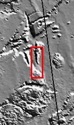
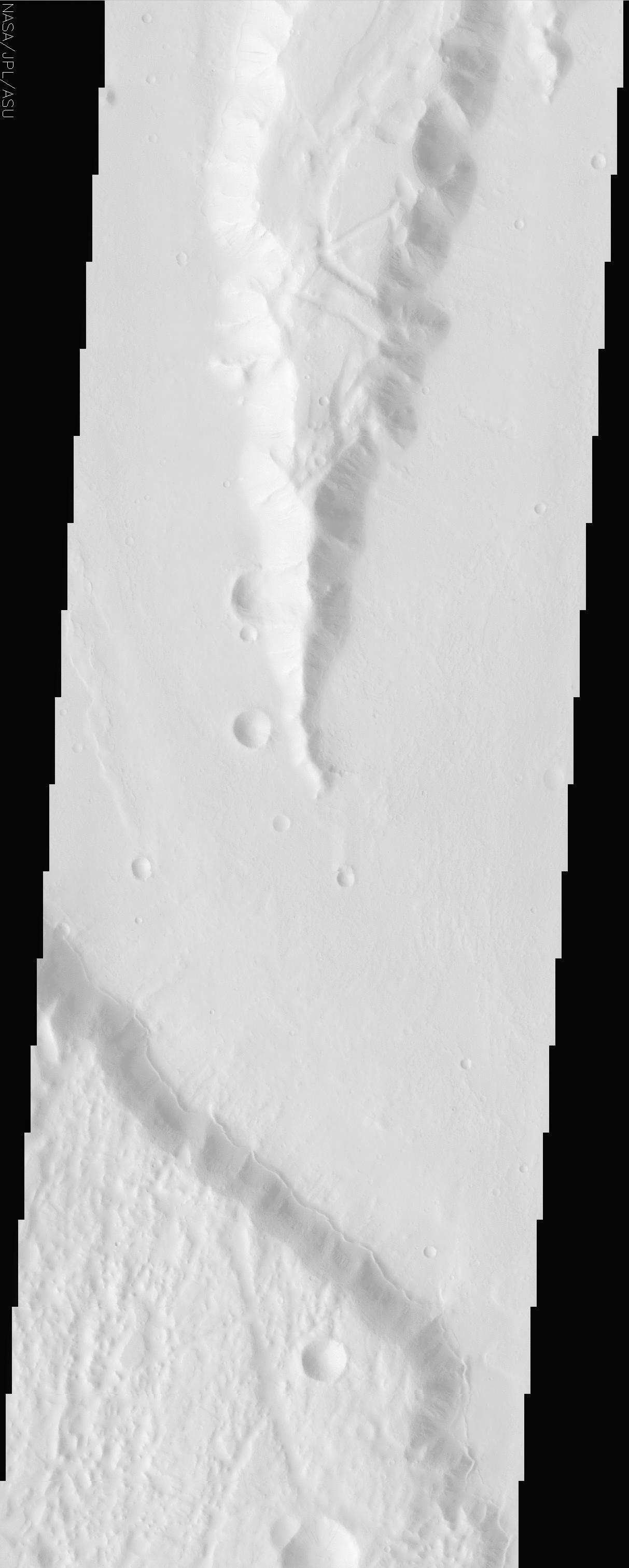
This image is within a region called Lunae Planum, near 27.3N, 75.3W. This is a region west of the Viking 1 landing site that marks the transition between the Tharsis rise, a giant volcanic complex, and the northern lowland plains. The topographically high regions display numerous graben, signs of significant amounts of crustal deformation. The low areas display signs of resurfacing, including an unusual unit that appears to "lap" onto the base of the uplands. This scarp follows the transition between the high and low areas throughout much of the image. It is not clear what caused these deposits, but a likely candidate is ice, which is suspected to have played a major role in the surface morphology of the fretted terrains and many features within the northern lowlands.
The Story
Lunae Planum was named after the Roman moon goddess Luna, who in ancient stories ruled over the night just as her counterpart, the sun god Sol, ruled over the day (a "sol" is, in fact, the word used for a Martian day). Wearing the symbol of the crescent moon upon her head, Luna was known to ride on chariot pulled by two powerful horses. If the fictional Luna ever rode over the Martian plain named for her, she would find the terrain fairly rough going. You might say that she'd face a large number of "ruts" on a geologic scale.
That's because Lunae Planum marks the transition between the high Tharsis rise, a giant volcanic bulge on Mars, and the northern lowland plains. In this region, there are many signs of significant crustal deformation. Look for the dropped blocks of terrain called "graben" on the higher surfaces in this image. Graben are created when tectonic forces tear apart the terrain, leaving long, large "ruts" on the surface. We find graben on Earth too (think of Death Valley, the lowest dry land in the United States, or of the Jordan Dead Sea depression).
Much more exciting than these depressions is the thin ridge that seems to lap up against the base of the uplands at the bottom of this image. While it's not clear what caused these deposits, ice is a likely candidate. Scientists have hypothesized that the mysterious systems of valleys and ridges (called "fretted terrain") in this area were created through fractures and the collapse of large surface areas. Fretted terrain may have developed as icy debris flowed off of faulted valley walls and down onto the northern plains a long time ago in Martian history. This dramatic period would have coincided with the great Martian flood epoch, when melted ice from the subsurface was rapidly released in catastrophic amounts, carving out channels seen in other nearby regions.
Lunae Planum lies west of Chryse Planitia (the Plains of Gold), where the Viking 1 spacecraft made history on July 20, 1976 as the first spacecraft to land safely on the surface of another planet. Viking Lander 1 made its final transmission to Earth on November 11, 1982. Perhaps one day a future spacecraft will settle down on this bright plain, using information collected by Odyssey today as the basis of its ground studies of this complex terrain. And who knows? Maybe even the design of a future rover could recall the image of a swiftly moving chariot, carrying the symbol of a crescent moon.
- Image Credit:
-
NASA/JPL/Arizona State University
Image Addition Date: -
2002-06-26
|
 Planetary Data System


