- Original Caption Released with Image:
-
(Released 13 June 2002)
The Science
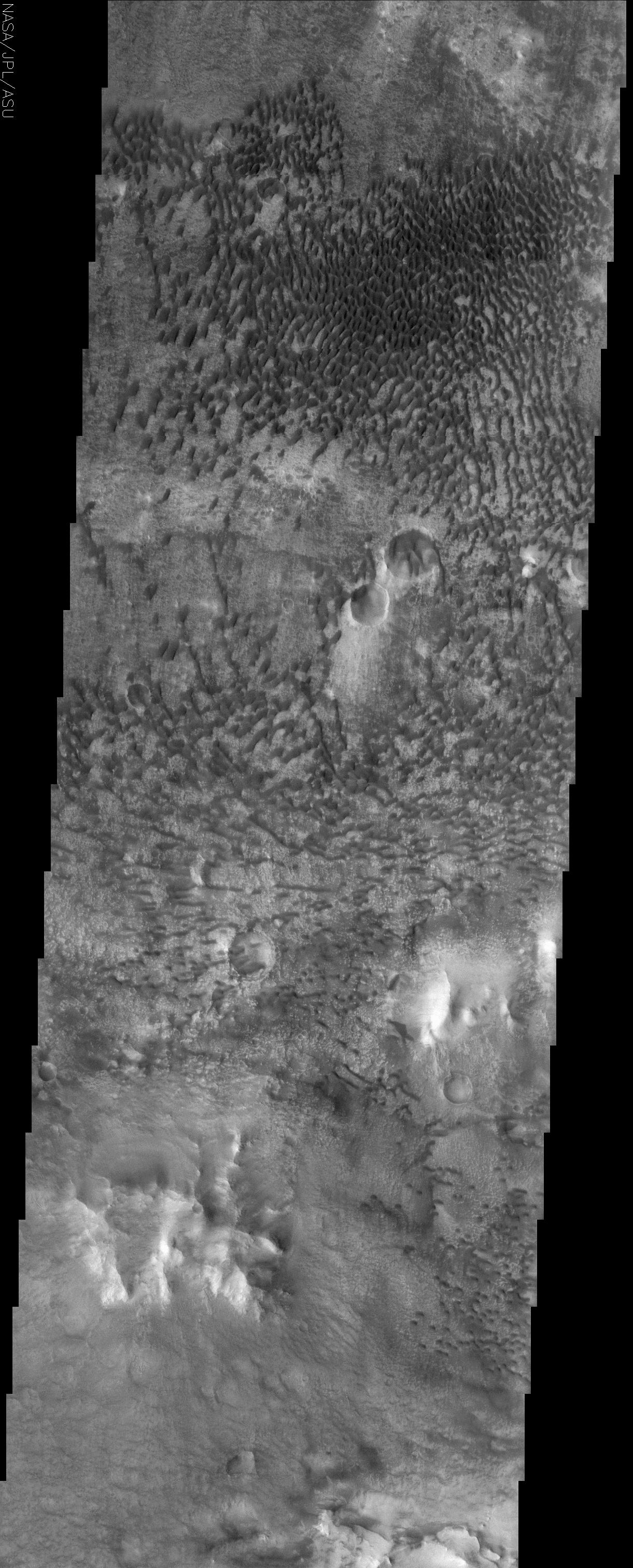
This THEMIS visible image shows a remarkable array of dunes on the floor of a large impact crater named Baldet located near 22.8° N. Many of the dunes in this region are isolated features, with large, sand-free "interdune" surfaces between the individual dunes. These isolated dunes typically occur in regions where there is a limited supply of sand. Any sand that is present moves rapidly across the interdune surfaces, which in many cases are hardened surfaces over which the sand can easily bounce, or "saltate." When this loose sand lands on a dune it cannot travel as quickly and is trapped within the dune. In some areas within this sand mass the dunes have grown together to form crescent dunes and dune ridges. The dunes in this image are likely active today, slowly migrating across the crater floor. THEMIS will re-image this and other dunes throughout the Mars Odyssey mission to search for any evidence of dune motion over time. Based on the asymmetrical shape of the dunes, the wind direction over much of the dune field appears to be from the right (west) or upper right (northwest). However, the topography of the crater floor apparently produces complex wind patterns within the dune field, as can be seen by the different orientations of the dunes. For example the dunes in the lower portion of the image appear to be somewhat symmetrical and aligned east-west, suggesting that the wind in this region blows from both the north (top) and south (bottom).
The Story
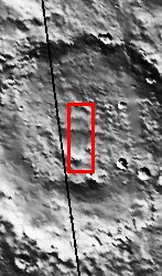
A fuzzy "carpet" of sand dunes covers the floor of a large impact crater, which you can see almost in full in the context image to the right. While the dunes give this area a plush, tufted look, there actually isn't a lot of sand in this area. How can you tell? Large, sand-free spaces exist in between the dunes, and those usually occur when sand particles are sparse. You can see these "interdune spaces" better if you click on the image for the more detailed view.
The sand that is present on the crater floor doesn't just drift, it hops or bounces across the hardened surface. Given the very thin Martian atmosphere, the wind doesn't have the strength to pick up grains of sand and transport them very far. So, the sand simply skips across the land until it is trapped within a dune like the ones in this image.
The wind doesn't always blow in the same direction, though, so the sand hops and skips in different directions too. Based on the shape of the dunes at the top of this image, the wind direction over much of the dune field appears to be from the west or northwest. However, the dunes in the lower portion of the image are clearly aligned in a different (east-west) direction, meaning the wind blows in a north-south direction there. Such differences in wind direction are probably due to the topography of the crater floor, which apparently produces complex wind patterns within the dune field. This difference gives the entire dune field a whirly feel.
In some areas within this sand mass the dunes have grown together to form curvy, crescent dunes and long, snaky dune ridges. While some sand dunes on Mars have solidified into stationary landforms, the dunes in this image are probably active today, slowly migrating across the crater floor in tiny leaps and bounds. Keep following THEMIS images to witness this migration over time, because the camera will re-image these and other dunes throughout the Mars Odyssey mission.
- Image Credit:
-
NASA/JPL/Arizona State University
Image Addition Date: -
2002-06-17
|
 Planetary Data System


