- Original Caption Released with Image:
-
(Released 12 June 2002)
The Science
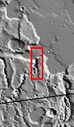
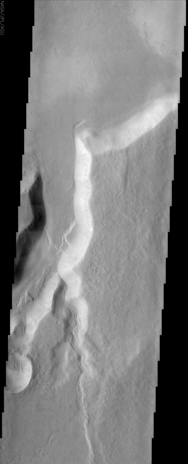
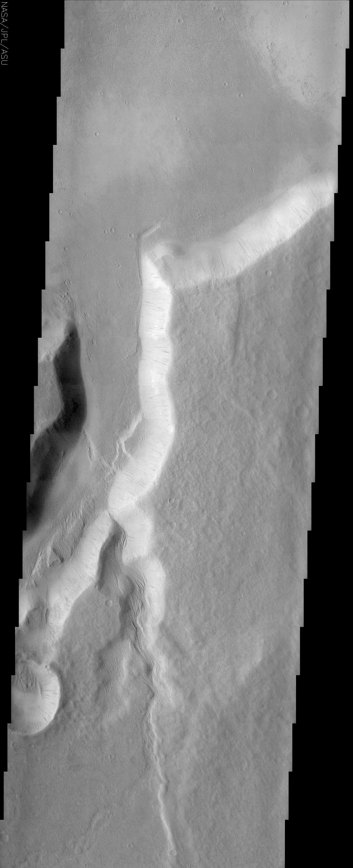
One of the many branches of the Mangala Vallis channel system is seen in this image. The water that likely carved the channels emerged from a huge graben or fracture almost 1000 km to the south. The THEMIS image shows where one of the channels exits the cratered highlands terrain onto the lowland plains. A bright scarp marks the transition between the two terrain types and demonstrates that in this location the highlands terrain is being eroded back. Note how the floor of the main channel appears to be at the same level as the lowland terrain, suggestive of a base level where erosion is no longer effective. Most of the steep slope faces in the image display darker slope streaks that are thought to be dust avalanche scars and indicate that a relatively thick mantle of dust is present in this region. Wind-sculpted ridges known as yardangs cover many of the surfaces throughout the area as shown by images from the Mars Global Surveyor mission. Most of them are at the limit of resolution in the THEMIS image but some are evident on the floor of the main channel at the point at which a smaller side channel enters. In this location they appear to extend right up to the base of the channel wall, giving the appearance that they are emerging from underneath the thick pile of material into which the channel is eroded. This suggests a geologic history in which a preexisting landscape of eroded yardangs was covered over by a thick pile of younger material that is now eroding back down to the original level. Alternatively, it is possible that the yardangs formed more recently at the abrupt transition between the channel floor and wall. More analysis is necessary to sort out the story.
The Story
This channel system is named "Mangala," the word for Mars in Sanskrit, a language of the Hindus of India that goes back more than 4,000 years, with written literature almost as long. Great epic tales have been written in this language, and Odyssey is continuing in the spirit of those adventures with its daily discoveries.
Long ago, many thousands of years before Sanskrit was spoken on the Earth, a rush of water emerged from a giant fracture in the Martian land, carving the channels seen above. Since this fracture is located almost 600 miles to the south of this picture, you can only image the force of the flood. Today, the only real movement is the tired fall of dust avalanches down the channel slopes, which leave long dark trickles down the side. It's a dry, dusty world now, with a thick layer of dust everywhere.
This image was taken at a place of transformation on Mars, where the cratered highlands meet the smooth, lowland plains. You can see that especially well in the context image to the right. Erosion is working tirelessly over time to bring the highlands level with the lowland terrain, but that will take eons more time into the future. Erosion may be "deadly" to geological features, but it doesn't always happen quickly.
If you want to look at one thing close up in this image, click on the above image and check out the floor of the main channel, just at the point where a smaller side channel enters (about a third of the way up). What you'll find are wind-sculpted ridges known as yardangs (some of them are almost triangular). What's interesting about these ridges is that they seem to have eroded long ago, then were covered by a thick pile of younger material, which is now itself eroding back, uncovering them once again.
Yardangs are pretty common in this region of Mars, but if you have trouble finding them in many THEMIS images, don't worry, you're not alone. That's because the THEMIS camera is designed to take pictures of a larger area than its sister camera on the Mars Global Surveyor spacecraft, so some smaller yardangs are barely detectable. The Mars Orbital Camera, however, takes more detailed pictures of a narrower slice of the Martian landscape, and has shown many yardangs in the area. The great thing is that the THEMIS and MOC cameras are very complementary to one another. It's important to get the larger context of the terrain, as well as the sharp details of a tinier area for the greatest understanding possible.
For example, while the yardangs in this image seem to be emerging from a blanket of younger material, it's also possible that they formed more recently at the abrupt transition between the channel floor and the wall. More analysis - and more pictures from both cameras! - will be needed to sort out the story.
- Image Credit:
-
NASA/JPL/Arizona State University
Image Addition Date: -
2002-06-17
|