- Original Caption Released with Image:
-
(Released 10 June 2002)
The Science
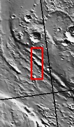
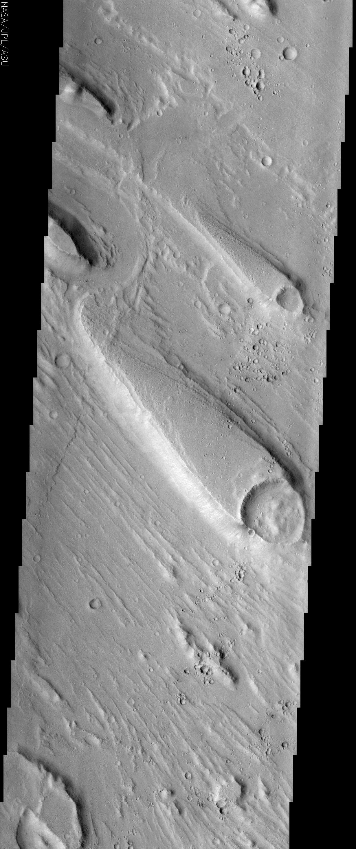
Although liquid water is not stable on the surface of Mars today, there is substantial geologic evidence that large quantities of water once flowed across the surface in the distant past. Streamlined islands, shown here, are one piece of evidence for this ancient water. The tremendous force of moving water, possibly from a catastrophic flood, carved these teardrop-shaped islands within a much larger channel called Ares Valles. The orientation of the islands can be used as an indicator of the direction the water flowed. The islands have a blunt end that is usually associated with an obstacle, commonly an impact crater. The crater is resistant to erosion and creates a geologic barrier around which the water must flow. As the water flows past the obstacle, its erosive power is directed outward, leaving the area in the lee of the obstacle relatively uneroded. However, some scientists have also argued that the area in the lee of the obstacle might be a depositional zone, where material is dropped out of the water as it briefly slows. The ridges observed on the high-standing terrain in the leeward parts of the islands may be benches carved into the rock that mark the height of the water at various times during the flood, or they might be indicative of layering in the leeward rock. As the water makes its way downstream, the interference of the water flow by the obstacle is reduced, and the water that was diverted around the obstacle rejoins itself at the narrow end of the island. Therefore, the direction of the water flow is parallel to the orientation of the island, and the narrow end of the island points downstream. In addition to the streamlined islands, the channel floor exhibits fluting that is also suggestive of flowing water. The flutes (also known as longitudinal grooves) are also parallel to the direction of flow, indicating that the water flow was turbulent and probably quite fast, which is consistent with the hypothesized catastrophic floods that came through Ares Valles.
The Story
In symbolism only, these guppy-shaped islands and current-like flutes of land beside them may conjure up a mental image of a flowing Martian river. This picture would only be half-right. Scientifically, no fish ever swam this channel, but these landforms do reveal that catastrophic floods of rushing water probably patterned the land in just this way.
Geologists who study flood areas believe that a tremendous force of moving water probably carved both the islands and the small, parallel, "current-like" ridges around them. The blunt end of the islands (the "heads" of the "fish") are probably ancient impact craters that posed obstacles to the water as it rushed down the channel in torrents. Because a crater is resistant to erosion, it creates a geologic barrier around which the water must flow.
As the water makes its way downstream, the crater's interference with the water flow is reduced, so the water that was diverted around the obstacle rejoins at the narrow end of the island (the "tail" of the "fish"). Therefore, from this information, you can tell that the water flowed from the southeast to the northwest. As a rule of thumb for the future, you can say that the narrow end of the island points downstream.
The result may be the island behind the crater, but geologists disagree about the exact process by which the island forms. Some scientists argue that the erosive power of the water is directed outward, leaving the area behind, or in the lee of, the obstacle relatively untouched. Other scientists argue that the water slows when it encounters the crater obstacle, and small particles of sand and "dirt" drop out of the water and are deposited in the lee. There's another small associated uncertainty too. Look closely at the edges of the islands and notice how the land is terraced. These ledges might mark the height of the water at various times during the flood . . . or they might be an indication that layering occurred. It all depends on your hypothesis.
Like the streamlined islands, the current-like flutes are parallel to the direction of flow, indicating that the water flow was turbulent and probably quite fast, which is consistent with the hypothesis that catastrophic floods broke forth in this region, known as Ares Vallis.
Ares Vallis is the region where Pathfinder landed to help understand the possible history of water on Mars. Geologists want to understand not only if there was a catastrophic flood, but why it happened. Both orbiters and landers can add to the information on hand, but some Earth examples might provide clues as well. On our planet, some glacial valleys have had major catastrophic floods that were caused by the sudden outburst and drainage of glacial lakes. The Channeled Scabland in Washington state is great Earthly example of a place where the sudden failure of a glacier ice dam spewed out water, leaving a system of large, dry channels with flutes similar to the ones seen in this image. Did something similar happen to cause this outburst on Mars? Hopefully, future studies of THEMIS and other images will help us understand the answer.
- Image Credit:
-
NASA/JPL/Arizona State University
Image Addition Date: -
2002-06-17
|
