- Original Caption Released with Image:
-
(Released 4 June 2002)
The Science
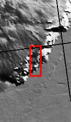
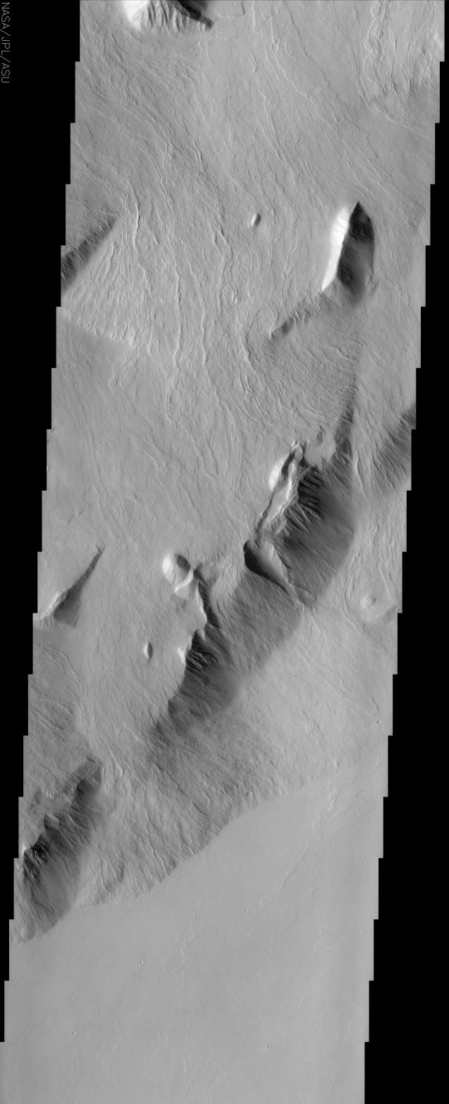
The movement pathways of molten rock, or lava, is demonstrated in this image of a portion of Olympus Mons, the largest volcano in our solar system. These now-solid lava flows all show nearly the same orientation, having flowed from northeast to southwest, down the slope of the volcano's southeastern flank. Throughout the image, narrow pairs of lineaments can be observed ? these are called levees, and are essentially channel walls formed by the solidification and buildup of the edges of the lava flows. We can determine that the high-standing mountains must be older than the flows because they blocked their passage, causing the flows to change direction and go around the taller mountains. As in other THEMIS images, the lack of bright-dark contrast in this image indicates that a layer of dust covers these surfaces. The surfaces of the lava flows are virtually uncratered, attesting to the relatively recent formation of the flows, where ?recent? is within the last 500 million years or so. Several meteorites found on Earth appear to have come from volcanic regions on Mars ? their ages are as young as 180 million years, leading many scientists to suggest that volcanoes of the Tharsis region, including Olympus Mons, may be the source regions of these meteorites. A prominent pear-shaped bowl is apparent on a hill in the lower right third of the image ? the collapse and mass movement of material down slope, which also formed a debris pile below and southeast of the bowl, likely formed this feature.
The Story
Millions and millions of years ago, a huge impact blasted a crater into the surface of Mars, sending particles of the Martian surface scattering into space at great speeds, where they spent millions and millions of years calmly in space before encountering a nearby orbiting planet: our own planet Earth. Hurtling down through Earth's atmosphere, these pieces of Mars landed in various regions of our world and were discovered by modern-day meteorite hunters. When scientists analyzed the ages and chemical composition of several meteorites, they were able to determine that these ancient space rocks came from Mars, were volcanic in origin, and were around 180 million years old.
So, where on Mars did they come from? Geologists had to turn the Martian globe, looking for volcanic areas that were relatively recent in their formation. Believe it or not, "recent" in geological terms can actually mean "180 million years young." So, where did their fingers point? To the Tharsis region, home to Olympus Mons, the largest volcano in our solar system.
The above THEMIS image hints at the young age of the lava flows around Olympus Mons. Since the surfaces of the lava flows are virtually uncratered, that means these lava flows were "relatively recent," forming within the last 500 million years or so. While no one knows for sure if the Mars meteorites came from this area, this lava-rich region seems likely as a possibility.
Always in search of relative ages of geological happenings on the red planet, geologists can also tell that the high-standing mountains in the area are older than the lava flows. You can follow the evidence too. Take a look at the mountains and the lava flows near them. The narrow, flowing lava lines throughout the image are called levees, and outline the supple contours of the channel walls that formed as the lava flows became solid and built up at the edges. Now solid, cool, and still, these lava flows once moved dramatically down the slope of the volcano's southeastern flank. It couldn't have been an entirely free flow: the mountains must have stood in their way, because it's clear that the layered flows of molten rock had to change direction and move around them.
That's not the only dramatic movement that took place here. Look also for the pear-shaped bowl on a hill in the lower right third of the image. It was formed when a huge mass of material collapsed and moved downslope, forming a debris pile below and southeast of the bowl.
Not everything that's happened in this region is ferocious, however. Because this image does not have severe black-and-white contrasts of landforms on the Martian surface, it's likely that a layer of dust has blanketed the region over time, giving it a calm uniform look that belies its angrier past.
- Image Credit:
-
NASA/JPL/Arizona State University
Image Addition Date: -
2002-06-17
|
 Planetary Data System


