- Original Caption Released with Image:
-
(Released 15 May 2002)
The Science
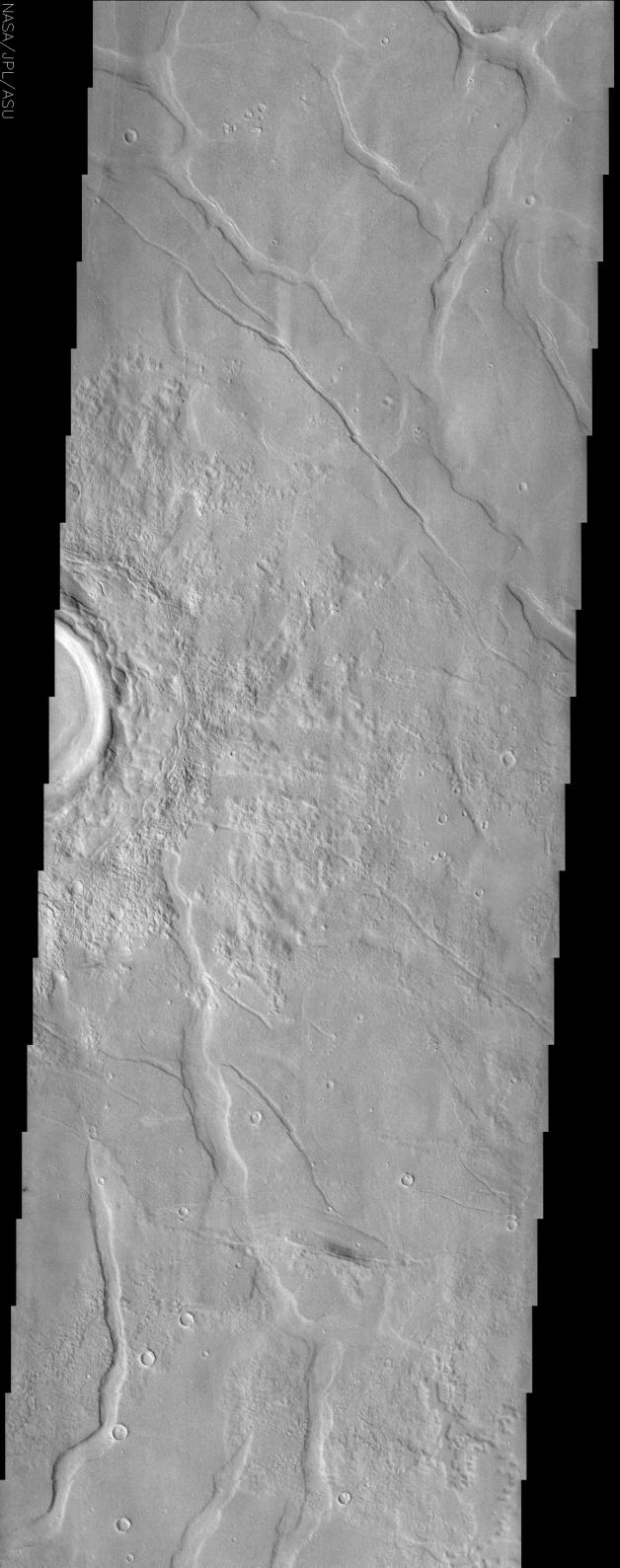
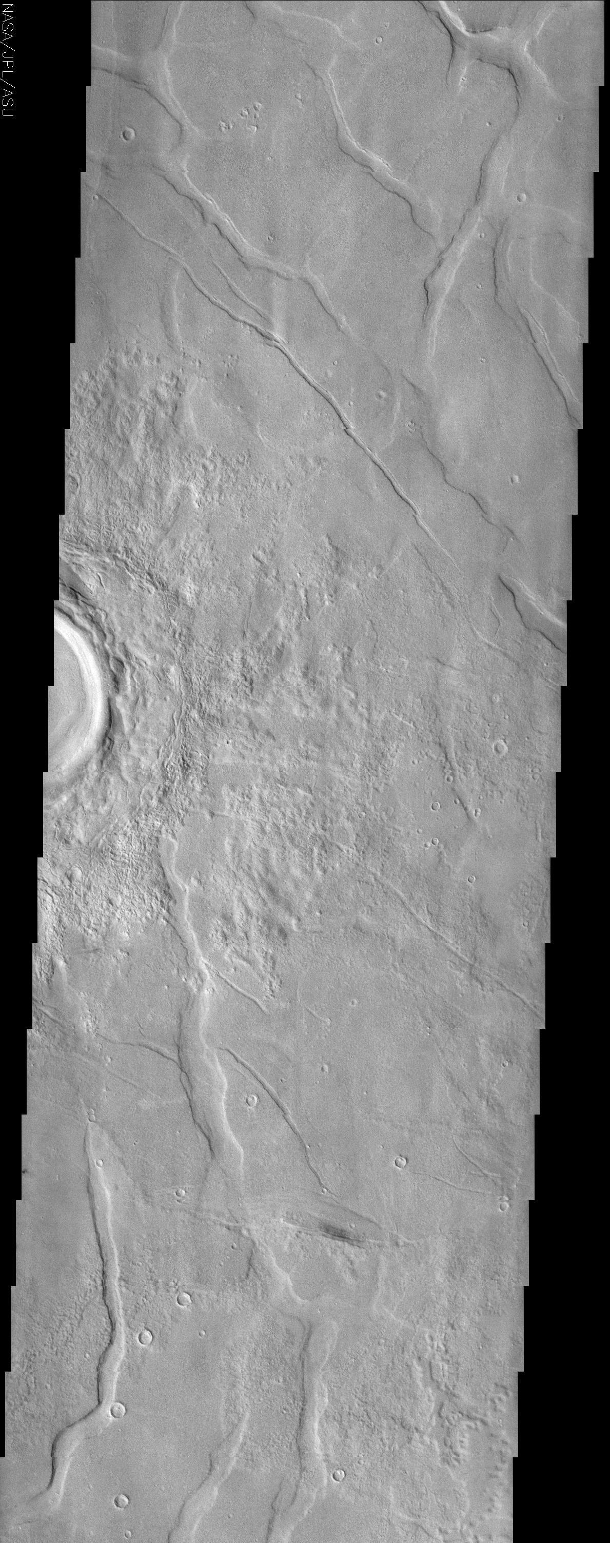
This image is located in Utopia Planitia, a large plain in the northern hemisphere. It is believed that this basin is the result of a large impact. On the right side of the image is a partially imaged crater with a well-preserved ejecta blanket. The morphology of the ejecta implies that the crater is young relative to the surrounding material and has not undergone extensive deposition or erosion. Surrounding the crater are polygonal troughs in the smooth surface material. This polygon pattern is relatively common in the northern plains of Mars, and are primarily located in Acidalia Planitia, Elysium Planitia, and Utopia Planitia. These troughs are believed to be small grabbens, however, scientist are currently debating the origin of these features. The two most accepted hypotheses are that these grabbens either form as volcanic material cools and contracts, or are produced as sediment shrinks as a result of compaction.
The Story
When you think of Utopia, you probably don't think of a large Martian plain, riddled with troughs and pockmarked by craters. Of course, it may actually be a more fitting name than you think. When Sir Thomas More wrote his book about a fictitiously optimal place guided and governed by reason, he made up the word utopia from Greek words meaning "nowhere."
Utopia Planitia became "somewhere" for the first time, however, when its first visitor, the Viking 2 lander, settled down and analyzed the area. And scientists today are using their own reasoning and logic to discern even more about how this northern Martian plain developed geologically.
Right now, scientists have two hypotheses for how the troughs seen here were formed. Because Utopia Planitia is a volcanic region of Mars, these rifts in the surface could have formed when volcanic material cooled and then contracted. Alternatively, this area might be made up of a lot of sediments - small particles of rock, soil, and dust deposited in the area. Just like any loose material, it could have compacted together in places or "shrunk down" to create the lowered rifts in the terrain.
The polygonal patterns of these troughs can be seen more widely in the context image to the right. On Earth, we can sometimes see this pattern occurring in the Arctic and subarctic, where permafrost creates polygonal, "frozen-soil wedges" that form an almost honeycomb pattern throughout the terrain. We know from Viking 2 pictures that it can be pretty cold in this area, as a thin layer of white ground frost was observed there during a few of the Martian winters.
The whiter, brighter material near the crater, however, isn't frost or snow, but instead the record of all of the material that was once ejected from the crater at the left-hand-side of the image. You can see by the smoothness of the crater rim and the clarity of where the ejected material landed that there hasn't been much erosion. That means this crater is fairly young.
- Image Credit:
-
NASA/JPL/Arizona State University
Image Addition Date: -
2002-06-04
|
 Planetary Data System


