- Original Caption Released with Image:
-
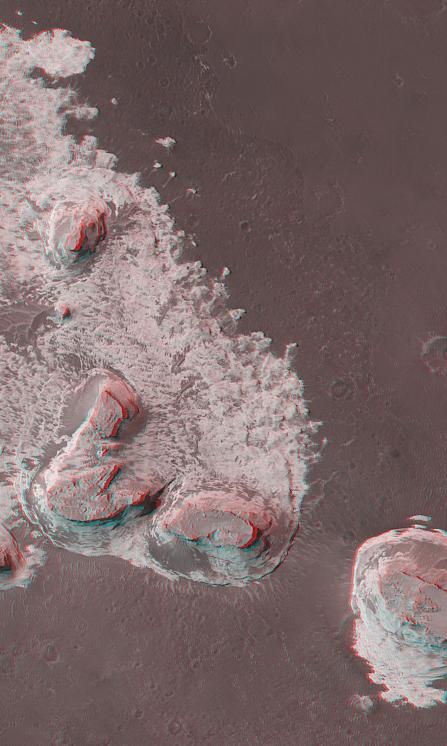
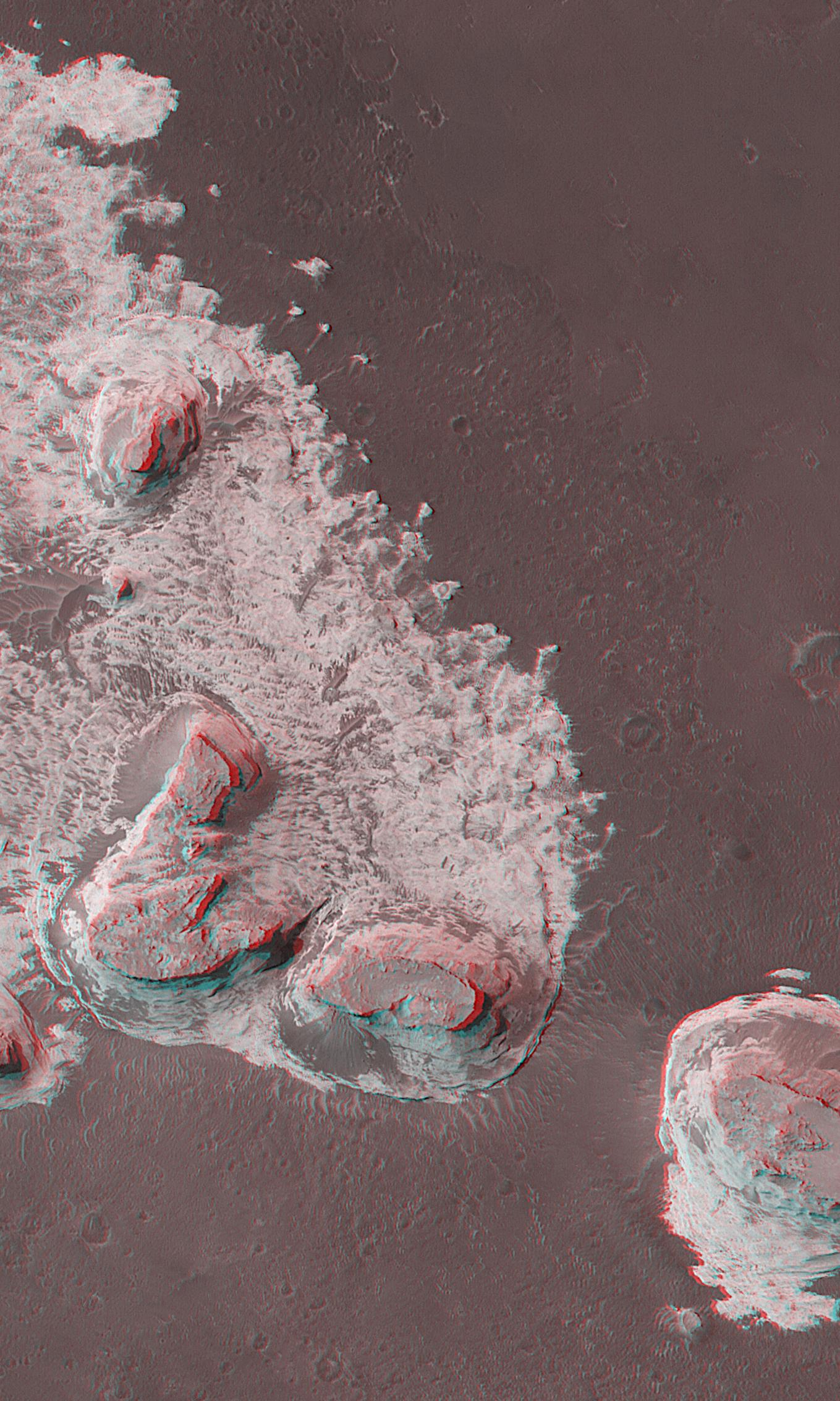
Northern Terra Meridiani, near the intersection of the martian equator and prime meridian, is a region of vast exposures of layered rock. A thermal image from the Phobos 2 orbiter in 1989 showed these materials to be anomalously cool during the daytime, an observation very suggestive of dense, hardened materials like rock. Mars Global Surveyor (MGS) Mars Orbiter Camera (MOC) images of this region show layered material exposed in cliffs, buttes, and mesas that in some ways resemble the rock outcrops of northern Arizona and southeastern Utah in North America (e.g., Monument Valley, Canyonlands, Zion National Park, Four Corners). MGS MOC Extended Mission operations have included several hundred opportunities for the spacecraft to be rolled off-nadir (i.e., at an angle other than "straight down") to take pictures that repeat earlier MOC coverage. These repeat images, because they are taken from a different angle, can be combined with the original picture to produce a stereoscopic ("3-D") view. The image shown here is a composite of two pictures, the first taken October 23, 2000, the second acquired by pointing the spacecraft off-nadir on May 15, 2001. This view shows four buttes and a pinnacle (near left-center) composed of eroded, layered rock. The four buttes are each capped by the remains of a single layer of rock that is harder than the materials beneath it. It is the presence of this cap rock that has permitted these buttes to remain standing after surrounding materials were eroded away. Like the buttes of Monument Valley in the Navajo Nation on the Arizona/Utah border, these are believed to consist of sedimentary rocks, perhaps deposited in water or by wind, though some scientists have speculated that they could be made of thick accumulations of volcanic ash. The image covers an area approximately 3 km (1.9 mi) across and is illuminated by sunlight from the left. To see the image in 3-D, red (left-eye) and blue (right-eye) "3-D" glasses are required.
- Image Credit:
-
NASA/JPL/MSSS
Image Addition Date: -
2002-05-07
|
 Planetary Data System


