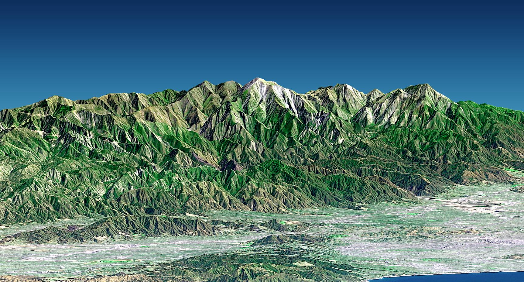
Mount San Antonio (more commonly known as Mount Baldy) crowns the San Gabriel Mountains northeast of Los Angeles in this computer-generated east-northeast perspective viewed from above the Malibu coastline. On the right, the Pacific Ocean and Santa Monica are in the foreground. Further away are downtown Los Angeles (appearing grey) and then the San Gabriel Valley, which lies adjacent to the mountain front. The San Fernando Valley appears in the left foreground, separated from the ocean by the Santa Monica Mountains. At 3,068 meters (10,064 feet) Mount Baldy rises above the tree line, exposing bright white rocks that are not snow capped in this early autumn scene.
This 3-D perspective view was generated using topographic data from the Shuttle Radar Topography Mission (SRTM), an enhanced color Landsat 7 satellite image, and a false sky. Topographic expression is exaggerated one and one-half times.
Landsat has been providing visible and infrared views of the Earth since 1972. SRTM elevation data matches the 30-meter (98-foot) resolution of most Landsat images and will substantially help in analyzing the large and growing Landsat image archive. The Landsat 7 Thematic Mapper image used here was provided to the SRTM project by the United States Geological Survey, Earth Resources Observation Systems (EROS) Data Center, Sioux Falls, S.D.
Elevation data used in this image was acquired by the Shuttle Radar Topography Mission (SRTM) aboard the Space Shuttle Endeavour, launched on Feb. 11, 2000. SRTM used the same radar instrument that comprised the Spaceborne Imaging Radar-C/X-Band Synthetic Aperture Radar (SIR-C/X-SAR) that flew twice on the Space Shuttle Endeavour in 1994. SRTM was designed to collect 3-D measurements of the Earth's surface. To collect the 3-D data, engineers added a 60-meter (approximately 200-foot) mast, installed additional C-band and X-band antennas, and improved tracking and navigation devices. The mission is a cooperative project between NASA, the National Imagery and Mapping Agency (NIMA) of the U.S. Department of Defense and the German and Italian space agencies. It is managed by NASA's Jet Propulsion Laboratory, Pasadena, Calif., for NASA's Earth Science Enterprise, Washington, D.C.
Size: View width 26 kilometers (16 miles), View distance 85 kilometers (53 miles)
Location: 34.2 deg. North lat., 118.2 deg. West lon.
Orientation: View east-northeast, 3 degrees below horizontal
Image Data: Landsat Bands 3, 2+4, 1 as red, green, blue, respectively, sharpened with Band 8 panchromatic detail
Original Data Resolution: SRTM 1 arcsecond (30 meters or 98 feet), Thematic Mapper 30 meters color plus 15 meters sharpening (98 and 49 feet, respectively)
Date Acquired: February 2000 (SRTM) 20 September 1999 (Landsat)
 Planetary Data System


