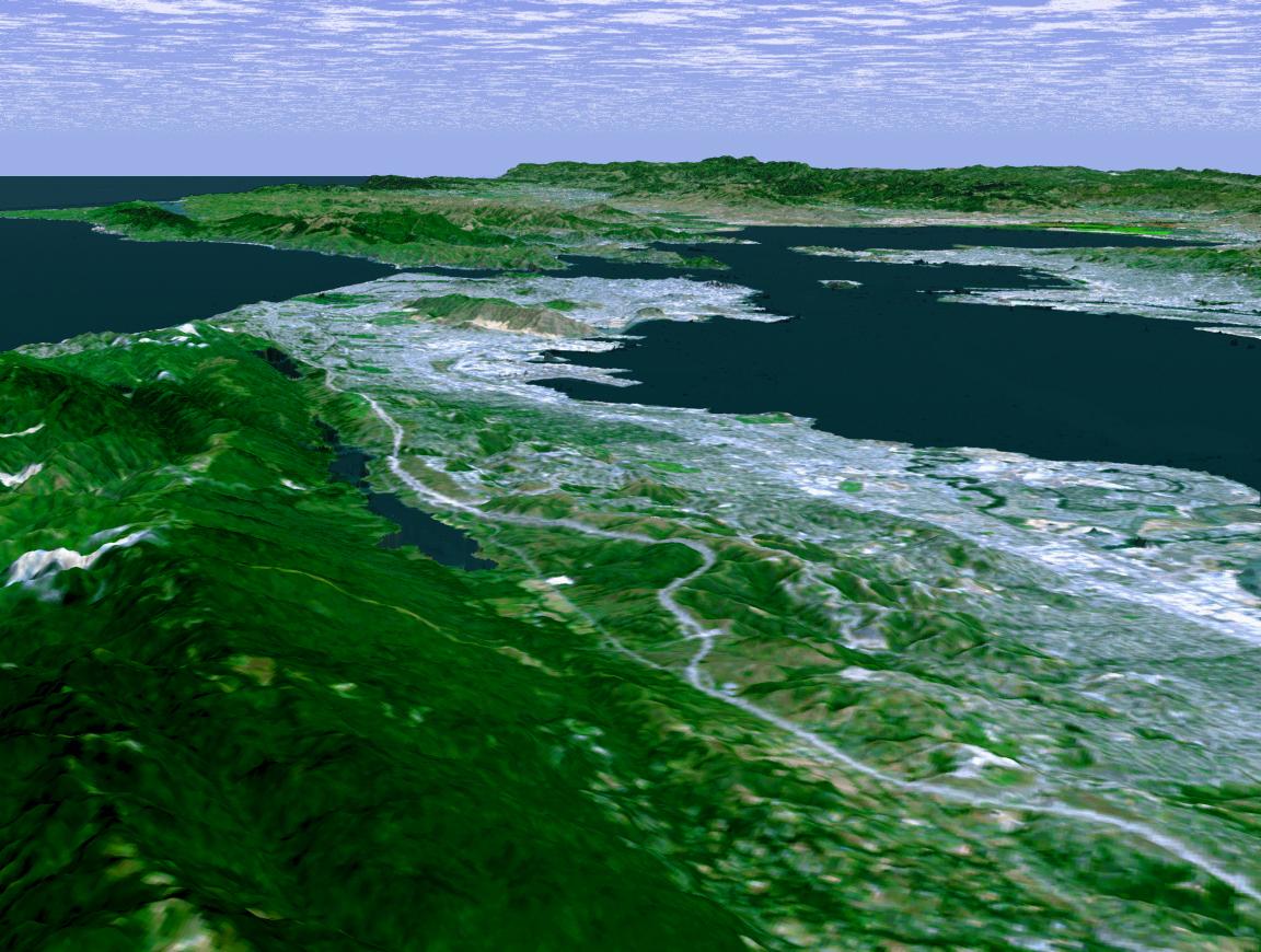
The defining landmarks of San Francisco, its bay and the San Andreas Fault are clearly seen in this computer-generated perspective viewed from the south. Running from the bottom of the scene diagonally up to the left, the trough of the San Andreas Fault is occupied by Crystal Springs Reservoir and San Andreas Lake. Interstate 280 winds along the side of the fault. San Francisco International Airport is the angular feature projecting into the bay just below San Bruno Mountain, the elongated ridge cutting across the peninsula. The hills of San Francisco can be seen beyond San Bruno Mountain and beyond the city, the Golden Gate.
This 3-D perspective view was generated using topographic data from the Shuttle Radar Topography Mission (SRTM) and an enhanced color Landsat 5satellite image. Topographic expression is exaggerated two times.
Landsat has been providing visible and infrared views of the Earth since 1972. SRTM elevation data matches the 30-meter (98-foot) resolution of most Landsat images and will substantially help in analyzing the large and growing Landsat image archive.
Elevation data used in this image was acquired by the Shuttle Radar Topography Mission (SRTM) aboard the Space Shuttle Endeavour, launched on Feb. 11, 2000. SRTM used the same radar instrument that comprised the Spaceborne Imaging Radar-C/X-Band Synthetic Aperture Radar (SIR-C/X-SAR) that flew twice on the Space Shuttle Endeavour in 1994. SRTM was designed to collect 3-D measurements of the Earth's surface. To collect the 3-D data, engineers added a 60-meter (approximately 200-foot) mast, installed additional C-band and X-band antennas, and improved tracking and navigation devices. The mission is a cooperative project between NASA, the National Imagery and Mapping Agency (NIMA) of the U.S. Department of Defense and the German and Italian space agencies. It is managed by NASA's Jet Propulsion Laboratory, Pasadena, Calif., for NASA's Earth Science Enterprise, Washington, D.C.
Size: scale varies in this perspective image
Location: 37.5 deg. North lat., 122.3 deg. West lon.
Orientation: looking north
Image Data: Landsat Bands 3,2,1 as red, green, blue, respectively
Original Data Resolution: SRTM 1 arcsecond (30 meters or 98 feet), Thematic Mapper 1 arcsecond (30 meters or 98 feet)
Date Acquired: February 2000 (SRTM)
 Planetary Data System


