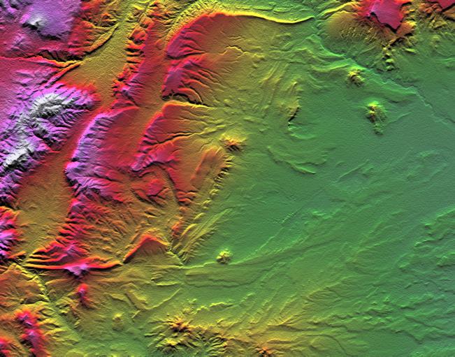
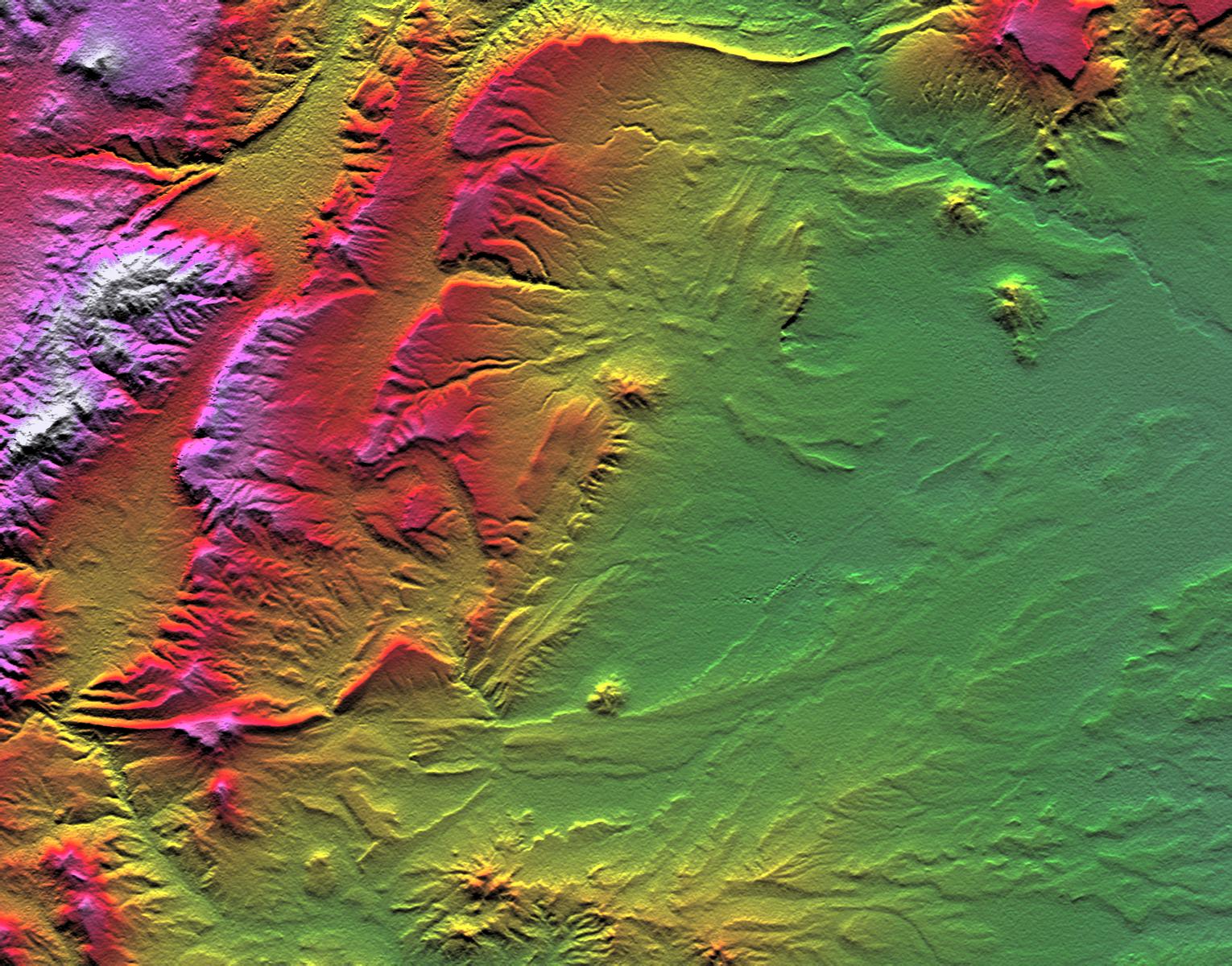
Topographic data provided by the Shuttle Radar Topography Mission can provide many clues to geologic history and processes. This view of an area southwest of Zapala, Argentina, shows a wide diversity of geologic features. The highest peaks (left) appear to be massive (un-layered) crystalline rocks, perhaps granites. To their right (eastward) are tilted and eroded layered rocks, perhaps old lava flows, forming prominent ridges. Farther east and south, more subtle and curvilinear ridges show that the rock layers have not only been tilted but also folded. At the upper right, plateaus that cap the underlying geologic complexities are more recent lava flows - younger than the folding, but older than the current erosional pattern. Landforms in the southeast (lower right) and south-central areas appear partially wind sculpted.
Two visualization methods were combined to produce this image: shading and color coding of topographic height. The shade image was derived by computing topographic slope in the north-south direction. Northern slopes appear bright and southern slopes appear dark, as would be the case at noon at this latitude in the southern hemisphere. Color-coding is directly related to topographic height, with green at the lower elevations, rising through yellow, red, and magenta, to white at the highest elevations.
Elevation data used in this image were acquired by the Shuttle Radar Topography Mission aboard Space Shuttle Endeavour, launched on February 11, 2000. The mission used the same radar instrument that comprised the Spaceborne Imaging Radar-C/X-Band Synthetic Aperture Radar that flew twice on Space Shuttle Endeavour in 1994. Shuttle Radar Topography Mission was designed to collect three-dimensional measurements of the Earth's surface. To collect the 3-D data, engineers added a 60-meter-long (200-foot) mast, installed additional C-band and X-band antennas, and improved tracking and navigation devices. The mission is a cooperative project between the National Aeronautics and Space Administration, the National Imagery and Mapping Agency of the U.S. Department of Defense, and the German and Italian space agencies. It is managed by NASA's Jet Propulsion Laboratory, Pasadena, CA, for NASA's Earth Science Enterprise, Washington, DC.
Size: 45.9 by 36.0 kilometers ( 28.5 by 22.3 miles)
Location: 39.4 deg. South lat., 70.3 deg. West lon.
Orientation: North toward the top
Image Data: Shaded and colored Shuttle Radar Topography Mission elevation model
Date Acquired: February 2000
 Planetary Data System


