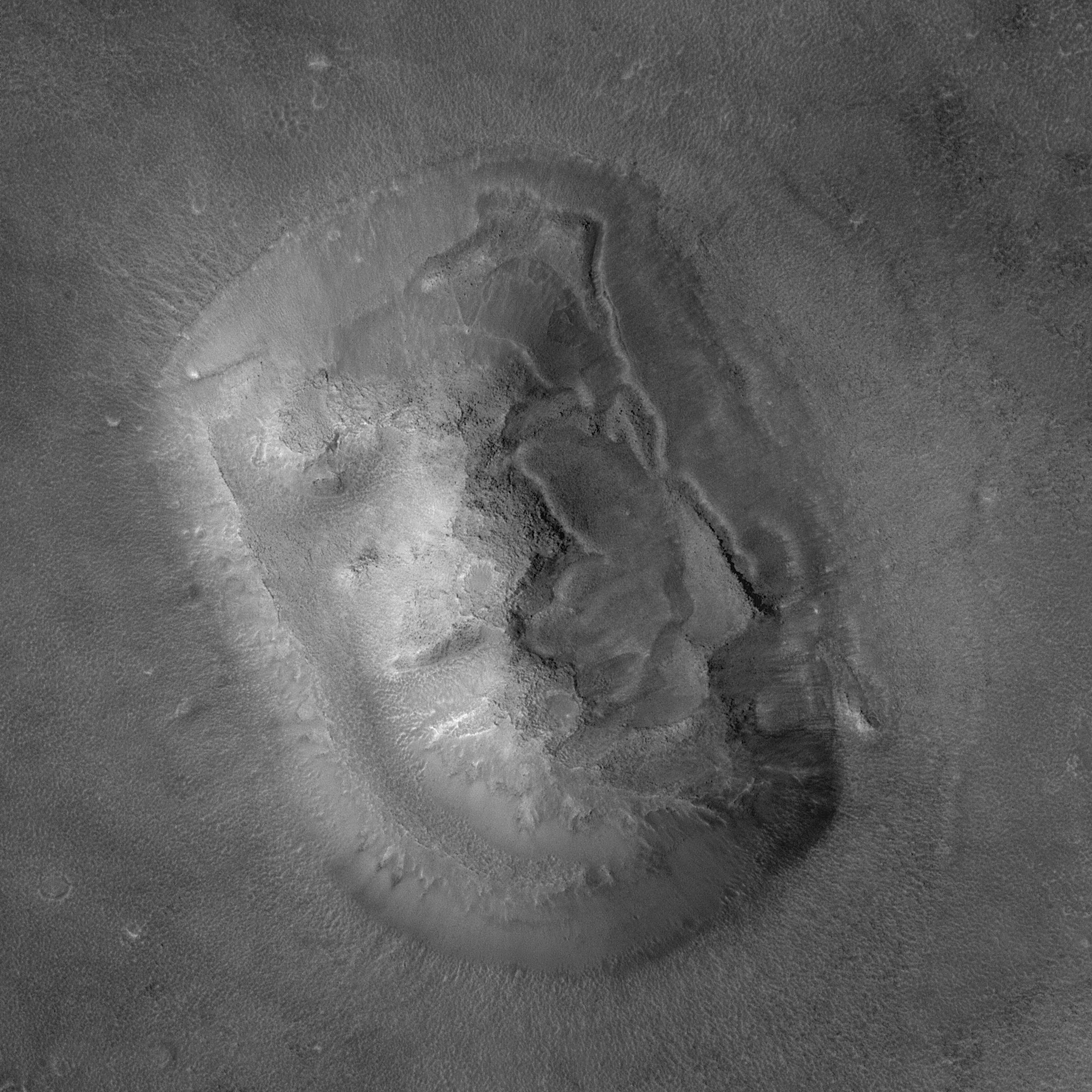
A key aspect of the Mars Global Surveyor (MGS) Extended Mission is the opportunity to turn the spacecraft and point the Mars Orbiter Camera (MOC) at specific features of interest. A chance to point the spacecraft comes about ten times a week. Throughout the Primary Mission (March 1999 - January 2001), nearly all MGS operations were conducted with the spacecraft pointing "nadir"--that is, straight down. In this orientation, opportunities to hit a specific small feature of interest were in some cases rare, and in other cases non-existent. In April 1998, nearly a year before MGS reached its Primary Mission mapping orbit, several tests of the spacecraft's ability to be pointed at specific features was conducted with great success (e.g., Mars Pathfinder landing site, Viking 1 site, and Cydonia landforms). When the Mars Polar Lander was lost in December 1999, this capability was again employed to search for the missing lander. Following the lander search activities, a plan to conduct similar off-nadir observations during the MGS Extended Mission was put into place. The Extended Mission began February 1, 2001. On April 8, 2001, the first opportunity since April 1998 arose to turn the spacecraft and point the MOC at the popular "Face on Mars" feature.
Viking orbiter images acquired in 1976 showed that one of thousands of buttes, mesas, ridges, and knobs in the transition zone between the cratered uplands of western Arabia Terra and the low, northern plains of Mars looked somewhat like a human face. The feature was subsequently popularized as a potential "alien artifact" in books, tabloids, radio talk shows, television, and even a major motion picture. Given the popularity of this landform, a new high-resolution view was targeted by pointing the spacecraft off-nadir on April 8, 2001. On that date at 20:54 UTC (8:54 p.m., Greenwich time zone), the MGS was rolled 24.8° to the left so that it was looking at the "face" 165 km to the side from a distance of about 450 km. The resulting image has a resolution of about 2 meters (6.6 feet) per pixel. If present on Mars, objects the size of typical passenger jet airplanes would be distinguishable in an image of this scale. The large "face" picture covers an area about 3.6 kilometers (2.2 miles) on a side. Sunlight illuminates the images from the left/lower left.
 Planetary Data System


