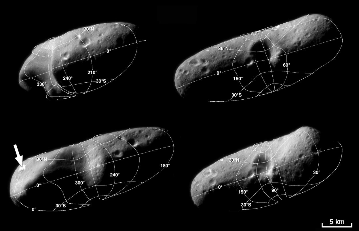
These four image mosaics of Eros illustrate the reference system the NEAR team uses to locate points on the asteroid's surface. Choosing from a variety of systems, the team members use latitude and longitude as their directional guide.
Latitude is the angle between the equatorial plane and a line connecting the surface point with the center of the body. By convention, the north pole is +90 degrees, the equator is 0 degrees, and the south pole is -90 degrees. Longitude is the angle around the rotational axis separating the point on the surface from the "prime meridian." The prime meridian selected by NEAR scientists is drawn though a large, bright crater at one end of Eros (indicated by an arrow in the lower left mosaic).
Again by convention, "west longitude" is used for most planetary bodies, including Eros, and it increases west from the prime meridian.
Built and managed by The Johns Hopkins University Applied Physics Laboratory, Laurel, Maryland, NEAR was the first spacecraft launched in NASA's Discovery Program of low-cost, small-scale planetary missions. See the NEAR web page at http://near.jhuapl.edu/ for more details.