PIA03017: Volcanic Pit Chain
 Target Name:  Mars
 Is a satellite of:  Sol (our sun)
 Mission:  Mars Global Surveyor (MGS)
 Spacecraft:  Mars Global Surveyor Orbiter
 Instrument:  Mars Orbiter Camera (MOC)
 Product Size:  672 x 1212 pixels (w x h)
 Produced By:  Malin Space Science Systems
 Producer ID:  MOC2-1241
 Full-Res TIFF:  PIA03017.tif (815.5 kB)
 Full-Res JPEG:  PIA03017.jpg (116.9 kB)

Click on the image above to download a moderately sized image in JPEG format (possibly reduced in size from original)

Original Caption Released with Image:

5 October 2005
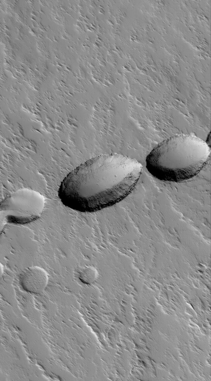
This Mars Global Surveyor (MGS) Mars Orbiter Camera (MOC) image shows a chain of collapse pits on the lower south flank of Ascraeus Mons. Pit chains such as this are the result of collapse along fault lines. In this case, before the collapses occurred, the fault was a conduit for molten rock -- magma -- which erupted to form a suite of lava flows (now covered by mantles of dust) that can be seen radiating away from the pit at the center of the image.

Location near: 7.2°N, 104.3°W
Image width: width: ~3 km (~1.9 mi)
Illumination from: lower left
Season: Northern Autumn

Image Credit:
NASA/JPL/Malin Space Science Systems

Image Addition Date:
2005-10-05