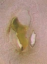
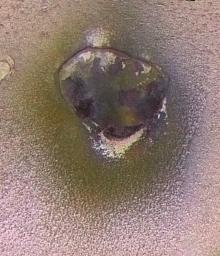
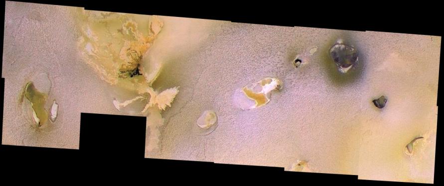
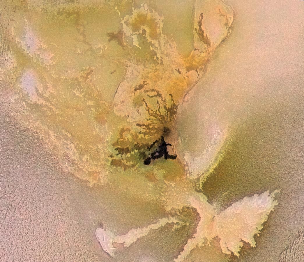
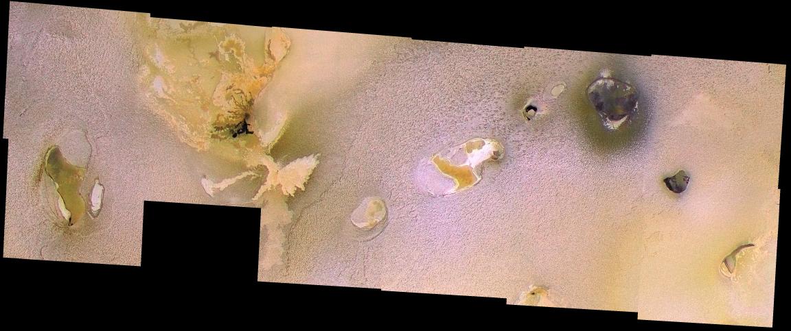
Most of the 12 images in this mosaic were taken on February 22, 2000, by NASA's Galileo spacecraft. It has been merged with lower-resolution color data acquired by Galileo during the summer of 1999. The mosaic covers the region from Chaac Patera (the green-floored depression on the left side; see Cutout A (below)) to Camaxtli Patera (the depression with a dark halo in upper right; see Cutout B (below)). At least nine other paterae can be seen here.
 |  |
| Cutout A | Cutout B |
This mosaic illustrates the range of patera morphology on Io. What is a patera? It is an irregular depression, or a complex one with scalloped edges, but which does not have the characteristics of an impact crater. The paterae on Io often correspond to active volcanic centers, and are in some ways similar to calderas. What's a caldera? Calderas are large, usually roughly circular depressions that form by collapse over shallow magma chambers that have been partially emptied by volcanic eruptions. However, the paterae on Io are different from calderas seen elsewhere in the solar system. They have many straight edges and sharp angles, suggesting that they are related to fractures in Io's crust. In many cases the lava can be seen to erupt from these straight edges. Planetary geologists aren't sure whether the paterae form over magma chambers or if they result from fractures and movements in the crust, and the lava subsequently follows the fractures.
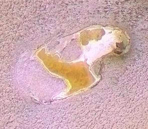
One of the paterae (with orange and white materials--right center; see Cutout C (below)) shows what may be thin plates of crust that have broken off and rafted over a lava lake.
 |  |
| Cutout C | Cutout D |
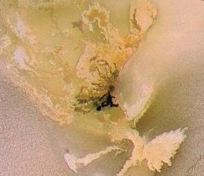
Also seen in this mosaic are various dark, bright, and reddish lava flows (towards the upper left but east of Chaac; see Cutout D (above)}) that are not confined to patera floors. The dark flows are associated with high temperatures consistent with silicate compositions. In fact, all the black areas in this mosaic correspond to high-temperature hot spots. The bright flows may have a different composition (such as sulfur) or they may be older silicate flows that have been coated by sulfurous materials.
The bright plains surrounding the volcanic centers have a bumpy texture. These plains are relatively old, so the roughness may develop slowly over time rather than representing the original topography of volcanic deposits. sublimation of sulfur dioxide is one process that might contribute to the texture.
The mosaic covers the region from latitude 7 north to 18 north, longitude 130 west to 160 west, with a total width of 850 kilometers (509 miles). The images have a resolution of 186 meters (200 yards) per picture element. The Sun is almost directly overhead (actually 12 degrees to the south), so most of the brightness variations in this image are due to different types of surface materials rather than topographic shading. Colors have been exaggerated.
The Jet Propulsion Laboratory, Pasadena, Calif., manages the Galileo mission for NASA's Office of Space Science, Washington, D.C. JPL is a division of the California Institute of Technology in Pasadena.
This image and other images and data received from Galileo are posted on the Galileo mission home page at http://solarsystem.nasa.gov/galileo/. Background information and educational context for the images can be found at http://galileo.jpl.nasa.gov/gallery/io.cfm.


