PDS logoPlanetary Data System
PDS Information
Find a Node - Use these links to navigate to any of the 8 publicly accessible PDS Nodes.

This bar indicates that you are within the PDS enterprise which includes 6 science discipline nodes and 2 support nodes which are overseen by the Project Management Office at NASA's Goddard Space Flight Center (GSFC). Each node is led by an expert in the subject discipline, supported by an advisory group of other practitioners of that discipline, and subject to selection and approval under a regular NASA Research Announcement.
Click here to return to the Photojournal Home Page Click here to view a list of Photojournal Image Galleries Photojournal_inner_header
Latest Images  |  Spacecraft & Technology  |  Animations  |  Space Images App  |  Feedback  |  Photojournal Search  

PIA02556: Highest-Resolution Picture of Io
 Target Name:  Io
 Is a satellite of:  Jupiter
 Mission:  Galileo
 Spacecraft:  Galileo Orbiter
 Instrument:  Solid-State Imaging 
 Product Size:  800 x 600 pixels (w x h)
 Produced By:  University of Arizona
 Producer ID:  MRPS96264
 Addition Date:  2000-05-31
 Primary Data Set:  Galileo EDRs
 Full-Res TIFF:  PIA02556.tif (471.2 kB)
 Full-Res JPEG:  PIA02556.jpg (105.6 kB)

Click on the image above to download a moderately sized image in JPEG format (possibly reduced in size from original)

Original Caption Released with Image:

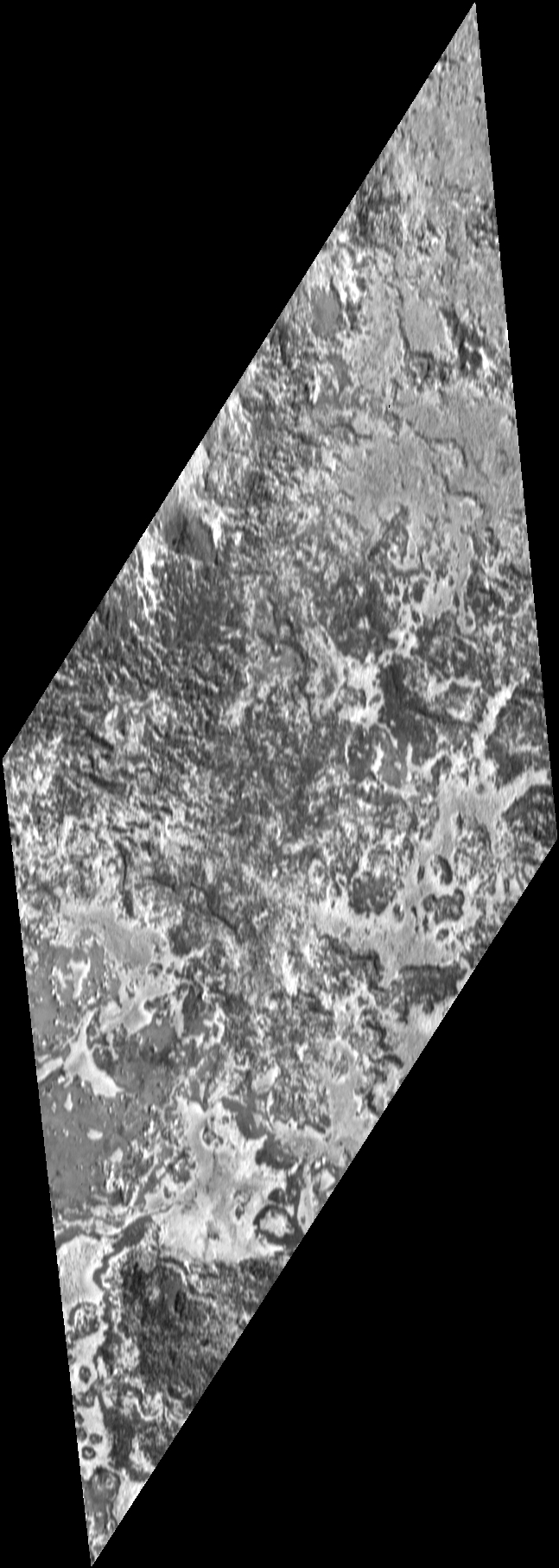
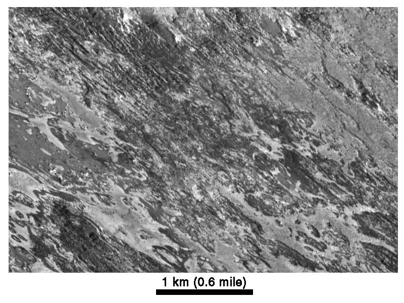
This image, acquired by NASA's Galileo spacecraft on February 22, 2000, is the highest resolution image ever taken of Io. The resolution is 5.2 meters (18 feet) per picture element.

Galileo viewed the surface obliquely, tilted 72 degrees from straight overhead. Illumination is from the lower right, but the topographic shading is difficult to see because of the strong contrasts in brightness of the surface materials. The bright areas are generally higher in elevation than adjacent dark areas. The surface appears to have been eroded by an unknown process, in places exposing layers of bright and dark material. Evaporation of solid ice may also play a role in separating the bright and dark materials. North is toward the upper right.

Also shown is a version of this image processed to give a bird's-eye view over the terrain. This image maps out the true distribution of bright and dark surface materials.

The Jet Propulsion Laboratory, Pasadena, CA manages the mission for NASA's Office of Space Science, Washington, DC. JPL is a division of the California Institute of Technology, Pasadena, CA.

This image and other images and data received from Galileo are posted on the Galileo mission home page at http://solarsystem.nasa.gov/galileo/. Background information and educational context for the images can be found at http://solarsystem.nasa.gov/galileo/gallery/io.cfm.

Image Credit:
NASA/JPL/University of Arizona

Image Addition Date:
2000-05-31