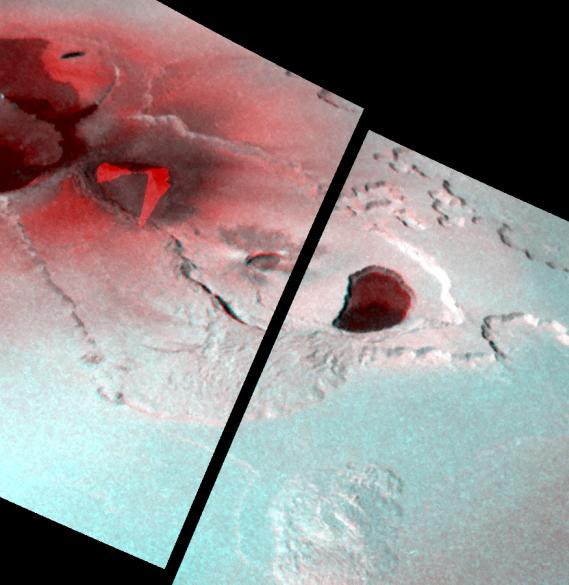
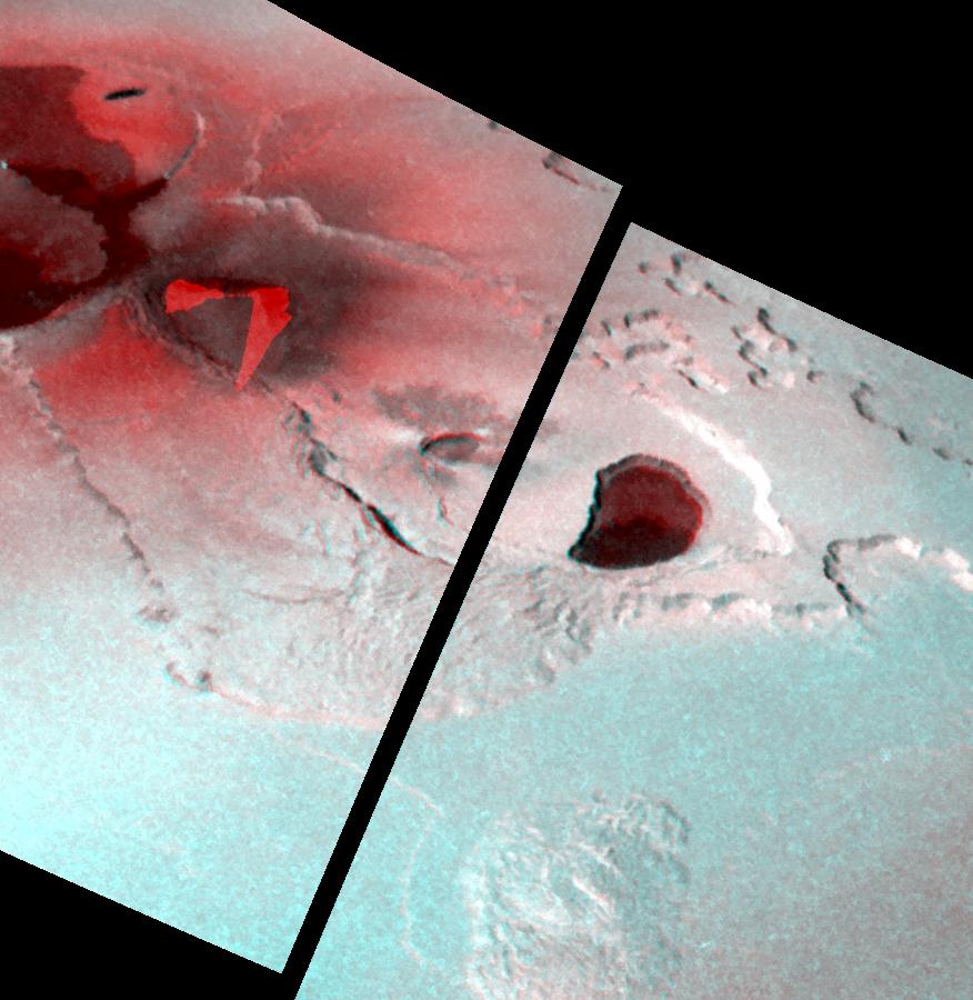
This stereo image illustrates the topography of the Tvashtar Catena region on Jupiter's moon Io. It was created by combining two different views of Tvashtar taken by NASA's Galileo spacecraft on November 25, 1999 (shown in red) and February 22, 2000 (shown in blue).
A raised plateau surrounds the volcanic depression, or caldera, in the center of the image. To the northeast of the main caldera, the plateau's inner and outer margins are scalloped, which may indicate that a process called sapping is eroding them. Sapping occurs when fluid escapes from the base of a cliff, causing the material above it to collapse. Smaller calderas have formed in the floor of the main caldera. This nesting of calderas is also observed on Earth, at Kilauea in Hawaii. (The two bright red regions toward the upper left of this image, which are roughly triangular in shape, are the areas where the earlier image was overexposed by the brightness of hot lava fountains).
Galileo scientists are in the process of generating topographic maps from these images. Such maps will reveal the heights and slopes of different landforms in this region, which will help scientists determine the strength and other properties, of Io's surface materials. They will also be useful in understanding the processes of uplift and erosion on Io.
The picture is centered at 59 degrees north latitude and 121 degrees west longitude. North is to the top of the picture and the Sun illuminates the surface from the lower left. The observations used to make the stereo image were made at ranges of 18,000 and 34,500 kilometers (11,400 and 21,600 miles) from Io. The resolution of the stereo image is about 320 meters (350 yards) per picture element.
The Jet Propulsion Laboratory, Pasadena, CA manages the Galileo mission for NASA's Office of Space Science, Washington, DC. JPL is a division of the California Institute of Technology, Pasadena, CA.
This image and other images and data received from Galileo are posted on the Galileo mission home page at http://solarsystem.nasa.gov/galileo/. Background information and educational context for the images can be found at http://galileo.jpl.nasa.gov/gallery/io.cfm.
 Planetary Data System


