Over the past six months, the southern hemisphere of Mars has passed through spring and into summer. Spring started in early August 1999 and summer arrived toward the end of December 1999. Mars Global Surveyor (MGS) is in a polar orbit, thus the spacecraft's Mars Orbiter Camera (MOC) has had an excellent view of the daily changes that have occurred as the south polar frosts sublimed away during spring and into the summer season.
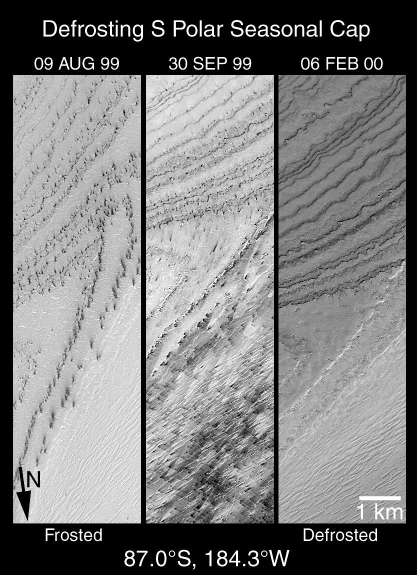
Shown here are three views of the same portion the layered terrain near the martian south pole. Together, these three views document changes that occurred between August 1999 and February 2000 for the same small region. Each view is 3 kilometers (1.9 miles) wide. The differences in orientation of the surface features are caused by the fact that the MGS did not pass directly over the exact same spot in each view. Each view is illuminated by sunlight from the lower right. The wavey, almost parallel lines in the upper half of each picture are exposed layers of the south polar "layered terrain."
As the terrain began to defrost in early August 1999, dark spots appeared. Wind occasionally picks up some of the dark material and blows it across the landscape, creating dark streaks. By late September, much of the scene is covered with these dark spots and narrow, dark wind streaks. By February, all of the frost and dark spots were gone, revealing the underlying layered terrain surface.
Based upon the extremely cold temperatures measured by the MGS Thermal Emission Spectrometer (TES) during southern spring at 87°S latitude, the frost seen in the left and middle pictures are probably composed mostly of frozen carbon dioxide--known on Earth as "dry ice." The 1 km scale bar is also equivalent about 0.62 miles; the arrow indicates the general direction of north.