Dunes on Earth move downwind at different speeds depending upon the local wind conditions, the amount of loose sand available to be transported by wind, the shape and volume of the dunes, and overgrowths of vegetation. Typically, smaller dunes move faster than larger dunes. On Earth, some of the fastest-moving dunes that have been measured (e.g., in the deserts of Peru) move 10 to 30 meters (33 to 100 feet) per year. Small dunes usually have an almost crescent-shape to them, and are known to geologists as barchan dunes.
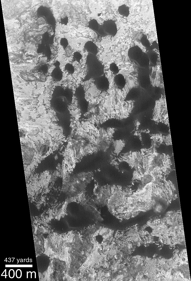
To look for evidence of dune movement on Mars, the Mars Global Surveyor (MGS) Mars Orbiter Camera (MOC) has been used to re-visit some areas of known barchan dunes -- because these types move the fastest -- that were observed by the Mariner 9 orbiter in 1972 and the Viking 1 and 2 orbiters between 1976 and 1980. The picture above, left, shows a MOC high-resolution image taken December 25, 1999. The classic, crescentic shape of the dark barchan dunes can be seen in this picture. The steep slopes, also known as the dune slip faces, on these dunes are facing toward the southwest (north is up in both pictures). Thus, the shape of the dunes indicates that they are moving toward the southwest.
The picture above right shows the MOC image from December 1999 superimposed on a Viking 1 image taken May 27, 1978. During the 11 1/2 Mars years that passed between these two dates, it turns out that no difference can be detected in the position of the dunes seen in the MOC image and the Viking image. The earlier Viking image had a resolution of about 17 meters (56 ft) per pixel, while the MOC image had a resolution of about 3.8 meters (12 ft) per pixel. Although it looks like the dunes didn't move between the Viking and MOC images, this observation is limited by the resolution of the Viking image. It is entirely possible that the dunes have moved as much as 17-20 meters (16-66 ft) and one would not be able to tell by comparing the images. As it is, movement of less than 20 meters (66 ft) in 11 martian years (nearly 22 Earth years) is slower than some dunes of similar size and shape on Earth. Thus, it appears that martian dunes are not "experiencing" the level of activity commonly reported for some of the modern desert dunes found on Earth. The dune field illustrated in these pictures is located in a western Arabia Terra crater at 1.6°N, 351.6°W. Both the Viking and MOC images are illuminated from the left.