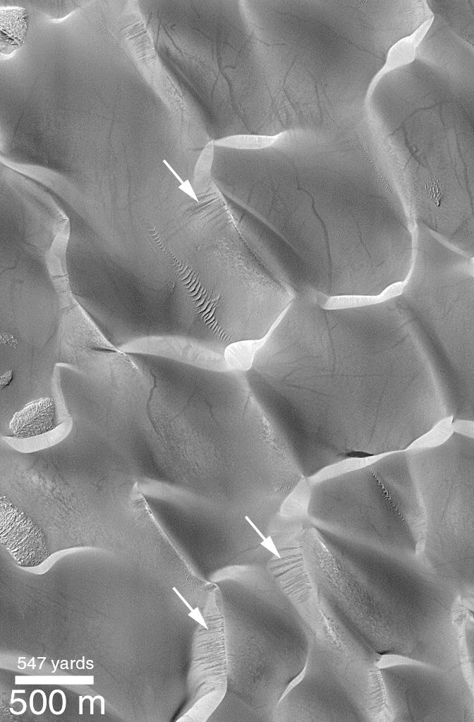
Dark streaks on the steep, down-wind slopes of sand dunes in Rabe Crater are seen at several locations in this Mars Global Surveyor (MGS) Mars Orbiter Camera (MOC) image. These streaks indicate relatively recent (i.e., in the past few years or less) movement of sand down these slopes.
Sand dunes move forward by the combined action of wind that drives sand up the shallow slope on the windward side of the dune (in this case, the slopes that face toward the lower right) and the avalanching of this sand down the steeper, lee-side slope. The steep slope is also known as the slip face. The dark streaks indicated by arrows are evidence for sand avalanches that occurred within a few months or years of the time when the picture was taken in March 1999. Other streaks which are seen criss-crossing the dunes may be the result of passing dust devils. This image is illuminated from the upper left and located in Rabe Crater of the Hellespontus-Noachis region near 44.2°S, 325.6°W.