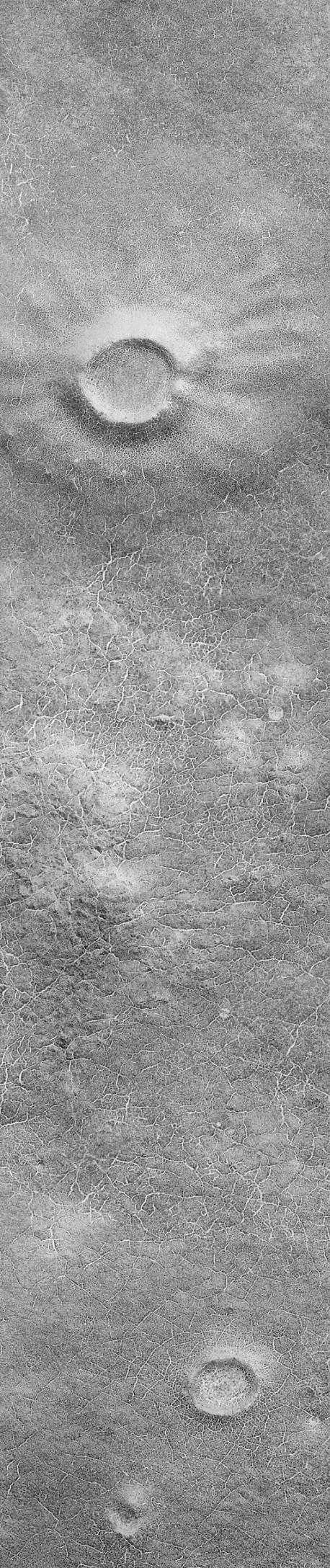
Remnant frost from the retreating south polar ice cap, trapped in cracks, enhances the visibility of polygonal patterns in this new [sic] picture of Malea Planum in the far southern regions of Mars. This scene, taken by the Mars Global Surveyor (MGS) Mars Orbiter Camera (MOC) in October 1999 shows a relatively smooth portion of Mars (a plain) that is covered with polygons both at large and small scales. Smaller polygons are mostly found on the surfaces of old, mantled impact craters (e.g., top and lower center), while larger polygons are evident on the surfaces between the craters. (Note: The polygons are too small to see in the above image--click on it to see the full-resolution image and the polygons).
It is spring in the southern hemisphere of Mars, and the region shown here has recently emerged from beneath a winter coating of frost. Patches of frost (bright material) remain in the cracks that make up the edges of each polygon in the picture. The image covers a narrow strip of martian terrain only 1.5 km (0.9 mi) across at a resolution of 3 meters (10 ft) per pixel.
Polygons such as these are common in Earth's arctic and antarctic regions and they usually indicate the presence of ice (i.e., frozen water) in the ground. Polygons form from the cycle of freezing and thawing of ground ice over the course of years, decades, and centuries. The fact that polygons are found on all surfaces in the Malea Planum scene shown here indicates that the ice is not too deeply buried because only a thin veneer (a few meters--or yards) of material appears to have covered the crater at the top of the scene.