- Original Caption Released with Image:
-
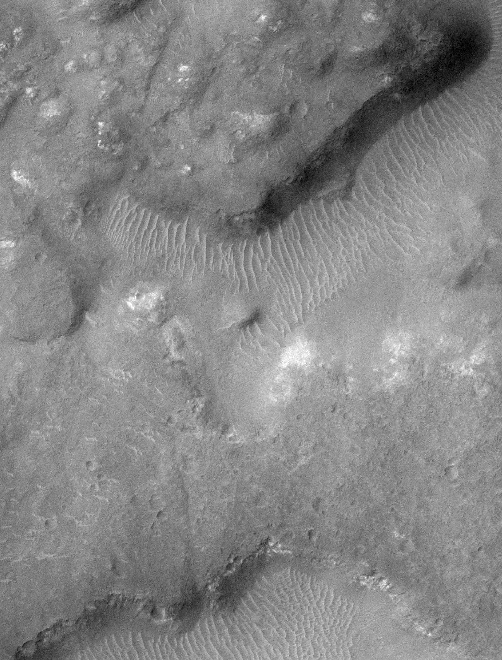
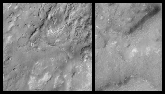 The jumbled and broken terrain in the picture on the left is known as chaotic terrain. Chaotic terrain was first observed in Mariner 6 and 7 images of Mars more than 30 years ago, and is thought to result from collapse after material -- perhaps water or ice -- was removed from the subsurface by events such as the formation of giant flood channels. The region shown here is named "Margaritifer Chaos." The left picture is a Mars Global Surveyor (MGS) Mars Orbiter Camera (MOC) red wide angle camera context frame that covers an area 115 km (71 miles) across. The small white box is centered at 10.3°S, 21.4°W and indicates the location of the high-resolution view on the right. The high resolution view (right) covers a small portion of the Margaritifer Chaos at 1.8 meters (6 feet) per pixel. The area shown is 3 km (1.9 miles) across. Uplands are lumpy with small bright outcrops of bedrock. Lowlands or valleys in the chaotic terrain have floors covered by light-toned windblown drifts. This image is typical of the very highest-resolution views of the equatorial latitudes of Mars. Both pictures are illuminated from the left/upper left, north is toward the top.
- Image Credit:
-
NASA/JPL/MSSS
Image Addition Date: -
2000-05-15
|
